
Philadelphia Streets Department Surveys
2755 result(s). Showing results 501 to 550.
View page: 1 2 3 4 5 6 7 8 9 10 11 12 13 14 15 16 17 18 19 20 21 22 23 24 25 26 27 28 29 30 31 32 33 34 35 36 37 38 39 40 41 42 43 44 45 46 47 48 49 50 51 52 53 54 55 56 (Show all on one page)
| Identifer | Preview | Title | Surveyor | Date | Media / Size / Scale | Area / Map Features |
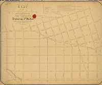
| 130-01 CP |
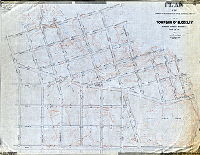
|
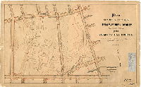
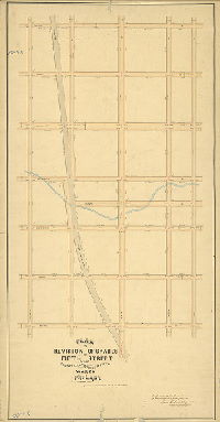
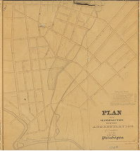
Plan of the Fifth Section of the regulation of the late Township of Blockley. [Resolution Sept. 29, 1858; confirmed May 18, 1896] | Smedley, Samuel L. | 1858 |
Mounted
43 x 56 in.
|
West Philadelphia, Blockley Township, 5th Section. Bounded by Market St., 55th St., Wyalusing Ave., 49th St. Aspen St., and 46th St.
Topography, Mill Creek, mill races
|
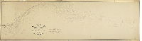
| 130-01 MTD |
|
Plan of the Fifth Section of the regulation of the late Township of Blockley made under resolution of Councils passed Septr. 29th, 1858. | Smedley, Samuel L. | 1859 |
Mounted
43 x 56 in.
|
West Philadelphia, Blockley, 5th Section. Bounded roughly by Wyalusing Ave., 55th St., Market St. and 46th St.
Topography, shows two different courses for Mill Creek
|
| 130-02 MTD |
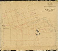
|
Plan of the Fifth Section of the regulation of the late Township of Blockley. [Resolution Sept. 29, 1858; confirmed May 18, 1896] | Smedley, Samuel L. | 1858 |
Mounted
46 x 54 in.
|
West Philadelphia, Blockley Township, 5th Section. Bounded by Market St., 55th St., Wyalusing Ave., 49th St. Aspen St., and 46th St.
Topography, Mill Creek, mill races
|
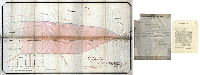
| 130-03 MTD |
|
Plan of the Fifth Section of a survey of the District of West Philadelphia and Township of Blockley. [Act of Assembly April 3, 1851; surveyed Dec. 29, 1855; approved by Board of Surveyors May 17, 1858; confirmed by Court July 17, 1858] | Lightfoot, Francis | 1855 |
Mounted
34 x 55 in.
|
West Philadelphia District and Blockley Township, 5th Section. Bounded by Market St., 55th St., Wyalusing Ave., 49th St. Sycamore (Aspen) St., and 46th St.
Mill Creek, building footprint at Pennsylvania Hospital for the Insane, Unusual north arrow.
|
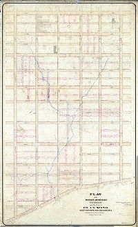
| 130-04 MTD |
|
Plan to place on city plan Forty-fourth Street 60 feet wide from Market St. to Haverford St. [Ordinance June 5, 1913; confirmed Sept. 29, 1913] | Johnson, Joseph | 1913 |
Mounted
22 x 36 in.
1 inch = 100 feet
|
West Philadelphia. Bounded by Haverford Ave. to Market St., 42nd to 46th Sts.
Topography, building footprints and driveways of Pennsylvania Hospital for the Insane, Mill Creek not shown
|
| 130-07 MTD |
|
Plan for placing on City Plan Hoopes Street between 51st Street and 52nd Street [Ordinance Jan. 4, 1902; confirmed May 5, 1902] | Johnson, Joseph | 1902 |
Mounted
12 x 10 in.
|
West Philadelphia. Bounded by Westminster Ave., 51st St., Ogden St. and 52nd St.
Curb elevations
|
| 130-12 MTD |
|
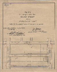
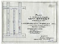
Plan for placing on the City Plan May Street of the width of 30 feet from Haverford St. to Fairmount Ave. [Ordinance Jan. 7, 1904; confirmed May 2, 1904] | Johnson, Joseph | 1904 |
Mounted
10 x 14 in.
|
West Philadelphia. Bounded by Fairmount Ave., Markoe St., Haverford St. and 47th St.
Curb elevations
|
| 130-18 MTD |
|
Plan for placing on City Plan forty feet wide Reno Street and Funston Street from 50th Street and 51st Street [Ordinance June 18, 1906; confirmed Oct. 1, 1906] | Johnson, Joseph | 1906 |
Mounted
12 x 24 in.
|
West Philadelphia. Bounded by Parrish St., 50th St., Brown St. and 51st St.
Curb elevations
|
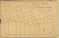
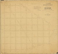
| 131-01 MTD |
|
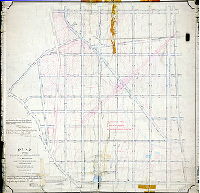
Plan of the First Section of the survey of Kingsessing in the Twenty-fourth Ward. [Act of Assembly March 26, 1853; survey returned 1856; confirmed by Court May 1, 1857] | Miller, James | 1856 |
Mounted
47 x 51 in.
|
Kingsessing, 1st Section. Bounded by Baltimore Ave., Walton St., 53rd St., Woodland Ave., and 45th St.
Mill Creek and mill dam (pond) at 45th and Woodland
|
| 131-04 MTD |
|
Plan placing upon City Plan St. Bernard St. from Springfield to Florence Ave. 27th Ward, Phila. [Ordinance March 29, 1897; confirmed June 21, 1897] | Gillingham, J. Harvey | 1897 |
Mounted
18 x 9 in.
1 inch = 100 feet
|
West Philadelphia. Bounded by Florence to Springfield Aves., 49th to 50th Sts.
Building footprints, curb elevations, railroad
|
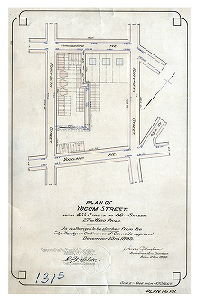
| 131-05 MTD |
|
Plan of Yocum Street from 45-1/2 Street to 46th St, 27th Ward, Phila., as authorized to be stricken from the City Plan [Ordinance Dec. 23, 1895; confirmed Jan. 17, 1898] | Gillingham, J. Harvey | 1896 |
Mounted
18 x 12 in.
1 inch = 100 feet
|
West Philadelphia. Bounded by Kingsessing to Woodland Aves., 45th to 46th Sts.
Building footprints, curb elevations
|
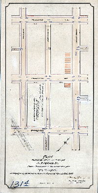
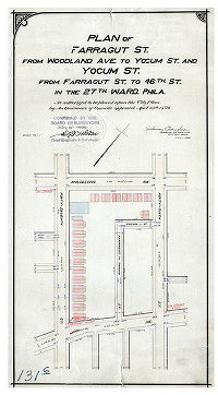
| 131-06 MTD |
|
Plan of Farragut St. from Woodland Ave. to Yocum St. and Yocum St. from Farragut St. to 46th St. in the 27th Ward, Phila. [Ordinance April 13,1896; confirmed July 6, 1896] | Gillingham, J. Harvey | 1896 |
Mounted
20 x 12 in.
1 inch = 100 feet
|
West Philadelphia. Bounded by Kingsessing to Woodland Aves., 46th to 47th Sts.
Building footprints, curb elevations
|
| 131-07 MTD |
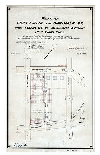
|
Plan of Forty-Five and One-Half St. from Yocum St. to Woodland Avenue, 27th Ward Phila. [Ordinance April 13, 1896; confirmed Jan. 17, 1898] | Gillingham, J. Harvey | 1896 |
Mounted
20 x 12 in.
1 inch = 100 feet
|
West Philadelphia. Bounded by Kingsessing to Woodland Aves., 45th to 46th Sts.
Building footprints, curb elevations
|
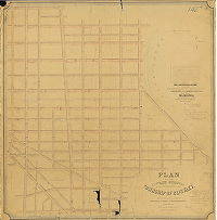
| 131-17 CP |
|
Plan of the revision of lines and grades with topography of that portion of the Twenty-seventh Ward, Philadelphia embraced within the limits of Plan No. 131 on file in the Department of Surveys [Ordinance Dec. 31, 1883; confirmed May 18, 1885] | Not named | 1885 |
Tracing
43 x 48 in.
|
West Philadelphia. Bounded by Baltimore and Woodland Aves., 45th to 53rd Sts.
Topography, streams
|
| 132-01 MTD |
|
Plan of the First Section of the survey and regulation of the late Township of Bristol, Twenty-second Ward Philadelphia. | Lightfoot, Jesse | 1857 |
Mounted
36 x 40 in.
|
22nd Ward, 1st Section, Bristol. Bounded by Annsbury St. to Fisher's Lane, 2nd to 6th Sts.
Wingohocking Creek, Fisher's Lane shown as dotted line, curb elevations
|
| 132-02 MTD |
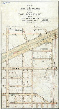
|
Revision of lines and grades and placing The Boulevard upon City Plan No. 132, Forty-second Ward Philadelphia. [Ordinance Dec. 24, 1902; confirmed March 2, 1903] | Brinton, Walter | 1903 |
Mounted
38 x 22 in.
|
42nd Ward. Bounded by Rockland St., 2nd St., Wingohocking St. and 5th St.
Topography, Wingohocking Creek, railroad, building footprints
|
| 132-03 MTD |
|
Plan of revision of grades of Fifth Street of the Twenty-second and Twenty-fifth Wards Philada. [Ordinance July 1, 1879; confirmed June 7, 1880] | Not named | 1880 |
Mounted
48 x 25 in.
|
Bounded by Rockland to Bristol Sts., 3rd to 7th Sts.
Wingohocking Creek, railroad, curb elevations
|
| 132-04 MTD |
|
Topography on a portion of Plan 132 | Bloch, Frits | 1889 |
Mounted
35 x 21 in.
|
Bounded by Rockland St. to Wingohocking Creek, 2nd to 5th Sts.
Topography, Wingohocking Creek and tributary streams, building footprints
|
| 132-05 MTD |
|
Plan of the revision of lines and grades on City Plan No. 132 in the Forty-second Ward, Philadelphia. [Ordinances June 23, 1884 and March 15, 1892; survey returned Jan. 20, 1902; confirmed March 3, 1902] | Brinton, Walter | 1902 |
Mounted
42 x 24 in.
|
Bounded by Rockland to Bristol Sts., 7th to 3rd Sts.
Topography, Wingohocking Creek and tributary streams, building footprints. Shows topography and street alignment before Roosevelt Boulevard placed on plan.
|
| 132-06 MTD |
|
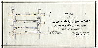
Plan for striking from City Plan Mayer Street from Fifth St. to Lawrence St., Thirty-third Ward Philadelphia. [Ordinance Dec. 1, 1910; survey returned April 17, 1911; confirmed May 17, 1915] | Brinton, Walter | 1911 |
Mounted
12 x 9 in.
1 inch = 100 feet
|
Mayer Street
Curb elevations
|
| 132-07 MTD |
|
Plan for placing on City Plan Mayer Street from Fifth St. to Lawrence St., Forty-second Ward Philadelphia. [Ordinance Jan. 11, 1908; survey returned March 16, 1908; confirmed Jan. 4, 1909] | Brinton, Walter | 1908 |
Mounted
12 x 9 in.
1 inch = 100 feet
|
Mayer Street
Curb elevations
|
| 132-08 MTD |
|
Plan for placing Raymond Street from Fifth St. to Fourth St. on City Plan No. 132, Forty-second Ward Philadelphia. [Ordinance May 13, 1913; survey returned Aug. 11, 1913; confirmed Dec. 1, 1913] | Brinton, Walter | 1913 |
Mounted
14 x 10 in.
1 inch = 100 feet
|
Raymond Street
Curb elevations
|
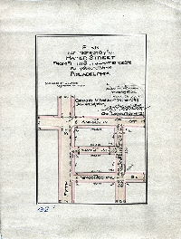
| 132-09 MTD |
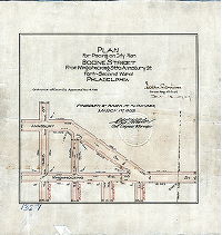
|
Plan for placing on City Plan Bodine Street from Wingohocking St. to Annsbury St., Forty-second Ward Philadelphia [Ordinance Nov. 4, 1908; survey returned Feb. 15, 1909; confirmed March 1, 1909] | Brinton, Walter | 1909 |
Mounted
13 x 12 in.
1 inch = 100 feet
|
Bodine Street
Curb elevations
|
| 132-10 MTD |
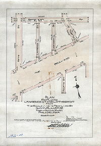
|
Plan for placing on City Plan Lawrence St. and Leithgow St. from The Boulevard to Rockland St. on City Plan No. 132, Forty-second Ward, Philadelphia [Ordinance Jan 30, 1913; confirmed May 6, 1913] | Brinton, Walter | 1913 |
Mounted
17 x 12 in.
1 inch = 100 feet
|
Lawrence Street and Leithgow Street
Curb elevations
|
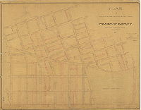
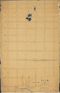
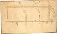
| 133-01 HP |
|
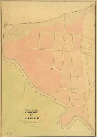
Plan of all that part of the 1st Section of the late Borough of Frankford, City of Philadelphia…lying northwest of Frankford Street and southwest of Orthodox Street | Shallcross, Isaac | 1855 |
Mounted
45 x 42 in.
1 inch = 100 feet
|
Frankford Borough, 1st Section. Northwest of Frankford Street and southwest of Orthodox Street.
Very detailed delineation of Frankford Creek, with two mill dams and islands, and various tributaries, curb elevations, sewers penciled in
|
| 134-01 HP |
|
[No title. Possibly Thomas Street. "Made in pursuance of an Act of Assembly approved Feb. 28th, 1861 … approved … by the Board of Surveyors and Regulators October 21st, 1872"] | Shallcross, Isaac E. | 1861 |
Paper
9 x 18 in.
|
Frankford. Bounded by Main St. to Paul St., Church St. to Green St.
Curb elevations
|
| 134-02 HP |
|
Plan of Gillingham Street Twenty-third Ward Philadelphia | Shallcross, Isaac E. | 1873 |
Paper
18 x 14 in.
1 inch = 100 feet
|
Frankford, Gillingham Street, 23rd Ward
Curb elevations, creek
|
| 134-03 HP |
|
Plan of the Second Section of the regulations of Frankford, 23d Ward Philadelphia. | Shallcross, Isaac (probably) | 1858 |
Mounted
48 x 38 in.
1 inch = 100 feet
|
Frankford Borough, 2nd Section. Bounded by Frankford St. to Orthodox St.., Stiles and Ashland Sts., and Frankford Creek
Frankford Creek, Little Tacony Creek, reservoir for Tackawanna Print Works, Philadelphia & Trenton railroad, curb elevations, benchmark building, penciled annotations
|
| 134-04 HP |
|
Plan of the Second Section of the survey and regulation of Frankford, 23d Ward Philadelphia. | Shallcross, Isaac | 1858 |
Mounted
44 x 40 in.
1 inch = 100 feet
|
Frankford Borough, 2nd Section. Bounded by Frankford St. to Orthodox St.., Stiles and Ashland Sts., and Frankford Creek
Frankford Creek, Little Tacony Creek, reservoir for J. Briggs & Co., Philadelphia and Trenton Railroad, curb elevations, penciled annotations
|
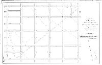
| 135-01 MTD |

|
Plan of the Second Section of survey & regulation of the late Township of Bristol, Ninth Survey District, Twenty-second Ward, City of Philadelphia. [Survey returned Nov. 17, 1856; approved by Board of Surveyors Oct. 19, 1857; confirmed by Court Nov. 23, 1857] | Lightfoot, Jesse | 1856 |
Mounted
48 x 60 in.
1 inch = 100 feet
|
22nd Ward, 2nd Section, Bristol. Bounded by Ruscomb St., Old York Rd., Cayuga St., Germantown Ave. and E. Logan St.
Streams, curb elevations
|
| 135-03 MTD |
|
Plan of the revision of lines and grades of Plan No. 135, Twenty-second Ward Philadelphia [Ordinance March 23, 1886; various confirmations, 1886 to 1899] | Stallman, H. A. | 1886 |
Mounted
52 x 52 in.
|
22nd Ward. Bounded by Germantown Ave., E. Logan St., Stenton Ave., Duncannon St., Broad St. and Cayuga St.
Topography, Wingohocking Creek
|
| 136-01 HP |
|
Plan of Bridesburg showing the curb regulations as approved by the Borough Council January 1854. Curb heights made to correspond to the City base in 1856. Isaac Shallcross, Sur. 10th dist. | Shallcross, Isaac | 1836 |
Mounted
38 x 26 in.
1 inch = 100 feet
|
Bridesburg
Frankford Creek, Delaware River, Kirkbride Street, marshland, curb elevations, penciled modern street names
|
| 137-01 HP |
|
Plan and profile of the survey and regulation of Broad Street from Montgomery Street to Germantown Road in the Twenty-first Ward of the City of Philadelphia [No date on plan. From City Plans Index (City Archives Record Group 90.15): "Authoriz'd by 2nd sec. ord. approved Oct. 25, 1855] | Siddall, Joseph S. | 1855 ca. |
Mounted
22 x 127 in.
1 inch = 100 feet
|
Broad Street. Bounded by Montgomery to Germantown Aves., 15th to 13th Sts.
Monument Cemetery, Philadelphia, Germantown and Norristown Railroad, property owners, curb elevations, profile of Broad Street
|
| 137-02 HP |
|
Plan of Wissahickon Street, or Township Line Road, as widened to 50 feet. | Lightfoot, Jesse | 1856 |
Mounted
13 x 107 in.
3/8 inch = 50 feet
|
Wissahickon Avenue, Franklin Street to Robert's Avenue
Curb elevations, property owners, streams crossing road in pencil
|
| 138-01 HP |
|
Plan of the wharf line on the Delaware River as fixed by ordinances of the Councils approved December 4, 1856. [Act of Assembly February 2, 1854] | Not named | 1856 |
Mounted
43 x 146 in.
1 inch = 528 feet
|
Delaware River front, Poquessing Creek to South Philadelphia (nine streets south of Curtin Street), across to the New Jersey shore
Windmill Island, Petty's Island, Pennshaukin [Pennsauken] Creek, Pennsylvania Railroad Co. property, Camden, many named tributary streams on both sides of river, soundings, wharf lines, building lines
|
| 138-z HP |
|
[No title. Pennsylvania Railroad property at Greenwich Point, South Philadelphia. Attachments: Act of Assembly No. 805, April 4, 1865, and accompanying letter] | Young, Alfred | 1865 |
Tracing
20 x 33 in.
1 inch = 250 feet
|
South Philadelphia
Wharves, Port Wardens Line, river bank,
|
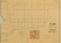
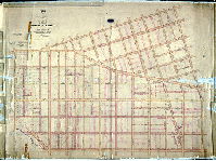
| 139-01 MTD |
|
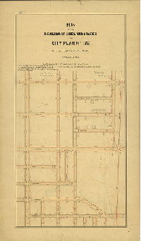
Plan of the revision of lines and grades with topography upon the streets of Plan No. 139, Twenty-seventh Ward Philadelphia. [Ordinance March 20, 1888; confirmed March 18, 1895] | Jones, William H. | 1895 |
Mounted
62 x 37 in.
|
West Philadelphia. Bounded by Market St. to Baltimore Ave., 52nd to 57th Sts.
Topography, Thomas Run (Ameaseka Creek) and tributaries, spring houses, building footprints
|
| 139-02 MTD |
|
Plan of the Second Section of a survey and regulation of Blockley. [Act of Assembly April 3, 1851; survey returned 1857; approved by Board of Surveyors Oct. 17, 1870; confirmed by Court Feb. 15, 1871]. | Miller, James | 1857 |
Mounted
52 x 35 in.
|
West Philadelphia, Blockley Township, 2nd Section. Bounded by Baltimore Ave., 52nd St., Market St., and 57th St.
Thomas Run at Baltimore Pike, old roads, many penciled additions
|
| 139-03 MTD |
|
Plan of Rabbit Lane from Spruce Street to Pine Street and from Fifty-seventh Street to Catharine Street in the Twenty-seventh Ward, authorized to be vacated by ordinance of Council approved Mar. 10th, 1905. [Confirmed Nov. 6, 1905] | Gillingham, J. Harvey | 1905 |
Mounted
26 x 41 in.
1 inch = 100 feet
|
West Philadelphia. Bounded by Spruce, 55th, Catharine and 60th Sts.
Vacating Rabbit Line, an old diagonal street
|
| 140-01 HP |
|
Plan of the regulations of the Third Section of Frankford, 23d Ward Philadelphia. | Shallcross, Isaac | 1858 |
Mounted
35 x 49 in.
1 inch = 100 feet
|
Frankford, 3rd Section. Bounded on two sides by Little Tacony Creek, Frankford Ave. and Orthodox St.
Little Tacony Creek, mill pond, marshland, curb elevations, bridge at Orthodox Street
|
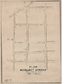
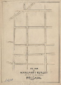
| 140-02 HP |
|
Plan of Margaret Street, Twenty-third Ward, Philada. | Not named | 1860 ca. |
Mounted
24 x 18 in.
|
Frankford, Margaret Street
Curb elevations
|
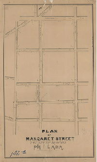
| 140-03 HP |
|
Plan of Margaret Street, Twenty-third Ward, Philada. | Not named | 1860 ca. |
Mounted
24 x 18 in.
|
Frankford, Margaret Street
Curb elevations
|
| 140-04 HP |
|
Plan of Margaret Street, Twenty-third Ward, Philada. | Not named | 1860 ca. |
Mounted
23 x 14 in.
|
Frankford, Margaret Street
Curb elevations
|
| 140-05 HP |
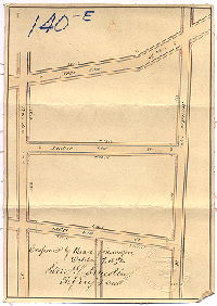
|
[No title. Possibly plan of Lesher Street. Confirmed Oct. 7, 1872] | Not named | 1872 |
Mounted
10 x 7 in.
|
Bounded by Paul to Hedge Sts., Orthodox to Meadow Sts.
Curb elevations
|
| 141-01 HP |
|
Plan of the regulations of the Fourth Section of Frankford, 23d Ward Philadelphia. | Shallcross, Isaac (probably) | 1858 |
Mounted
37 x 47 in.
1 inch = 100 feet
|
Frankford, 4th Section. Orthodox to Little Tacony Creek, Adams St. to Frankford St.
Curb elevations
|
| 141-z HP |
|
Oakland Street [Handwritten title on reverse] | Not named | 1875 ca. |
Mounted
15 x 23 in.
|
Bounded by Orthodox to Harrison Sts., Leiper to Oakland Sts.
Curb elevations
|
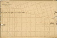
| 142-01 HP |
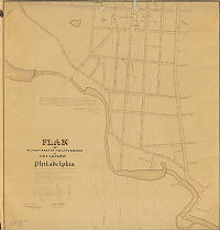
|
Plan of the Fourth Section of the survey of the Township of Blockley | Smedley, Samuel L. | 1856 |
Mounted
48 x 47 in.
1 inch = 150 feet
|
West Philadelphia, Blockley Township, 4th Section. Westminster Ave. to Berks St., Schuylkill River to 49th St.
Public Square, Olive Cemetery, Cathedral Cemetery, Sweet Briar Creek, Lansdowne Park, South Belmont property line, curb elevations, sewers, buildings in street, West Philadelphia Water Works (unnamed)
|
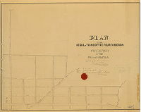
| 143-01 MTD |
|
Plan of grade regulation of the Sixth Section of the late Township of Blockley [1908 copy of original plan 143-3 MTD] | Johnson, Joseph | 1880 |
Mounted
54 x 73 in.
|
West Philadelphia, Blockley Township, 6th Section. Bounded by 65th St., Market St., 54th St., Paschall (now Master) St. and Haverford Ave.
Topography, Cobb's Creek and tributary streams, building footprints
|
| 143-02 MTD |
|
Plan of grade regulation of the Sixth Section of the late Township of Blockley. [Resolution April 26, 1867; either survey returned or confirmation date: Dec. 21, 1867] | Smedley, Samuel L. | 1869 |
Mounted
46 x 69 in.
|
West Philadelphia, Blockley Township, 6th Section. Bounded by 65th St., Market St., 54th St., Paschall (now Master) St. and Haverford Ave.
Cobb's Creek and tributary streams, spring, sewers, curb elevations, old roads, sewer drawn over Cobb's Creek at 63rd and Market Sts.
|
| 143-04 MTD |
|
Plan of the Sixth Section of the survey of the District of West Philadelphia and Township of Blockley made in pursuance of two Acts of Assembly of the Commonwealth of Pennsylvania approved respectively on the 3rd of April 1851 and 13th of May 1856. [Survey returned Feb. 18, 1857; approved May 3, 1858; confirmed by Court Dec. 22, 1860] | Lightfoot, Francis; Walton, Joseph | 1857 |
Mounted
44 x 52 in.
|
West Philadelphia and Blockley, 6th Section. Bounded by Paschall (now Master) St. to Market St., 54th to 65th Sts.
Curb elevations, old roads, building footprints. Signed by six Blockley Township commissioners.
|