
Philadelphia Streets Department Surveys
2755 result(s). Showing results 801 to 850.
View page: 1 2 3 4 5 6 7 8 9 10 11 12 13 14 15 16 17 18 19 20 21 22 23 24 25 26 27 28 29 30 31 32 33 34 35 36 37 38 39 40 41 42 43 44 45 46 47 48 49 50 51 52 53 54 55 56 (Show all on one page)
| Identifer | Preview | Title | Surveyor | Date | Media / Size / Scale | Area / Map Features |
| 201-13 HP |
|
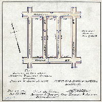
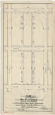
Plan placing on City Plan Mildred & Darien Streets between Porter & Shunk Streets. [Ordinance July 7, 1908; survey returned July 17, 1908; confirmed March 7, 1910] | McFadden, R. A. | 1908 |
Mounted
11 x 11 in.
|
South Philadelphia
Curb elevations
|
| 201-14 HP |
|
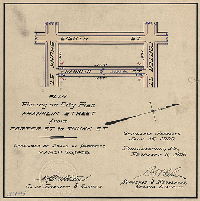
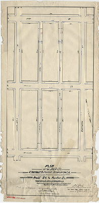
Plan for placing on City Plan Franklin Street from Porter St. to Shunk St. [Ordinance Jan. 15, 1906; survey returned Feb. 6, 1906; confirmed March 26, 1906] | Close, Charles W. | 1906 |
Mounted
11 x 11 in.
|
South Philadelphia
Curb elevations
|
| 201-15 HP |

|
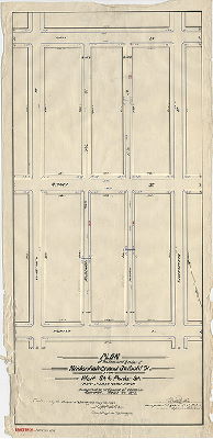
Plan for placing on City Plan Sartain Street from Porter St. to Shunk St. [Ordinance March 21, 1906; survey returned May 3, 1906; confirmed July 2, 1906] | Close, Charles W. | 1906 |
Mounted
11 x 11 in.
|
South Philadelphia
Curb elevations
|
| 201-16 HP |
|
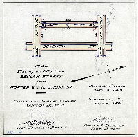
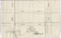
Plan for placing on City Plan Beulah Street from Porter St. to Shunk St. [Ordinance Jan. 15, 1906; survey returned Feb. 6, 1906; confirmed March 26, 1906] | Close, Charles W. | 1906 |
Mounted
11 x 11 in.
|
South Philadelphia
Curb elevations
|
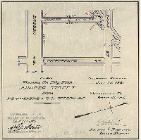
| 201-17 HP |
|
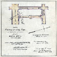
Plan placing on City Plan Sheridan Street from Shunk St. to Oregon Ave. [Ordinance April 4, 1910; survey returned April 28, 1910; confirmed Sept. 19, 1910] | McFadden, R. A. | 1910 |
Mounted
11 x 11 in.
|
South Philadelphia
Curb elevations
|
| 201-18 HP |
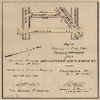
|
Plan for placing on City Plan Camac Street from Moyamensing Ave. to Shunk St. [Ordinance March 30, 1906; survey returned July 25, 1906; confirmed Sept. 17, 1906] | Close, Charles W. | 1906 |
Mounted
11 x 11 in.
|
South Philadelphia
Curb elevations
|
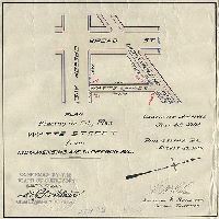
| 201-19 HP |
|
Plan placing on City Plan Watts Street from Moyamensing Ave. to Oregon Ave. [Ordinance July 25, 1901; survey returned Aug. 28., 1901; confirmed Sept. 17, 1901] | Close, Charles W. | 1901 |
Mounted
11 x 11 in.
|
South Philadelphia
Curb elevations
|
| 201-20 HP |
|
Plan placing on City Plan Juniper Street from Moyamensing Ave. to Oregon Ave. [Ordinance July 25, 1901; survey returned Aug. 28., 1901; confirmed Sept. 17, 1901] | Close, Charles W. | 1901 |
Mounted
11 x 11 in.
|
South Philadelphia
Curb elevations
|
| 201-21 HP |
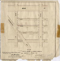
|
Plan for placing Watts, Juniper and Clarion Sts. from Porter to Shunk Sts. on the City Plan [Confirmed Feb. 5, 1894] | Close, Charles W. | 1893 |
Mounted
11 x 11 in.
|
South Philadelphia
Curb elevations
|
| 201-y HP |
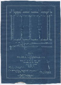
|
Plan for placing Fairhill & Marshall Sts. from Shunk St. to Oregon Ave. on City Plan No. 201. Thirty-ninth Ward Philadelphia. [Ordinance April 9, 1914; confirmed May 19, 1914.] | Puff, Charles F., Jr. | 1914 |
Mounted
13 x 9 in.
1 inch = 100 feet
|
South Philadelphia
Curb elevations
|
| 201-z HP |
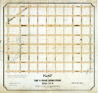
|
Plan of the line & grade regulations, Section No. 4, First Ward, Philadelphia [Ordinance May 10, 1862; confirmed Oct. 22, 1864] | Young, Alfred | 1864 |
Mounted
49 x 57 in.
1 inch = 100 feet
|
South Philadelphia, 1st Ward, 4th Section. Bounded by Porter to Curtin Sts., 5th to Broad Sts.
Building footprints, old roads, sewers, streams
|
| 202-b HP |
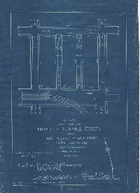
|
Plan for placing Bonsall and Bucknell Streets from Jackson Street to Wolf Street on City Plan No. 202, Forty-eighth Ward, Philadelphia. [Ordinance April 9, 1914; confirmed May 19, 1914] | Puff, Charles F., Jr. | 1914 |
Blueprint
14 x 10 in.
1 inch = 100 feet
|
South Philadelphia
Curb elevations
|
| 202-c HP |
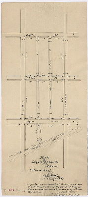
|
Plan of Lingo & Mt. Holly Sts. In the 26th Ward. [Ordinance March 31, 1891; confirmed May 15, 1893] | Daly, Thomas | 1893 |
Paper
20 x 9 in.
|
South Philadelphia
Curb elevations
|
| 202-d HP |
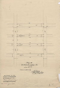
|
Plan of McClellan & Sigel Sts. In the 26th Ward [Ordinance April 4, 1891; confirmed Sept. 8, 1891] | Daly, Thomas | 1891 |
Paper
18 x 12 in.
|
South Philadelphia
Curb elevations
|
| 202-e HP |
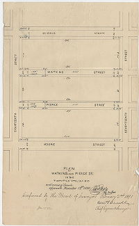
|
Plan of Watkins and Pierce Sts. In the Twenty-sixth Ward. [Ordinance Nov. 12, 1890; confirmed Feb. 2, 1891] | Daly, Thomas | 1891 |
Paper
18 x 11 in.
|
South Philadelphia
Curb elevations
|
| 202-f HP |
|
Plan of Bancroft Street [Ordinance April 7, 1890; confirmed May 19, 1890] | Daly, Thomas | 1890 |
Paper
18 x 12 in.
|
South Philadelphia
Curb elevations
|
| 202-g HP |
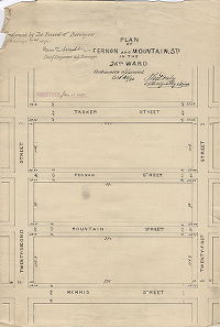
|
Plan of Fernon and Mountain Sts. In the 26th Ward [Ordinance Oct. 21, 1890; confirmed Feb. 2, 1891] | Daly, Thomas | 1891 |
Paper
16 x 11 in.
|
South Philadelphia
Curb elevations
|
| 202-h HP |
|
Plan of Ward and Dorrance Sts. In the 26th Ward [Ordinance June 26, 1891; confirmed Aug. 1, 1892] | Daly, Thomas | 1892 |
Paper
17 x 12 in.
|
South Philadelphia
Curb elevations
|
| 202-i HP |
|
Plan of the lines and grades of Mountain Street from Eighteenth St. to Twenty-first St. in the Thirty-sixth Ward, Philadelphia [Ordinance Jan. 25, 1894; confirmed May 7, 1894] | Daly, Thomas | 1894 |
Paper
14 x 47 in.
|
South Philadelphia
Curb elevations
|
| 202-j HP |
|
Plan showing lines and grades, Hoffman and Dudley Sts. From Nineteenth to Twentieth St., Thirty-sixth Ward, Philadelphia [Ordinance Dec. 20, 2891; survey returned Jan. 1893; confirmed May 15, 1893] | Daly, Thomas | 1893 |
Paper
17 x 11 in.
|
South Philadelphia
Curb elevations
|
| 202-k HP |
|
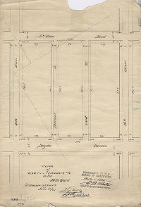
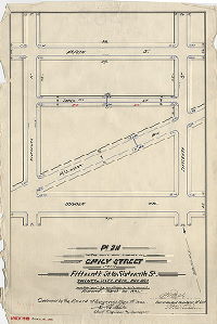
Plan of the lines and grades of Emily Street from Fifteenth St. to Sixteenth St., Thirty-sixth Ward, Philadelphia [Ordinance March 30, 1893; confirmed May 7, 1894] | Daly, Thomas | 1894 |
Paper
19 x 13 in.
|
South Philadelphia
Curb elevations
|
| 202-L HP |
|
Plan of the lines and grades of Mole St. and Hicks St. from Wolf St. to Porter St., Twenty-sixth Ward, Phila. [Ordinance March 30, 1893; survey returned April 1893; confirmed May 14, 1894] | Daly, Thomas | 1893 |
Paper
28 x 13 in.
|
South Philadelphia
Curb elevations
|
| 202-m HP |
|
Plan of the lines and grades of Chadwick St. and Bancroft St. from Wolf St. to Porter St., Twenty-sixth Ward, Phila. [Ordinance March 30, 1893; survey returned April 1893; confirmed May 14, 1894] | Daly, Thomas | 1893 |
Paper
28 x 13 in.
|
South Philadelphia
Curb elevations
|
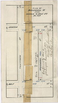
| 202-n HP |
|
Plan of the lines and grades of Mildenhall [now Bouvier] St. and Seibold St. from Wolf St. to Porter St., Twenty-sixth Ward, Phila. [Ordinance March 30, 1893; survey returned April 1893; confirmed May 14, 1894] | Daly, Thomas | 1893 |
Paper
27 x 13 in.
|
South Philadelphia
Curb elevations
|
| 202-o HP |
|
Plan of Fernon Street from 19th to 20th Street [Ordinance Nov. 11, 1885; confirmed April 19, 1886] | Daly, Thomas | 1886 |
Paper
9 x 15 in.
|
South Philadelphia
Curb elevations
|
| 202-p HP |
|
Plan of Bancroft Street, 26th Ward Ordinance Dec. 9, 1889; confirmed May 5, 1890] | Daly, Thomas | 1890 |
Paper
17 x 18 in.
|
South Philadelphia
Curb elevations
|
| 202-q HP |
|
Plan of Hicks & Mole Sts. From Mifflin to McKean Sts. [Ordinance Nov. 11, 1885; confirmed April 19, 1886] | Daly, Thomas | 1886 |
Paper
15 x 15 in.
|
South Philadelphia
Curb elevations
|
| 202-r HP |
|
Plan of Hicks St. from Moore to Mifflin Sts. [Ordinance Dec. 31, 1881; confirmed June 5, 1882] | Cranmer, William C. | 1882 |
Paper
15 x 9 in.
|
South Philadelphia
Curb elevations
|
| 202-s HP |
|
Plan of Mildenhall [now Bouvier] St. from Jackson to Wolf St. Dec. 1876 [Ordinance Nov. 13, 1876; survey returned Dec. 1876; confirmed Jan. 15, 1877] | Not named | 1876 |
Paper
6 x 10 in.
|
South Philadelphia
Curb elevations
|
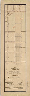
| 202-t HP |
|
Plan of Broad Street showing revision of footways and grades from Federal to Porter Street. Authorized by Councils May 19, 1873 [Confirmed April 17, 1876] | Not named | 1876 |
Mounted
12 x 66 in.
|
South Philadelphia
Curb elevations
|
| 202-u HP |
|
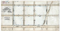
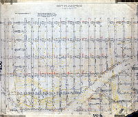
Plan of the revision of lines and grades on City Plan No. 202 bounded by Broad, Porter, 26th and Tasker Streets in the 26th and 36th Wards, Philadelphia. [Ordinances April 4, 1884 and Dec. 28, 1895; confirmed June 16, 1902] | Nobré, John M. | 1902 |
Mounted
46 x 75 in.
|
South Philadelphia. Bounded by Broad, Porter, 26th and Tasker Sts.
Curb elevations
|
| 202-x HP |
|
Plan of curb heights on 25th street, Long Lane and the Philadelphia Gas Works. | Daly, Thomas | 1862 |
Mounted
28 x 65 in.
1 inch = 150 feet
|
South Philadelphia. Bounded by Washington Ave. to Johnston St., 24th St. to 34th Sts. and Schuylkill River
Building footprints, curb elevations, railroad
|
| 202-y HP |
|
Plan of Passyunk Road and vicinity showing revision of grades in the 26th Ward [Confirmed July 7, 1873] | Not named | 1873 |
Mounted
31 x 39 in.
1 inch = 100 feet
|
South Philadelphia. Bounded by Snyder to Oregon Aves., 19th to 27th Sts.
Curb elevations., creeks, railroad
|
| 203-02 HP |
|
Plan of the revision of lines & grades on Plan No. 20, 26th & 36th Wards. [Ordinances April 4, 1894, Dec. 28, 1895 and Jan. 17, 1898; confirmed July 1, 1901] | Nobré, John M. | 1898 |
Mounted
44 x 63 in.
1 inch = 100 feet
|
South Philadelphia
Curb elevations, railroads
|
| 203-03 HP |
|
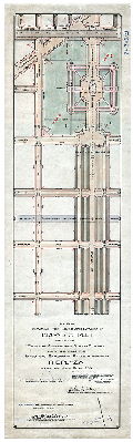
Plan revising the lines and grades of Broad Street between Oregon Avenue and Curtin Street and revising the lines and grades of streets bounding The Plaza. Part of City Plan 203. [Ordinance April 29, 1913; confirmed August 11, 1913] | Nobré, John M. | 1913 |
Mounted
40 x 12 in.
|
South Philadelphia. Broad Street
Curb elevations, park areas
|
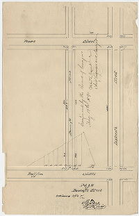
| 203-05 HP |
|
Plan of Girard Park in the Twenty-sixth Ward. [Ordinance April 11, 1890; confirmed April 15, 1895] | Daly, Thomas | 1895 |
Mounted
14 x 26 in.
|
South Philadelphia
Curb elevations, railroad
|
| 203-06 HP |
|
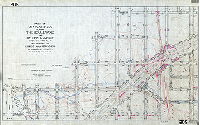
Plan revising the lines and grades of Broad Street between Oregon Avenue and Curtin Street and creating a plaza bounded by Oregon Ave., 13th St., Bigler St. and 15th St. and making Broad Street from Bigler St. to Curtin St. 300 ft. wide. Part of Plan 203. [Ordinance June 16, 1904; confirmed Jan. 16. 1905] | Nobré, John M. | 1904 |
Mounted
45 x 14 in.
|
South Philadelphia. Broad Street
Curb elevations, Marconi Plaza
|
| 203-07 HP |
|
Plan of Broad Street showing revision of footways and grades from Porter to Curtin Street. Authorized by Councils May 19, 1873. [Approved by Board of Surveyors April 17, 1876] | Not named | 1876 |
Mounted
12 x 38 in.
|
South Philadelphia. Broad Street
Curb elevations
|
| 203-z HP |
|
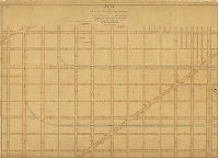
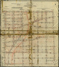
[No title. Part of South Philadelphia. Lithograph. "21." See plan 210-Z_HP for similar plan of another section of Philadelphia] | Not named | 1870 ca. |
Paper
39 x 62 in.
1 inch = 200 feet
|
South Philadelphia. Bounded by Bigler Ave. to Avenue 44 South, Broad St. to Schuylkill River
Topography, Hollanders Creek, streams, most building footprints, dikes in meadows, river soundings
|
| 204-01 MTD |
|
Plan of the Ninth Section of the resurvey and regulation of the late Borough of Germantown, Twenty-second Ward, City of Philadelphia. [Resolution April 17, 1856; approved by Board of Surveyors June 6, 1864] | Lightfoot, Jesse | 1864 |
Mounted
59 x 42 in.
|
22nd Ward, 9th Section, Germantown. Bounded by Gorgas St., East Washington Ave., Stenton Ave., and Chew St.
Curb elevations, Wingohocking Creek and tributary streams, railroad, building footprints
|
| 204-02 CP |
|
Topography of Plan 204 | Not named | 1880 ca. |
Tracing
46 x 42 in.
|
Bounded by Gorgas St., Washington Lane, Stenton Ave., and Chew St.
Topography, Wingohocking Creek and tributary streams, spring house, building footprints, woods, marshland, greenhouses
|
| 204-02 MTD tracing |
|
A revision of the lines and grades of City Plan 204 bounded by Washington Lane, Chew Street, Gorgas Street and Stenton Avenue 22d Ward. Topography copied from old city plan. [Ordinance June 23, 1905; confirmed 1905 and 1906] | Wagner, Joseph C. | 1905 |
Tracing
54 x 48 in.
1 inch = 100 feet
|
Bounded by Washington Lane, Chew St., Gorgas St., and Stenton Ave.
Topography, Wingohocking Creek and tributary streams, curb elevations
|
| 205 CP |
|
City Plan No. 205 revised to April 1, 1936 | Not named | 1936 |
Tracing
45 x 40 in.
|
Bounded by Broad to 5th Sts., Wingohocking to Ruscomb Sts.
Topography, Logan neighborhood, Wingohocking Creek and tributary streams, ponds, railroad
|
| 205-01 MTD |
|
Plan of the Fourth Section of the survey and regulation of the late Township of Bristol, Twenty-second Ward, City of Philadelphia [Resolution date not noted; approved by Board of Surveyors June 20, 1864; confirmed by Court March 18, 1867] | Lightfoot, Jesse | 1864 |
Mounted
49 x 49 in.
|
22nd Ward, 4th Section, Bristol. Bounded by Cayuga to Ruscomb Sts., Broad to 5th Sts.
Wingohocking Creek around Logan
|
| 205-05 MTD tracing |
|
Part of City Plan No. 205 placing the Boulevard and Bellfield [Belfield] Avenue upon the City Plan and revising the lines and grades of adjacent streets. Forty-second Ward, Philadelphia. [Ordinance Dec. 24, 1902; survey returned and confirmed March 2, 1903] | Brinton, Walter | 1903 |
Tracing
30 x 49 in.
|
Bounded roughly by Rockland to Wingohocking Sts., Broad to 7th Sts.
Topography. Boulevard around Wingohocking Creek and Logan neighborhood
|
| 206-01 MTD |
|
A revision of the lines and grades of a portion of City Plan 206, 22d Ward Philadelphia, bounded by Gorgas Street, Germantown Avenue, Mount Airy Avenue, and Stenton Avenue. [Ordinance June 23, 1905; confirmed 1905 and 1906] | Wagner, Joseph C. | 1905 |
Mounted
36 x 55 in.
|
Bounded by Gorgas St., Germantown Ave., Mt. Airy Ave. and Stenton Ave.
Topography, Wingohocking Creek headwaters
|
| 206-03 CP |
|
Plan of the revision of lines and grades, Tenth Section of the Twenty-second Ward, Philadelphia. Copy. [Ordinance June 12, 1882; confirmed April 19, 1886] | Trik, C. A. | 1886 |
Tracing
41 x 46 in.
|
22nd Ward, 10th Section. Bounded roughly by Germantown Ave., Mermaid Lane, Mt. Airy Ave. and Stenton Ave.
Cresheim Creek and tributary streams, spring protected by circular road, building footprints, railroad, quarry.
|
| 206-06 MTD |
|
Plan of the revision of lines and grades to accord with the location of the Fort Washington Branch of the Philadelphia Germantown and Chestnut Hill R.R. [Ordinance Dec. 10, 1891; confirmed June 26, 1893] | Jones, Walter | 1893 |
Mounted
26 x 41 in.
|
Bounded roughly by Stenton Ave., Germantown Ave., Gowen Ave. and Mermaid La.
Topography, Cresheim Creek and tributary, quarry, pond, railroad.
|
| 206-07 MTD |
|
A revision of the lines and grades of a portion of City Plan 206, 22d Ward Philadelphia bounded by Germantown Ave., Gowen Ave., Stenton Ave. and Mount Airy Avenue [Ordinance June 23, 1905; confirmed March 30, 1908] | Wagner, Joseph C. | 1908 |
Mounted
21 x 53 in.
|
Bounded by Germantown Ave., Gowen Ave., Stenton Ave. and Mount Airy Ave.
Topography, streams
|
| 207 CP |
|
City Plan No. 207, to date February 17, 1944, March 1, 1950. | Not named | 1950 |
Tracing
47 x 44 in.
|
Bounded by Broad to Fifth St., Chew Ave. to Ruscomb St.
Topography
|