
Philadelphia Streets Department Surveys
2755 result(s). Showing results 51 to 100.
View page: 1 2 3 4 5 6 7 8 9 10 11 12 13 14 15 16 17 18 19 20 21 22 23 24 25 26 27 28 29 30 31 32 33 34 35 36 37 38 39 40 41 42 43 44 45 46 47 48 49 50 51 52 53 54 55 56 (Show all on one page)
| Identifer | Preview | Title | Surveyor | Date | Media / Size / Scale | Area / Map Features |
| 013-07 HP |
|
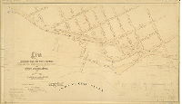
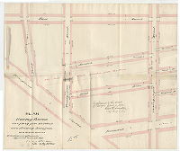
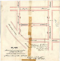
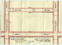
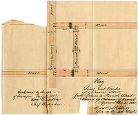
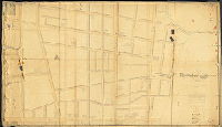
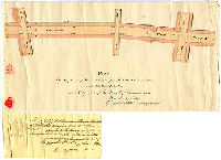
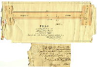
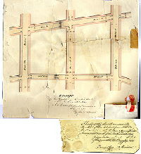
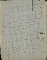
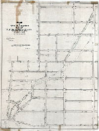
Plan of revisions of grades and width of footways on Pennsylvania Avenue between Coats Street and Poplar Street, and of grades on Canal Street in the 15th Ward [Resolution June 23, 1862; surveyed 1862; confirmed by Court May 18, 1863] | Roberts, Edward D. | 1862 |
Mounted
24 x 41 in.
1 inch = 100 feet
|
15th Ward. Pennsylvania Ave. between Coates St. and Poplar St., and along Pennsylvania Ave. to Schuylkill River
Curb heights, block dimensions, sidewalks, inlets, dock on Landing Ave., later penciled sections of tunnels, etc., from 1870s, 1880s by Samuel L. Smedley
|
| 013-08 HP |
|
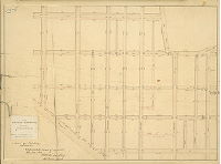
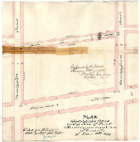
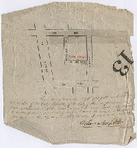
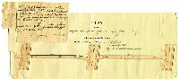
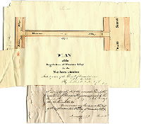
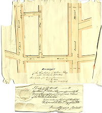
Plan of the revision of grades in a part of the Fifteenth Ward authorized by Act of Assembly June 26, 1871 and resolution of Councils July 11, 1871 [Confirmed by Board of Surveyors March 18, 1872] | Roberts, Edward D. | 1872 |
Mounted
23 x 31 in.
1 inch = 100 feet
|
15th Ward. Bounded by Girard Ave. to Hare St., 24th to 29th Sts.
Curb heights, block dimensions, sewers, tinted sidewalks
|
| 013-09 HP |
|
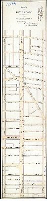
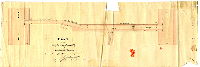
Copy of the plan of the survey and regulation of part of the District of Spring Garden as revised in pursuance of two Acts of Assembly passed respectively the 7th day of April anno Domini 1845 and the 14th day of March [1846] [See 013-23 for clearer copy of this plan] | Price, Philip M. | 1847 |
Mounted
37 x 71 in.
1 inch = 80 feet
|
Spring Garden District, bounded by Broad St. to Schuylkill River, Vine St. to Poplar St.
Fairmount Water Works, Reservoir, South Garden, Wire Bridge, sewers
|
| 013-10 HP |
|
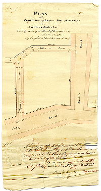
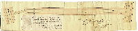
Plan of the revised survey of part of the 15th Ward [Approved by Board of Surveyors June 15, 1857. Attachment: Court confirmation of plan] | Stiles, Amos | 1857 |
Mounted
20 x 17 in.
1 inch = 80 feet
|
15th Ward. Bounded by Coates to Spring Garden Sts., 19th to 21st Sts.
Curb elevation, sewers
|
| 013-11 HP |
|
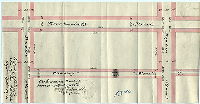
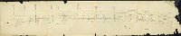
Plan of lines and grades of Simmonds Street from Ogden to Poplar Streets [Ordinance March 17, 1884; confirmed Aug. 4, 1884] | Roberts, Edward D. | 1884 |
Paper
9 x 9 in.
1 inch = 100 feet
|
Simmonds St. from Ogden to Poplar Sts.
Curb elevations
|
| 013-12 HP |
|
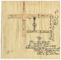
[No title. Bambrey St., Poplar St. to north of Brown St. Resolution March 11, 1875; confirmed April 19, 1875] | Roberts, Edward D. | 1875 |
Paper
9 x 15 in.
1.25 inch = 50 feet
|
Bambrey St., Poplar to Brown Sts.
Curb elevations, block dimensions, footways colored, grades
|
| 013-13 HP |
|
[Handwritten title on reverse: "Plan of Meredith Street from 24th to 25th St., 15th Ward." Survey returned May 1, 1872; confirmed March 3, 1873] | Roberts, Edward D. | 1873 |
Paper
17 x 15 in.
1.25 inch = 50 feet
|
Meredith St., 24th to 25th Sts.
Curb elevations
|
| 013-14 HP |
|
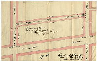
Plan of lines and grades of Woodstock Street from Brown to Parrish Streets [Ordinance June 29, 1883; confirmed Aug. 4, 1884] | Roberts, Edward D. | 1884 |
Paper
9 x 11 in.
1 inch = 100 feet
|
Woodstock St., Brown to Parrish Sts.
Curb elevations, block dimensions, footways, grades
|
| 013-15 HP |
|
Plan placing thereon two forty feet streets and striking therefrom Old Perot Street [Ordinance June 25, 1877; confirmed April 15, 1878] | Roberts, Edward D. | 1878 |
Paper
19 x 23 in.
1 inch = 40 feet
|
Bounded by 25th to Taney Sts., Hare St. to Fairmount Ave.
Curb elevations, block dimensions, footways, grades
|
| 013-16 HP |
|
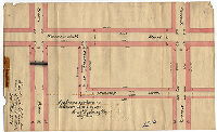
[No title. Bambrey Street, Poplar to Parrish Sts. Survey returned Sept. 19, 1874; confirmed April 19, 1875] | Roberts, Edward D. | 1874 |
Paper
8 x 16 in.
1.25 inch = 50 feet
|
Bambrey St., Poplar to Parrish Sts.
Curb elevations, block dimensions, footways, grades
|
| 013-17 HP |
|
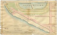
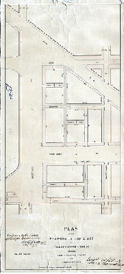
[No title. Ferry Road and Biddle Street, showing Fairmount Water Works Reservoir.] | Graff, Frederic, Jr. | 1842 |
Paper
14 x 23 in.
1 inch = 150 feet
|
Fairmount Water Works and vicinity
Fairmount Reservoir
|
| 013-18 HP |
|
[Handwritten title on reverse: "Virginia St., 24th to 25th St." Survey returned June 24, 1875; confirmed Oct. 23, 1876] | Roberts, Edward D. | 1875 |
Paper
9 x 15 in.
1.25 inch = 50 feet
|
Virginia [Olive] St., 24th to 25th Sts.
Curb elevations, block dimensions, footways, grades
|
| 013-19 HP |
|
Plan showing lines and grades of Ogden Street [Ordinance Nov. 13 1876; confirmed Jan. 15, 1877] | Roberts, Edward D. | 1877 |
Paper
14 x 14 in.
1 inch = 60 feet
|
Ogden St., 29th to 30th Sts.
Curb elevations, block dimensions, footways, grades
|
| 013-20 HP |
|
Plan showing the lines and grades of Perot Street [Resolution June 14, 1873; confirmed Oct. 23, 1876] | Roberts, Edward D. | 1873 |
Paper
15 x 15 in.
1.25 inch = 50 feet
|
Perot St. Bounded by 24th to 25th St., Perot St. to Fairmount Ave.
Curb elevations, block dimensions, footways, grades
|
| 013-21 HP |
|
Plan of Broad Street showing revision of footways and grades from Vine Street to Poplar Street [Resolution May 19, 1873; confirmed April 19, 1875] | Roberts, Edward D. | 1875 |
Mounted
56 x 13 in.
1 inch = 100 feet
|
Broad Street. Bounded by 13th to 15th Sts., Vine to Poplar Sts.
Curb elevations
|
| 013-22-large HP |
|
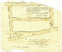
Plan of the revision of the lines of Twenty-Fifth Street between Spring Garden Street and Biddle Street [Ordinance April 5, 1884; confirmed Oct. 20, 1884] | Roberts, Edward D. | 1884 |
Mounted
30 x 14 in.
1 inch = 50 feet
|
25th St., Spring Garden to Biddle Sts.
Curb elevations, block dimensions, sidewalks
|
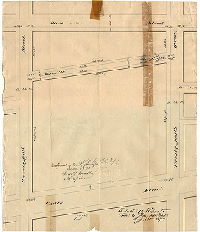
| 013-22-small HP |
|
[Handwritten title on reverse: "Swain St., 25th to 26th St." Survey returned June 29, 1874; resolution March 11, 1875; confirmed April 19, 1875] | Roberts, Edward D. | 1874 |
Paper
10 x 14 in.
1.25 inch = 50 feet
|
Swain St., 24th to 25th Sts.
Curb elevations, block dimensions, grades
|
| 013-23 HP |
|
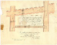
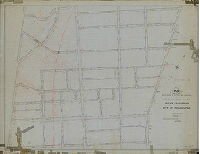
Copy of the plan of the survey and regulation of part of the District of Spring Garden as revised in pursuance of two Acts of Assembly passed respectively the 7th day of April anno Domini 1845 and the 14th day of March [1846] [Based on "worn and defaced" original as of 1900. Copy by Edwin M. Evans, June 1, 1900. See 013-09 HP for the original plan] | Price, Philip M. | 1900 |
Mounted
67 x 102 in.
|
Spring Garden District, bounded by Broad St. to Schuylkill River, Vine St. to Poplar St.
Fairmount Water Works reservoir and South Garden, Wire Bridge, streets, curbs, and sewers, wharves north and south of Water Works, street annotations up to 1884
|
| 013-s HP |
|
Philadelphia, Feb. 1,1888. (signed) John M. Dye, Engineer and Surveyor. [Property of Schuylkill River East Side Railroad from 24th Street north, along the Schuylkill River] | Dye, John H. | 1888 |
Tracing
28 x 29 in.
1 inch = 40 feet
|
Schuylkill River East Side Railroad, in the vicinity of 24th St.
Railroad
|
| 013-t HP |
|
Plan compiled from records and copies of surveys for Jos. D. Ellis….F. Bloch, Surveyor & Regulator, 4th District, March 20, 1899. [Plans shows line of Schuylkill River East Side Railroad in vicinity of 24th and Powelton] | Bloch, Frits | 1899 |
Tracing
19 x 21 in.
|
Schuylkill River East Side Railroad, in the vicinity of 24th St.
Railroad
|
| 013-u HP |
|
[No title. Property along Schuylkill River, between 24th St. and Powelton Ave., belonging to John J. Ridgway. Surveyed by Edward D. Roberts, April 1, 1869] | Roberts, Edward D. | 1869 |
Tracing
18 x 18 in.
|
Schuylkill River East Side Railroad, in the vicinity of 24th St.
Railroad
|
| 013-v HP |
|
[No title. Property along Schuylkill River, between 24th St. and Powelton Ave., belonging to John J. Ridgway. Surveyed by Edward D. Roberts, April 1, 1869] | Roberts, Edward D. | 1869 |
Tracing
18 x 18 in.
|
Schuylkill River East Side Railroad, in the vicinity of 24th St.
Railroad
|
| 013-w HP |
|
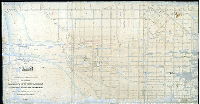
Plan of properties and water fronts along the Schuylkill River showing title lines of Irvine and Carty, former and revised Port Wardens Lines, Wharves, Docks, etc., Fifteenth Ward, Philadelphia | Bloch, Frits | 1901 |
Blueprint
42 x 32 in.
1 inch = 30 feet
|
15th Ward. Schuylkill River waterfront from 24th St. to the Schuylkill River, Callowhill to Vine Sts.
Block dimensions, property lines with dimensions, railroad right of way, wharf and docks as in 1869 and 1901
|
| 013-x HP |
|
Profile of Callowhill Street from 24th to Biddle Street. [Plan is on a larger sheet of graph paper. Portion not scanned was blank. No date.] | Not named | 1880 ca. |
Mounted
21 x 30 in.
|
Callowhill St. from 24th St. to Biddle St.
Profile of street grade on graph paper
|
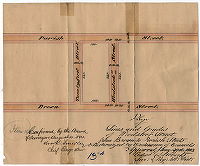
| 013-y HP |
|
Plan of lines and grades of Norwood Street from Brown to Parrish Street [Ordinance Dec. 31, 1881; confirmed June 5, 1882] | Roberts, Edward D. | 1881 |
Paper
9 x 11 in.
1 inch = 100 feet
|
Norwood St., Brown to Parrish Sts.
Curb elevations block dimensions
|
| 013-z HP |
|
[No title. Hedding Street. Confirmed by Court Nov. 29, 1869] | Not named | 1869 |
Tracing
9 x 8 in.
1 inch = 120 feet
|
Hedding St., bounded by 15th to 16th Sts. North St. to Coates St.
Street location
|
| 014-01 HP |
|
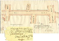
Plan of proposed extension of Spring-Garden St. from Sixth St. to Delaware River [Resolution June 2, 1870] | Wolf, John F. | 1870 |
Mounted
24 x 101 in.
1 inch = 40 feet
|
Spring Garden St., Sixth St. to Delaware River, Green to Noble Sts.
Property lines and dimensions, names of property owners, route of proposed street, assessed value of sections; road and sidewalks colored
|
| 014-02 HP |
|
Plan of line and grade regulations of Ocean Street, in the 11th Ward of the City of Philada., as authorised by resolution of Councils, approved Decr. 13th 1862. [Surveyed Jan. 1863; approved Feb. 2, 1863] | Wolf, John F. | 1863 |
Mounted
18 x 18 in.
1 inch = 20 feet
|
Ocean St., between Dana and Green Sts.
Curb elevations
|
| 014-03 HP |
|
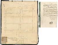
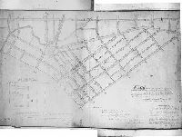
Plan of the Second Division of the Northern Liberties. Survey begun in 1796 and completed in 1798. | Brooke, Robert; Auston, Matthew | 1798 |
Mounted
52 x 89 in.
1 inch = 50 feet
|
Northern Liberties, 2nd Division. Delaware River to 6th St.; Brown St. to Callowhill St.
Pegg's Run, Canal, curb elevations, creeks, benchmark buildings
|
| 014-n HP |
|
Draught of the regulation of Julianna Street, between Buttonwood and Green Streets in the Northern Liberties. Made by order of the Board of Commissioners Jany. 8th 1828 by Jos. H. Siddall. [with attached affidavit] | Siddall, Joseph H. | 1828 |
Paper
14 x 17 in.
|
Northern Liberties. Julianna St.
Curb elevations
|
| 014-o HP |
|
Draught of the regulation of Peach Street, between Green and Coats Streets, in the Northern Liberties | Siddall, Joseph H. | 1828 |
Paper
13 x 17 in.
|
Northern Liberties. Peach St.
Curb elevations
|
| 014-p HP |
|
Plan of the regulation of Green Street between Old York Road and Sixth Street in the Northern Liberties | Siddall, Joseph H. | 1828 |
Paper
9 x 16 in.
|
Northern Liberties. Green St.
Curb elevations
|
| 014-q HP |
|
Plan of the regulation of New-market Street from Noble Street to Green Street in the Northern Liberties | Siddall, Joseph H. | 1824 |
Paper
9 x 18 in.
|
Northern Liberties. New-Market St.
Curb elevations
|
| 014-r HP |
|
Plan of the regulation of Brooke Alley and part of Rose Alley in the Northern Liberties | Siddall, Joseph H. | 1824 |
Paper
8 x 20 in.
|
Northern Liberties. Brooke and Rose Alleys.
Curb elevations
|
| 014-s HP |
|
Plan of the regulation of Jones Alley in the Northern Liberties | Siddall, Joseph H. | 1822 |
Paper
8 x 23 in.
|
Northern Liberties. Jones Alley
Curb elevations
|
| 014-t HP |
|
Plan of the regulation of Rogers Alley and Elbow Lane in the Northern Liberties | Siddall, Joseph H. | 1822 |
Paper
12 x 8 in.
|
Northern Liberties. Rogers Alley and Elbow Lane
Curb elevations
|
| 014-u HP |
|
Plan of the regulation of Magnolia Street in the Northern Liberties | Siddall, Joseph H. | 1824 |
Paper
7 x 17 in.
|
Northern Liberties. Magnolia St.
Curb elevations
|
| 014-v HP |
|
Plan of the regulation of Flowers Alley in the Northern Liberties | Siddall, Joseph H. | 1824 |
Paper
9 x 13 in.
|
Northern Liberties. Flowers Alley
Curb elevations
|
| 014-w HP |
|
Draught of the regulation of Crown Street, between Tammany and Green Streets in the Northern Liberties | Siddall, Joseph H. | 1829 |
Paper
7 x 27 in.
|
Northern Liberties. Crown St.
Curb elevations
|
| 014-x HP |
|
Plan of the regulation of Maria Street in the Northern Liberties | Siddall, Joseph H. | 1825 |
Paper
5 x 14 in.
|
Northern Liberties. Maria St.
Curb elevations
|
| 014-y HP |
|
Draught of the regulation of Kunckel Street in Northern Liberties | Siddall, Joseph H. | 1828 |
Paper
12 x 14 in.
|
Northern Liberties. Kunckel St.
Curb elevations
|
| 014-z HP |
|
Draught of the regulation of Willow Alley in the Northern Liberties | Siddall, Joseph H. | 1828 |
Paper
9 x 12 in.
|
Northern Liberties. Willow Alley
Curb elevations
|
| 015-01 HP |
|
Plan of the First Division of the survey and regulation of the Kensington District of the Northern Liberties, agreeably to an act of the General Assembly of the Commonwealth of Pennsylvania, Passed the sixth day of March one thousand eight hundred and twenty. Surveyed and returned October 10th 1821 by Robert Brooke. | Brooke, Robert | 1821 |
Microfilm Only
1 inch = 100 feet
|
Kensington, 1st Division
Curb elevations, benchmark buildings, property ownership
|
| 016-01 MTD |
|
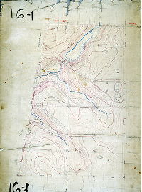
[No title. Topography of part of City Plan 16, in Mt. Airy. No date.] | Not named | 1885 ca. |
Mounted
26 x 38 in.
|
Bounded by Chelten Ave. to Washington Lane, Wayne Ave. to Wissahickon Ave.
Topography, Monoshone Creek and tributary streams, pond and dam, building footprints. Plan seems to be a draft and incomplete.
|
| 016-18 016-01 tracing1 |
|
Plan of the Second Section of the resurvey & regulation of the Borough of Germantown [Resolution April 17, 1856; approved by Board of Surveyors Nov. 15, 1858] | Lightfoot, Jesse | 1858 |
Tracing
68 x 54 in.
|
22nd Ward, 2nd Section, Germantown. Bounded by Germantown Ave., Queen St., Township Line Rd. (Wissahickon Ave.) and Washington La.
Streams, sewers, springs, curb elevations
|
| 016-53 CP |
|
Plan of the revision of lines and grades of part of the Second Section, Twenty-second Ward, City of Philadelphia. Made in accordance with a resolution of Councils approved January 19, 1885. | Jones, Walter | 1885 |
Tracing
45 x 58 in.
|
22nd Ward, 2nd Section. Bounded by Washington St. to School Lane, Wissahickon Ave. to Germantown Ave.
Topography, streams, pond, railroad
|
| 017-04 MTD |
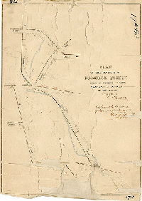
|
Plan of the revision of Hancock Street [Ordinance May 27, 1876; confirmed Oct. 23, 1876] | Lightfoot, Jesse | 1876 |
Mounted
18 x 24 in.
|
Hancock St.
Wingohocking Creek, railroad
|
| 017-05 MTD |
|
Plan of revision of grades on Armat Street [Ordinance Dec. 31, 1875; confirmed April 2, 1877] | Not named | 1877 |
Mounted
19 x 37 in.
1 inch = 100 feet
|
Germantown. Bounded by Chelten Ave., Magnolia Ave., Church Lane and Germantown Ave.
Wingohocking Creek and Honey Run, railroad
|
| 017-06 MTD tracing |
|
Plan of revision of Section No. 17 made in accordance with ordinance of Councils of April 2nd, 1878 [Confirmed Sept. 1, 1879; tracing copy of mounted plan made in 1911] | Not named | 1879 |
Tracing
48 x 37 in.
1 inch = 100 feet
|
Bounded roughly by Washington Lane to Church Lane, Baynton St. to Chew St.
Curb elevations, Wingohocking Creek and ponds, railroad
|
| 018-02 MTD |
|
Plan of revision of grades [of] part of Fifth Section 23d Ward Philada. [Ordinance July 11, 1868] | Not named | 1868 ca. |
Mounted
53 x 32 in.
|
23rd Ward, 5th Section. Bounded by Allegheny Ave., Kensington Ave., Lehigh Ave. and Fillmore St.
Streams, sewers, curb elevations
|