
Philadelphia Streets Department Surveys
2755 result(s). Showing results 1001 to 1050.
View page: 1 2 3 4 5 6 7 8 9 10 11 12 13 14 15 16 17 18 19 20 21 22 23 24 25 26 27 28 29 30 31 32 33 34 35 36 37 38 39 40 41 42 43 44 45 46 47 48 49 50 51 52 53 54 55 56 (Show all on one page)
| Identifer | Preview | Title | Surveyor | Date | Media / Size / Scale | Area / Map Features |
| 248-05 MTD |

|
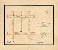
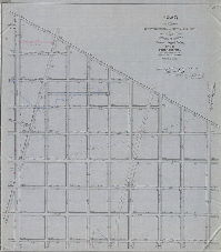
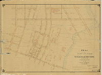
Plan of Brill St. and Bonnaffon St. from Woodland Ave. to Paschall Ave. and Glenmore St. from 67th St. to 68th St., 40th Ward, Phila., as authorized to be placed upon the City Plan by ordinance of Councils July 20, 1898 [Survey returned Sept. 1, 1898; confirmed May 2 and July 3, 1899] | Gillingham, J. Harvey | 1898 |
Mounted
24 x 17 in.
1 inch = 100 feet
|
Southwest Philadelphia
Curb elevations, building footprints, railroad
|
| 248-06 MTD |
|
Plan of Shields St. from Woodland Ave. to Paschall Ave. in the Twenty-seventh Ward, Philadelphia, as authorized to be placed upon the City Plan by ordinance of Councils approved Dec. 16th, 1896 [ Confirmed March 1, 1897] | Gillingham, J. Harvey | 1897 |
Mounted
16 x 18 in.
1 inch = 100 feet
|
Southwest Philadelphia
Curb elevations
|
| 248-08 MTD |

|
Plan placing on the City Plan Wheeler and Reedland Sts. From 63rd to 64th Sts. In the Fortieth Ward [Ordinance March 21, 1906; survey returned May 4, 1906; confirmed June 18, 1906] | Gillingham, J. Harvey | 1906 |
Mounted
11 x 17 in.
1 inch = 100 feet
|
Southwest Philadelphia
Curb elevations
|
| 248-09 MTD |
|
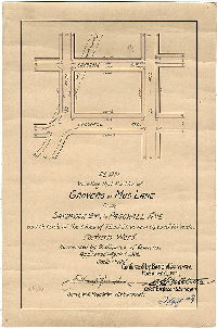
Plan vacating that portion of Grovers or Mud Lane from Saybrook St. to Paschall Ave. and outside of the lines of 72nd St. as now opened 60' wide [Ordinance April 6, 1908; confirmed Nov. 21, 1910] | Gillingham, J. Harvey | 1910 |
Mounted
13 x 9 in.
1 inch = 100 feet
|
Southwest Philadelphia
Curb elevations, old road
|
| 248-10 MTD |

|
Plan of Glenmore St. from Sixty-fourth St. to Sixty-fifth St., Fortieth Ward [Ordinance Feb. 27, 1902; survey returned March 18, 1902; confirmed April 21, 1902] | Gillingham, J. Harvey | 1902 |
Mounted
13 x 9 in.
1 inch = 100 feet
|
Southwest Philadelphia
Curb elevations, railroad
|
| 248-11 MTD |
|
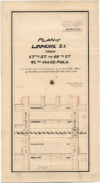
Plan of Linmore St. from 67th St. to 68th St., 40th Ward, Phil'a., as authorized to be placed upon the City Plan by ordinance of Councils Dec. 10th, 1898 [Confirmed July 3, 1899] | Gillingham, J. Harvey | 1899 |
Mounted
22 x 12 in.
1 inch = 100 feet
|
Southwest Philadelphia
Curb elevations, building footprints, railroad
|
| 249 CP |

|
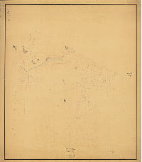
[No title. Topography of City Plan 249] | Not named | 1885 ca. |
Tracing
45 x 70 in.
|
Bounded by 5th to Broad Sts., Godfrey to Cheltenham Aves.
Topography, streams, building footprints, quarries
|
| 249-01 MTD |
|
Topography of Plan No. 249 [Ordinance June 23, 1884; "topography filed" June 1, 1887] | Bloch, Frits | 1887 |
Mounted
61 x 52 in.
|
Bounded by Broad to 5th Sts., Cheltenham to Chelten Aves.
Topography, streams, ponds, building footprints; "field work" by F. Bloch [Frits Bloch]
|
| 249-02 MTD tracing |
|
Plan of the Fifteenth Section of the survey and regulation of the late Township of Bristol, Twenty-second Ward, City of Philadelphia [Resolution date not noted; approved by Board of Surveyors May 1, 1871; confirmed by Court May 15, 1871] | Not named | 1871 |
Tracing
55 x 50 in.
|
22nd Ward, 15 Section, Bristol. Bounded by Broad to 5th Sts., Cheltenham to Chelten Aves.
Streams, ponds, springs, building footprints, railroad, old road (Oak Lane)
|
| 249-06 MTD |
|
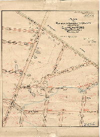
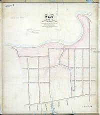
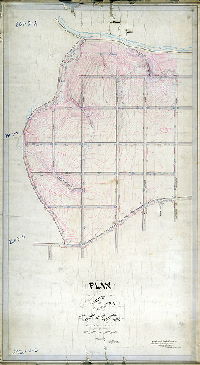
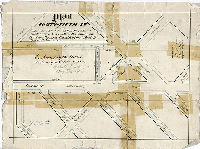
Plan of the revision of lines and grades on a portion of City Plan No. 249, Twenty-second Ward, Philadelphia [Ordinance Dec. 8, 1897; survey returned March 7, 1898; confirmed March 14, 1898] | Brinton, Walter | 1898 |
Mounted
26 x 23 in.
1 inch = 100 feet
|
Bounded roughly by Cheltenham Ave., Warnock St., 69th Ave. North, and Cheltenham and Willow Grove Turnpike
Topography, building footprints, streams, pond, shaded areas may delineate quarries
|
| 250-01 MTD |

|
Plan of line and grade regulations of the Eleventh Section of the Twenty-third Ward Philadelphia [Confirmed October 7, 1872] | Not named | 1872 |
Mounted
48 x 74 in.
1 inch = 100 feet
|
23rd Ward, 11th Section. Bounded by F St. to M St., unnamed diagonal street to Fisher St.
Curb elevations, stream, pond, building footprints
|
| 250-06 MTD |
|
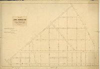
Plan of the revision of lines and grades City Plan No. 250, Thirty-fifth Ward Philadelphia. [Various ordinances, 1891 to 1902; confirmed Sept. 16, 1907] | Webster, John H., Jr. | 1907 |
Mounted
52 x 42 in.
|
Northeast Philadelphia. Bounded by Adams Ave. to Vankirk St., Hasbrook St. and Rising Sun Ave. to Whitaker Ave.
Topography, streams, building footprints
|
| 251-01 HP |

|
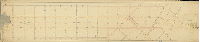
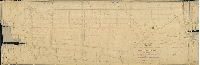
Plan of the revision of lines and grades on streets crossing the Connecting Railroad and adjacent streets as directed by resolution of Councils approved November 22nd, 1870 [Approved by Board of Surveyors Dec. 19, 1870] | Not named | 1870 |
Mounted
28 x 110 in.
1 inch = 100 feet
|
Bounded by Lehigh to Girard Aves., 19th St. to Schuylkill River
Topography, creeks, curb heights, buildings in street lines
|
| 251-02 HP |

|
Plan of the revision of lines and grades on streets crossing the Connecting Railroad and adjacent streets as directed by resolution of Councils approved November 22nd, 1870 [Approved by Board of Surveyors Dec. 19, 1870] | Not named | 1870 |
Mounted
24 x 136 in.
1 inch = 100 feet
|
Bounded by A St. to 20th St.; Erie Ave. to Cumberland Ave.
Topography, creeks, curb heights, buildings in street lines
|
| 251-03 HP |
|
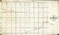
Plan of the revision of lines and grades on streets crossing the Connecting Railroad and adjacent streets as directed by resolution of Councils approved November 22nd, 1870 [Approved by Board of Surveyors Dec. 19, 1870] | Not named | 1870 |
Mounted
23 x 110 in.
1 inch = 100 feet
|
Bounded by A St. to Amber St.; Tioga St. to Butler St.
Topography (1-foot contours) over part of plan, creeks, curb heights, building footprints in street lines
|
| 252-02 MTD |
|
Plan of the survey and regulation of the Fifteenth Section, Twenty-first Ward, City of Philadelphia [Resolution July 14, 1869; confirmed Feb. 19, 1872] | Levering, John H. | 1872 |
Mounted
50 x 44 in.
|
21st Ward, 15th Section. Bounded Wissahickon Creek to Ridge Ave., Leverington St. to Roxborough Ave.
Topography, Wissahickon Creek, streams, Leverington Cemetery
|
| 253-01 MTD |
|
Plan of lines and grades with topography of the Thirteenth Section of the Twenty-third Ward Philadelphia. [Ordinance March 26, 1888; confirmed March 16, 1891] | Webster, George S. | 1891 |
Mounted
43 x 73 in.
|
23rd Ward, 13th Section. Bounded by Montgomery County line to M St., Vankirk St. to Longshore St.
Topography, building footprints, streams, Wentz Farm Reservoir
|
| 254-03 MTD |

|
Plan revising lines and grades and establishing new streets on City Plan No. 254, Thirty-fifth Ward Philadelphia [Ordinances 1892 to 1902; confirmed April 6, 1908] | Webster, John H., Jr. | 1908 |
Mounted
48 x 82 in.
|
Northeast Philadelphia. Bounded by Whitaker Ave. to Castor Ave. Vankirk St. to Longshore St.
Topography, Little Tacony Creek and tributary streams, building footprints, railroad
|
| 255-z HP |

|
Plan of line and grade regulations of Tenth Section of the Twenty-third Ward Philadelphia, prepared in accordance with an ordinance of Councils approved February 16th, 1869. | Not named | 1869 ca. |
Mounted
52 x 50 in.
1 inch = 100 feet
|
23rd Ward, 10th Section. Harrison to Sommerville Sts.; Frankford Ave. to T St.
Curb elevations, creeks, building footprints in line of streets
|
| 256-02 MTD |
|
Plan of the revision of lines and grades of the Ninth Section of the Twenty-third Ward [Ordinance June 28, 1876; confirmed Feb. 5, 1877] | Not named | 1877 |
Mounted
54 x 44 in.
|
23rd Ward, 9th section. Bounded by Wingohocking and Unity Sts., Leiper and T Sts., Somerville St. and M St.
Topography, streams, ponds, building footprints
|
| 256-20 MTD |

|
Plan of line and grade regulation of Ninth Section of the Twenty-third Ward Philadelphia. [Ordinance Feb. 16, 1869; not confirmed. Note on reverse: "This plan has been superseded"] | Not named | 1869 ca. |
Mounted
47 x 71 in.
1 inch = 100 feet
|
23rd Ward, 9th section. Bounded by Wingohocking St. to Somerville St., Leiper and T Sts. to M St.
Streams, ponds, mill races, building footprints
|
| 257-01 HP |

|
Plan of line and grade regulations of the Twelfth Section of the Twenty-third Ward Philadelphia [Confirmed Oct. 7, 1872] | Not named | 1872 |
Mounted
77 x 48 in.
1 inch = 100 feet
|
23rd Ward, 12th Section. Bonded by M St. to Bristol Turnpike; Fisher St. to Vankirk St. [old grid]
Curb elevations, streams, spring, mill race and footprint of mill building, original roads shown as dotted lines
|
| 258 MTD |

|
Plan of line and grade regulations of the Seventeenth Section of the Twenty-third Ward Philadelphia [Ordinance July 13, 1870; no confirmation date. Note on reverse: "Superseded"] | Not named | 1870 ca. |
Mounted
48 x 92 in.
1 inch = 100 feet
|
23rd Ward, 17th Section. Bounded by Dark Run Road to Bridge St., Bristol Turnpike (Frankford Ave.) to Frankford Creek and Delaware River
Curb elevations, stream, Frankford Creek, Mt. Sinai Cemetery
|
| 258-01 CP |
|
Plan of the revision of lines and grades on the Seventeenth Section in the Twenty-third Ward Philadelphia [Ordinance Dec. 31, 1883; confirmed on various dates, 1888 to 1891] | Webster, George S. | 1888 |
Tracing
40 x 93 in.
|
23rd Ward, 17th Section. Bounded by Foust to Bridge Sts., Frankford Ave. to Frankford Creek and Delaware River
Topography, building footprints, streams; Chevra Bikur Cholim, Adath Jeshuron, and Mt. Sinai Cemeteries
|
| 258-02 MTD |
|
Plan of revision of lines and grades along the line of the Philadelphia and Trenton Rail Road on part of the Seventeenth Section of the Twenty-third Ward Philadelphia [Ordinance March 29, 1887; filed Dec. 22, 1888; confirmed April 28, 1890] | Webster, George S. | 1888 |
Mounted
39 x 54 in.
|
23rd Ward, 17th Section. Bounded by Foust to Bridge Sts., Torresdale Ave. to Frankford Creek and Delaware River
Topography, building footprints, Frankford Creek and tributary near mouth, springs. U.S. Arsenal buildings
|
| 259-z HP |

|
Plan of line and grade regulations of the Fifteenth Section of the Twenty-third Ward Philadelphia prepared according to an ordinance of Councils approved May 7th, 1870 [Not confirmed] | Not named | 1870 ca. |
Mounted
47 x 79 in.
1 inch = 100 feet
|
23rd Ward, 15th Section. Bounded by Castor Ave. to Y St., Vankirk to Longshore Sts.
Curb heights, creeks, original roads
|
| 260-z HP |

|
Plan of line and grade regulations of the Sixteenth Section of the Twenty-third Ward Philadelphia prepared according to an ordinance of Councils approved May 7th, 1870 [Not confirmed] | Not named | 1870 ca. |
Mounted
62 x 47 in.
1 inch = 100 feet
|
23rd Ward, 16th Section. Longshore to Vankirk Sts., Y St. to Charles St.
Thompson's Dam, curb heights, creeks, original roads
|
| 261-03 MTD |
|
Plan of the survey and regulation of the Sixteenth Section, Twenty-first Ward, City of Philadelphia [Resolution Sept. 19, 1870; "hearing Feb. 19, 1872; see Feb. 26, 1872 + Apl. 1, 1872"; confirmed March 2, 1885] | Levering, John H. | 1872 ca. |
Mounted
62 x 35 in.
|
21st Ward, 16th Section. Bounded by Wissahickon Creek to Ridge Ave., Gorgas La. To Leverington Ave.
Topography, streams, Wissahickon Creek, ponds, factory and mill race
|
| 261-07 MTD |

|
Plan of the revision of Plan No. 261. [Ordinance Sept. 12, 1916; confirmed Jan. 29, 1917] | Sundstrom, C. A. | 1917 |
Mounted
41 x 33 in.
|
Bounded by Wissahickon Creek to Ridge Ave., Gorgas La. to Leverington Ave.
Topography, streams, Wissahickon Creek, ponds, building footprints
|
| 262-01 HP |

|
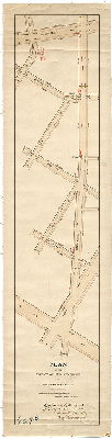
Plan of the revision of the lines and grades of a portion of Plan No. 262 [relating to Mantua Avenue and adjacent streets. Ordinance Nov. 21, 1894; survey returned May 8, 1895; confirmed Nov. 4, 1895] | Johnson, Joseph | 1895 |
Mounted
13 x 51 in.
|
West Philadelphia. Mantua Ave. from 38th St. to Holly St.
Curb elevations, railroad
|
| 262-y HP |

|
Plan to revise that portion of the City Plan bounded by Spring Garden Street, Thirty-second Street, Market Street and the Schuylkill River [and to place various streets on] City Plan Nos. 44 - 262 - 266. [Ordinance July 2, 1925; amended Dec. 19, 1927. | Hyde, George W. | 1931 |
Blueprint
47 x 35 in.
|
West Philadelphia. Bounded by Spring Garden St., 32nd St., Market St. and Schuylkill River
Curb elevations
|
| 262-z HP |
|
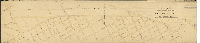
Plan of the revision of lines and grades of Mantua Avenue with the adjacent streets In the 24th Ward, directed by resolution of Councils, approved May 14th, 1873 | Hancock, George W. | 1873 |
Mounted
20 x 91 in.
1 inch = 100 feet
|
West Philadelphia. Bounded by 35th St. to Beaumont Ave., Pennsylvania Ave. to Hamilton St.
Curb elevations, many additions in pencil
|
| 263-01 MTD |

|
Plan of the survey and regulation of the Eighteenth Section, Twenty-Third Ward Philadelphia [Confirmed June 2, 1873] | Not named | 1873 |
Mounted
47 x 55 in.
|
22nd Ward, 19th Section. Bounded by Lott St. to Nester St., Krewstown Rd. to Starkey St.
Streams, curb elevations with original elevations, railroad
|
| 263-02 MTD |

|
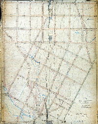
Plan of the revision of lines and grades on the Nineteenth Section of the Twenty-third Ward, now Thirty-fifth Ward, Philadelphia. [Ordinance March 30, 1889; confirmed Nov. 16, 1891] | Webster, George S. | 1891 |
Mounted
46 x 67 in.
|
23rd Ward, 19th Section. Bounded by Lott St. to Nester St., Krewstown Rd. to Starkey St.
Topography, building footprints, streams, ponds, quarries
|
| 264-z HP |

|
Plan of the survey and regulation of the Eighteenth Section, Twenty-Third Ward Philadelphia | Not named | 1871 ca. |
Mounted
51 x 56 in.
1 inch = 100 feet
|
23rd Ward, 18th Section. Krewstown Rd. to Starkey St., Pennypack St. to Nestor St.
Pennypack Creek, curb heights, creeks, original roads
|
| 265-01 MTD |

|
Plan of the revision of lines and grades with topography upon Plan No. 265, Twenty-seventh Ward Philadelphia [Ordinance January [?], 1886; confirmed various dates, [?] 1892] | Jones, William H. | 1886 |
Mounted
36 x 38 in.
|
West Philadelphia. Bounded by Cleveland Ave., Woodland Ave., 45th St. and Schuylkill River
Topography, Mill creek mouth, building footprints, walkway configuration within Woodlands Cemetery, stream in cemetery that follows course of present 38th St.
|
| 265-02 MTD |

|
Plan of the survey and regulation of that part of the Twenty-seventh Ward Philadelphia lying between the Alms-House Property and Mill Creek and Woodland Street and the Schuylkill River [Ordinance July 10, 1865; survey returned March 1872; confirmed Sept. 2, 1872] | Jones, William H. | 1872 |
Mounted
36 x 36 in.
|
West Philadelphia. 27th Ward. Bounded by Mill Creek to eastern edge of Woodland Cemetery, Woodland Ave. to Schuylkill River
Mill Creek, small stream through "Woodlands Cemetery", wharves, river bank, marshland, railroad
|
| 265-03 MTD |
|
Plan of the revision of grades on Forty-sixth Street, from Woodland Avenue to the Schuylkill River, 27th Ward Philadelphia [Ordinance July 5, 1877; survey returned Oct. 15, 1877; confirmed June 16, 1879] | Jones, William H. | 1877 |
Mounted
26 x 20 in.
|
West Philadelphia. 27th Ward. Bounded by 45th to 47th Sts., Woodland Ave. to Schuylkill River
Mill Creek with penciled additions along line of creek including building footprints, wharf line, bulkhead line, railroads
|
| 266-03 CP partial |

|
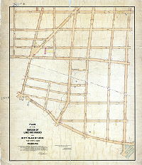
Plan of the First Section of the revised survey and regulation of the Twenty-fourth Ward in the vicinity of Fairmount Park. [Resolution Feb. 16, 1869; survey returned Dec. 29, 1871; confirmed Oct. 7, 1872. Plan only shows topographic coverage. See 266-03_MTD for full plan] | Smedley, Samuel L. | 1871 |
Tracing
31 x 92 in.
|
West Philadelphia. 24th Ward, 1st Section. Bounded roughly by Elm Ave., 40th St., Westminster Ave., Lancaster Ave. and 53rd St.
Topography over part of plan. Entire plan was not scanned.
|
| 266-03 MTD |
|
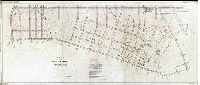
Plan of the First Section of the revised survey and regulation of the Twenty-fourth Ward in the vicinity of Fairmount Park. [Resolution Feb. 16, 1869; survey returned Dec. 29, 1871; confirmed Oct. 7, 1872] | Smedley, Samuel L. | 1871 |
Mounted
30 x 91 in.
|
West Philadelphia. 24th Ward, 1st Section. Bounded roughly by Elm Ave., 40th St., Westminster Ave., Lancaster Ave. and 53rd St.
Topography over part of plan, streams, sewers,
|
| 266-14 MTD |
|
Plan of Forty-fifth St. from Lancaster Ave. to Merion Avenue [Ordinance June 22, 1885; survey returned and confirmed Oct. 19, 1885] | Johnson, Joseph | 1885 |
Mounted
11 x 15 in.
|
West Philadelphia. 45th St.
Curb elevations
|
| 266-15 MTD |

|
Plan of Forty-fifth St. from Merion Avenue to Wyalusing Street [Ordinance Nov. 11, 1885; survey returned Dec. 2, 1886; confirmed Jan. 17, 1887] | Johnson, Joseph | 1886 |
Mounted
12 x 13 in.
|
West Philadelphia. 45th St.
Curb elevations
|
| 267-01 MTD |
|
Plan of the survey and regulation of the Twelfth Section, Twenty-eighth Ward [Resolution July 11, 1871; confirmed April 21, 1873 and Sept. 18, 1876] | Not named | 1873 |
Mounted
34 x 51 in.
1 inch = 100 feet
|
28th Ward, 12th section. Bounded by Nicetown Lane, Germantown Ave., Broad St., Venango St., and Township Line Rd.
Curb elevations
|
| 267-03 MTD |
|
Plan of the revision of lines and grades of Germantown Avenue [Ordinance March 5, 18878; confirmed April 15, 1878] | Not named | 1878 |
Mounted
37 x 9 in.
1 inch = 100 feet
|
Germantown Ave. from Erie Ave. to Hunting Park Ave.
Curb elevations
|
| 267-04 MTD |
|
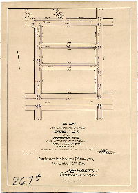
Plan for placing on the City Plan Carey St. and Airdrie St., from 19th St. to 20th Street, Thirty-eighth Ward, Philadelphia [Ordinance June 12, 1914; confirmed Nov. 2, 1914] | Fuller, H. M. | 1914 |
Mounted
14 x 10 in.
1 inch = 100 feet
|
Carey St. and Airdrie St.
Curb elevations
|
| 267-08 MTD |
|
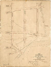
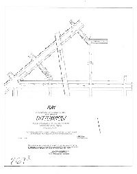
Plan of the revision of lines and grades of streets on a portion of City Plan No. 267, crossing or adjacent to the P.G.&N. R.R. between Erie Ave. and Hunting Park Ave., Philadelphia [Ordinance Oct. 13, 1906; confirmed May 13, 1907] | Fuller, H. M. | 1907 |
Mounted
24 x 19 in.
1 inch = 100 feet
|
Philadelphia, Germantown and Norristown Railroad between Erie Ave. and Hunting Park Ave.
Curb elevations, grade crossing removal
|
| 267-10 MTD |

|
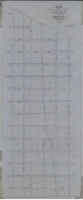
Plan for revising lines and grades of that portion of Plan No. 267 bounded by Nineteenth St., Hunting Park Ave., Seventeenth St. and Erie Ave., Thirty-eighth Ward, Philadelphia [Ordinance April 4, 1902; confirmed July 21, 1902] | Fuller, H. M. | 1902 |
Mounted
29 x 16 in.
1 inch = 100 feet
|
Bounded by 19th St., Hunting Park Ave., 17th St. and Erie Ave.
Curb elevations
|
| 268 CP |

|
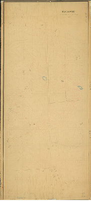
City Plan No. 268. Compiled November 1927 - W. G. Thomas. Checked January 1928 - E. J. Ginn, W. Voorhees. To date - March 2, 1950. | Thomas, W. G. | 1950 |
Tracing
35 x 90 in.
|
Bounded by Cheltenham Ave., Front St., Tabor Rd. and Somerville Ave., and 5th St.
Topography (copied from old plan), streams
|
| 268-01 MTD tracing |
|
Plan of the Sixteenth Section of survey and regulation of the late Township of Bristol, Twenty-second Ward, City of Philadelphia [Resolution March 16, 1870; survey returned Sept. 23, 1872; confirmed March 3, 1873] | Lightfoot, Jesse | 1872 |
Tracing
38 x 92 in.
1 inch = 100 feet
|
22nd Ward, 16th section, Bristol. Bounded by Cheltenham Ave., Front St., Sommerville Ave. and 5th St.
Streams, ponds, springs, sewers, curb elevations
|
| 268-02 MTD |
|
Topography of a portion of Plan 268 | Bloch, Frits | 1880 ca. |
Mounted
70 x 31 in.
|
Bounded by Chew St. Fifth St. Cheltenham Ave. and Front St.
Topography, streams, ponds, quarry, building footprints. "Work by F. Bloch"
|