
Philadelphia Streets Department Surveys
2755 result(s). Showing results 1201 to 1250.
View page: 1 2 3 4 5 6 7 8 9 10 11 12 13 14 15 16 17 18 19 20 21 22 23 24 25 26 27 28 29 30 31 32 33 34 35 36 37 38 39 40 41 42 43 44 45 46 47 48 49 50 51 52 53 54 55 56 (Show all on one page)
| Identifer | Preview | Title | Surveyor | Date | Media / Size / Scale | Area / Map Features |
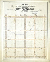
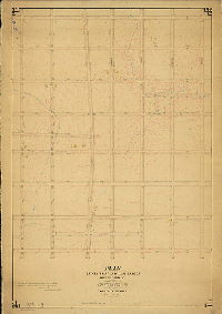
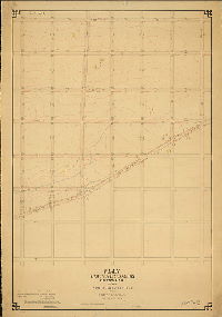
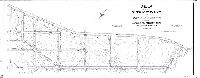
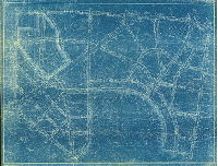
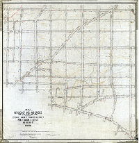
| 309-02 HP |
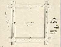
|
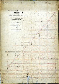
Plan of E. C. Knight Park, Twenty-sixth Ward, Philadelphia [Ordinance June 27, 1892; survey returned Sept. 14, 1892; confirmed May 1, 1893] | Daly, Thomas | 1892 |
Paper
16 x 21 in.
|
South Philadelphia
Curb elevations
|
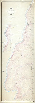
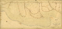
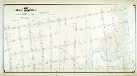
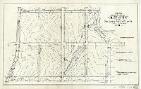
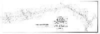
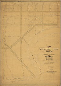
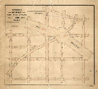
| 309-z HP |
|
Plan of the lines and grade regulations of the Tenth Section, Twenty-sixth Ward. [Ordinance Jan. 6, 1878; no confirmation date noted] | Not named | 1878 ca. |
Mounted
52 x 65 in.
|
South Philadelphia, 26th Ward, 10th Section. Bounded by Schuylkill River, Avenue 38 South, and 25th Street.
Curb elevations, creek, river bank, wharves
|
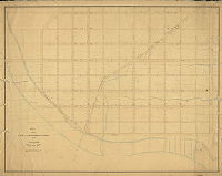
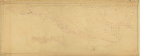
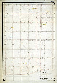
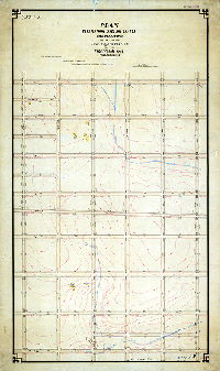
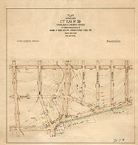
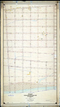
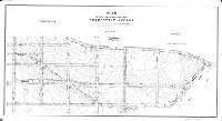
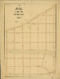
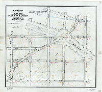
| 310-02 MTD |
|
Plan showing topography, Twenty-sixth section, Twenty-first Ward [Resolution June 20, 1881; no confirmation date] | Levering, John H. | 1881 ca. |
Mounted
42 x 84 in.
|
21st Ward, 26th Section. Bounded by Wissahickon Creek, Hermit St., School [School House] Lane, and Ridge Ave.
Topography, streams, ponds, springs, quarries, rock outcrops, railroad
|
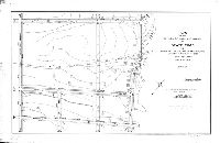
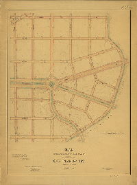
| 310-04 MTD |
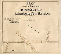
|
Plan of revision of lines and grades of Wissahickon Ave., Rittenhouse St. to Hermit St., Twenty-first Ward Philadelphia [Ordinance April 4, 1902; confirmed April 6, 1903] | Sundstrom, C. A. | 1903 |
Mounted
21 x 20 in.
1 inch = 100 feet
|
Wissahickon Avenue from Rittenhouse St. to Hermit St.
Curb elevations
|
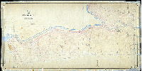
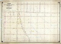
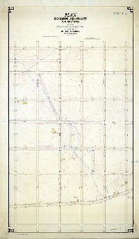
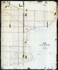
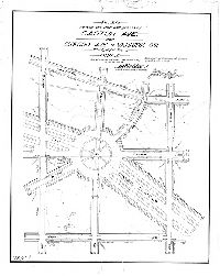
| 311-01 MTD |
|
Plan showing topography, Twenty-seventh Section, Twenty-first Ward, Phila. 1882 [Resolution June 20, 1882] | Levering, John H. | 1882 |
Mounted
101 x 36 in.
|
21st Ward, 27th Section. Bounded by Wissahickon Creek to Wissahickon Ave., Hartwell St. to Hermit St. (Entire City Plan 311 area)
Topography, streams, Carpenter's Run, ponds, building footprints, rock outcrops
|
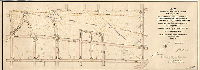
| 311-03 MTD |
|
Plan of survey and regulation of part of Plan No. 311, Twenty-first Ward, Philadelphia [Ordinance Oct. 24, 1900; confirmed March 4, 1901] | Sundstrom, C. A. | 1901 |
Mounted
19 x 32 in.
1 inch = 100 feet
|
Bounded by Wissahickon Ave., Cliveden St. and Park Line Rd.
Topography, stream, building footprints
|
| 311-04 MTD |
|
Plan of revision of lines and grades of Wissahickon Ave., Philellena St. to Allen's Lane, Twenty-first Ward Philadelphia [Ordinance April 4, 1902; confirmed April 6, 1903] | Sundstrom, C. A. | 1903 |
Mounted
21 x 47 in.
1 inch = 100 feet
|
21st Ward, Wissahickon Ave.
Curb elevations
|
| 311-07 MTD |
|
Plan of survey and regulation of Mount Airy Street from Wissahickon Ave. to Wissahickon Drive, 21st Ward, Philadelphia. Oct. 1905. [Ordinance Dec. 23, 1904; confirmed Feb. 5, 1906] | Sundstrom, C. A. | 1905 |
Mounted
18 x 34 in.
1 inch = 100 feet
|
Mt. Airy Avenue
Curb elevations
|
| 311-09 MTD |
|
Plan of revision of lines and grades and establishment of new streets upon City Plan No. 311, Twenty-first Ward, Philadelphia [Ordinance April 27, 1914; confirmed Nov. 16, 1914] | Sundstrom, C. A. | 1914 |
Mounted
31 x 66 in.
1 inch = 100 feet
|
Bounded by Wissahickon Ave. to Wissahickon Creek, and roughly from Livezey's Lane to Upsal St.
Topography, streams, Carpenter's Run, springs, building footprints
|
| 311-z MTD |
|
Verification of topography, April 30th, 1887, by C. A. Sundstrom, Surveyor and Regulator 8th Dist. | Sundstrom, C. A. | 1886 |
Mounted
42 x 102 in.
|
Wissahickon Creek valley
Topography, streams, Carpenter's Run, ponds, building footprints, rock outcrops. This plan may be plotting the course of the Wissahickon Low Level Intercepting Sewer.
|
| 312-01 MTD tracing |
|
Plan establishing street lines and grades also revising street lines (on a section of Outline Plan 193) in a portion of Twenty-third Ward Philadelphia [Ordinance April 3, 1888; confirmed Aug. 20, 1888 and Jan. 20, 1902] | Webster, George S. | 1888 |
Tracing
35 x 72 in.
1 inch = 100 feet
|
23rd Ward. Bounded by Convent Lane to Linden Ave., Frankford Ave. to Delaware River
Topography, streams, building footprints, tidal marshland, Pleasant Hill Park
|
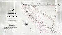
| 312-03 MTD |
|
Plan for placing Pleasant Hill Park on the City Plan, Thirty-fifth Ward, Philadelphia [Ordinance June 27, 1892; confirmed Oct. 3, 1892] | Webster, John H., Jr. | 1892 |
Mounted
16 x 20 in.
1 inch = 100 feet
|
Northeast Philadelphia. Pleasant Hill Park, Delaware River front at Delaware Ave. and Linden Ave.
Curb elevations, low water line, Port Wardens line
|
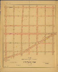
| 313-01 MTD |
|
Plan of survey and regulation with topography of that portion of the Twenty-seventh Ward Philadelphia bounded on the northeast by Seventy-fourth St., on the southeast by Laycock Ave. and on the Southwest by Island Ave. [Ordinance March 23, 1889; survey returned Sept. 16, 1889; confirmed 1898 to 1917] | Jones, William H. | 1889 |
Mounted
61 x 43 in.
|
Southwest Philadelphia. Bounded by 74th St., Laycock Ave., and Island Ave.
Topography, streams, spring house, Lands Creek, building footprints, property lines
|
| 314-01 MTD blueprint |
|
Plan of the survey and regulation with topography of that portion of the Twenty-seventh Ward Philadelphia bounded by Tinicum Road, Darby Creek, Eighty-Fifth and Ninetieth Streets. Ordinance of March 23d, 1888. [Survey returned Dec. 2, 1889] | Jones, William H. | 1889 |
Blueprint, Mounted
54 x 52 in.
|
Southwest Philadelphia. Bounded by Tinicum Rd., Darby Creek, 85th and 90th Sts.
Topography
|
| 314-02 MTD tracing |
|
Plan revising the lines and establishing the grades upon City Plan No. 314 bounded by 89th St., Darby Creek, 90th St. and Tinicum Ave. 40th Ward, Philadelphia [Ordinance Oct. 4, 1916; confirmed Oct. 20, 1919] | Gillingham, J. Harvey | 1919 |
Tracing
36 x 61 in.
1 inch = 100 feet
|
Southwest Philadelphia. Bounded by 85th to 90th Sts., Darby Creek to Tinicum Ave.
Curb elevations. drainage streets
|
| 314-z MTD |
|
Kingsessing and Tinicum Meadow Co. Location of Darby Creek bank from Bow Creek to the end of bank near 86th St. | Jones, William H. | 1892 |
Mounted
57 x 84 in.
|
Southwest Philadelphia
Meadow Company, dike or bank along Darby Creek, drainage ditches
|
| 315-02A MTD |
|
Plan revising lines and grades on a portion of City Plan No. 315, Thirty-fifth Ward Philadelphia [Ordinance June 24, 1914; survey returned March 15, 1915; confirmed Nov. 1, 1915] | Webster, John H., Jr. | 1915 |
Mounted
40 x 32 in.
|
Northeast Philadelphia. Bounded by Cottman Ave., Frontenac St., Longshore Ave. and Whitaker Ave.
Topography, stream, building footprints
|
| 315-02B MTD |
|
Plan establishing lines and grades with topography on the Thirty-sixth section of the Twenty-third Ward Philadelphia [Ordinance Sept. 21, 1887; no confirmation date] | Webster, George S. | 1890 ca. |
Mounted
59 x 40 in.
|
23rd Ward, 36th Section. Bounded by O St. to Bustleton Ave., Longshore Ave. to Bleigh St.
Topography, streams, building footprints,
|
| 316-01 MTD |
|
Plan establishing lines and grades with topography of the Thirty-seventh Section of the Twenty-third Ward Philadelphia [Ordinance Sept. 21, 1887; confirmed Dec. 21, 1891] | Webster, George S. | 1891 |
Mounted
40 x 56 in.
|
23rd Ward, 37th Section. Bounded by Bleigh St. to Longshore Ave., G St. (Montgomery County line) to O St.
Topography, streams, spring houses, building footprints
|
| 316-04 MTD |
|
Plan of the revision of lines and grades of Oakley St. from Longshore St. to Cottman St. and to place on the City Plan Friendship and Princeton Sts. from Rising Sun Ave. to Shelborne St., Shelborne St. from Princeton St. to St. Vincent St., and St. Vincent St. from Oakley St. to Shelborne St. Thirty-fifth Ward, Phila. [Ordinance April 15, 1914; confirmed June 5, 1914] | Webster, John H., Jr. | 1914 |
Mounted
20 x 52 in.
1 inch = 100 feet
|
Northeast Philadelphia. Bounded by Hasbrook St. to Rising Sun Ave., Knorr St. to Cottman Ave.
Topography, streams, spring house, building footprints
|
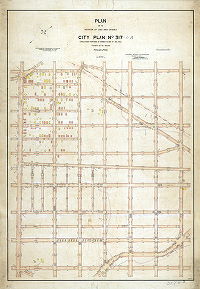
| 317-01 MTD |
|
Plan establishing lines and grades with topography on the Thirty-ninth Section of the Twenty-third Ward Philadelphia [Ordinance Sept. 21, 1887; confirmed Dec. 21, 1891] | Webster, George S. | 1891 |
Mounted
59 x 35 in.
|
23rd Ward, 39th Section. Bounded by I St. to P St., Bleigh St. to Borbeck St.
Topography, streams, building footprints, springs
|
| 317-02 MTD |
|
Plan of the revision of lines and grades up City Plan No. 317 (including portions of former Plans No. 315, 316). Thirty-fifth Ward Philadelphia [Ordinances Sept. 21, 1887 and Dec. 18, 1904; confirmed Dec. 6, 1915] | Webster, Clement B. | 1915 |
Mounted
63 x 43 in.
1 inch = 100 feet
|
Northeast Philadelphia. Bounded by Rising Sun Ave. (I St.) to Summerdale Ave., Cottman Ave. to Borbeck Ave.
Topography, streams, building footprints, springs, "made by J.W.K, checked by C.S.F"
|
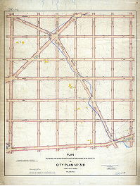
| 318-01 MTD |
|
Plan revising lines and grades and establishing new streets on City Plan No. 318, Thirty-fifth Ward Philadelphia. Portions of former City Plans 318 and 315 [Ordinances Sept. 21, 1887 and Nov. 4, 1908; survey returned May 21, 1909; confirmed June 28, 1909] | Webster, Clement B. | 1909 |
Mounted
53 x 44 in.
|
Northeast Philadelphia. Bounded by Summerdale St., Borbeck Ave., Bustleton Ave., and Cottman Ave.
Topography, streams, Sandy Run, springs, building footprints
|
| 318-02 MTD |
|
Plan establishing lines and grades with topography on the Thirty-eighth section of the Twenty-third Ward Philadelphia [Ordinance Sept. 21, 1887; no confirmation date] | Webster, George S. | 1887 ca. |
Mounted
60 x 36 in.
|
23rd Ward, 38th Section. Bounded by P St. to Bustleton Ave., Bleigh St. to Borbeck St.
Topography, Sandy Run, springs, streams, building footprints
|
| 319-01 MTD |
|
Plan establishing lines and grades with topography on the Fortieth Section of the Twenty-third Ward Phila. [Ordinance Sept. 21, 1887; confirmed May 18, 1891] | Webster, George S. | 1891 |
Mounted
60 x 41 in.
|
23rd Ward, 40th Section. Bounded by I to P Sts., Borbeck Ave. to Strahle St.
Topography, Sandy Run and other streams, building footprints
|
| 319-02 MTD |
|
Plan of portion of City Plan No. 319 establishing lines and grades of territory bounded by Rhawn St., Rising Sun Ave., Strahle St. and Tabor Ave. Thirty-fifth Ward, Philadelphia [Ordinance July 20, 1907; survey returned Dec. 17, 1909; no confirmation date] | Webster, Clement B. | 1909 |
Mounted
32 x 29 in.
|
Northeast Philadelphia. Bounded by Rhawn St., Rising Sun Ave., Strahle St. and Tabor Ave.
Topography, building footprints, stream, Pennypack Park
|
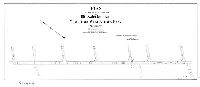
| 319-03 MTD |
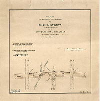
|
Plan establishing the grades of Rhawn Street at the crossing of the New York Short Line Railroad, Thirty-fifth Ward, Philadelphia [Ordinance April 4, 1904; survey returned Feb. 19, 1906; confirmed March 26, 1906] | Webster, Clement B. | 1909 |
Mounted
16 x 16 in.
|
Northeast Philadelphia. Rhawn St. from L St. to M St. (now Whitaker Ave.)
Curb elevations, railroad
|
| 320-01 MTD |
|
Plan establishing and revising lines and grades on City Plan No. 320, Thirty-fifth Ward Philadelphia [Ordinances 1887, 1907 and 1908; survey returned May 21, 1909; confirmed June 28, 1909] | Webster, Clement B. | 1909 |
Mounted
53 x 41 in.
|
Northeast Philadelphia. Bounded by Summerdale Ave. to Bustleton Ave. and Horrocks St., Borbeck Ave. to Strahle St.
Topography, streams, springs, building footprints
|
| 320-02 MTD |
|
Plan establishing lines and grades with topography on the Forty-third Section of the Twenty-third Ward Phila. [Ordinance Sept. 21, 1887; confirmed May 18, 1891 and April 7, 1902] | Webster, George S. | 1891 |
Mounted
60 x 41 in.
1 inch = 100 feet
|
23rd Ward, 43rd Section. Bounded by P to W Sts., Borbeck Ave. to Strahle St.
Topography, streams, springs, building footprints
|
| 321-01 MTD |
|
Plan establishing lines and grades with topography of the Forty-second Section of the Twenty-third Ward Philadelphia [Ordinance April 3, 1888; confirmed Dec. 21, 1891] | Webster, George S. | 1891 |
Mounted
38 x 71 in.
1 inch = 100 feet
|
23rd Ward, 42nd Section. Bounded by Pennypack St., Delaware River, Wingate St., and Frankford Ave.
Topography, Delaware River front, tidal marshland, mouth of Pennypack Creek, streams, building footprints, dikes, ditches
|
| 322-02 MTD |
|
Plan establishing lines and grades with topography of the Forty-first section of the Twenty-third Ward Philadelphia [Ordinance April 3, 1888; confirmed Dec. 21, 1891] | Webster, George S. | 1891 |
Mounted
79 x 45 in.
|
23rd Ward, 41st Section. Bounded by Delaware River to Frankford Ave., Pennypack St. to Linden St.
Topography, streams, building footprints, marshland, river bank
|
| 323-01 MTD tracing |
|
Plan of the revision of lines and grades on the Forty-third section of the Twenty-third Ward (now Thirty-fifth Ward) Philadelphia. [Ordinances April 3, 1888 and March 29, 1898; confirmed May 4, 1896 and Sept. 19, 1898] | Webster, George S. | 1896 |
Tracing
66 x 55 in.
1 inch = 100 feet
|
23rd Ward, 43rd Section. Bounded by Frankford Ave. to Delaware River, Convent St. to Poquessing Creek
Topography, Poquessing Creek and tributary streams, building footprints (including estates at Torresdale), railroads, Port Warden's Line
|
| 323-02 MTD tracing |
|
Plan of the revision of the curb lines on Frankford Avenue from Convent Ave. to Poquessing Creek. Thirty-fifth and Forty-first Wards, Philadelphia. [Ordinance June 30, 1902; survey returned Sept. 20, 1902; confirmed Oct. 20, 1902] | Not named | 1902 |
Tracing
24 x 59 in.
|
Northeast Philadelphia
Topography
|
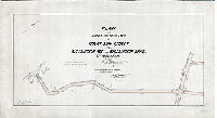
| 323-03 MTD tracing |
|
Plan for revising grades of Grant Street from Frankford Avenue to Tulip Street. Thirty-fifth Ward, Philadelphia. [Ordinance March 29,1898; survey returned April 16, 1898; confirmed Sept. 19. 1898] | Webster, Clement B. | 1898 |
Tracing
20 x 32 in.
|
Northeast Philadelphia
Topography
|
| 323-04 MTD tracing |
|
Plan revising the lines and grades of Torresdale Avenue from Convent Avenue to City Line at Poquessing Creek and of streets adjacent to thereto. Forty-first Ward, Philadelphia. [Ordinance June 30, 1910; survey returned Aug. 19, 1910; confirmed April 7, 1913] | Webster, Clement B. | 1910 |
Tracing
33 x 59 in.
|
Northeast Philadelphia
Topography
|
| 323-06 MTD tracing |
|
Plan of the revision of lines and grades of State Road from Convent Avenue to Grant Avenue. Forty-first Ward, Philadelphia. [Ordinance March 4, 1915; confirmed July 19, 1915] | Webster, Clement B. | 1915 |
Tracing
27 x 41 in.
1 inch = 100 feet
|
Northeast Philadelphia
Topography
|
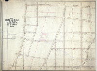
| 324 CP |
|
[No title. Streets around Pennypack Park in City Plan 324, with topography] | Not named | 1915 ca. |
Blueprint
62 x 48 in.
|
Northeast Philadelphia. Bounded roughly by Frankford Ave. to Ashton Ave., Willits Ave. to Welsh Road, Winchester Ave., Megargee Ave. and Craig Ave. (Pennypack Park boundary)
Topography, Pennypack Creek, building footprints
|
| 324-02 MTD tracing |
|
Plan for placing upon the City Plan 324 Holme Avenue from Welsh Road to Willits Ave., Willits Avenue from Holme Ave. to Academy Ave., and Academy Avenue from Willits Ave. to Frankford Ave. Thirty-fifth Ward, Philadelphia. [Ordinance June 30, 1910; confirmed Oct. 24, 1910.] | Webster, Clement B. | 1910 |
Tracing
25 x 73 in.
|
Northeast Philadelphia. Holme Ave., Willits Ave. and Academy Rd.
Topography
|
| 325-01 MTD |
|
Plan of the revision of lines and grades and placing The Boulevard upon City Plan No. 325, Thirty-fifth Ward, Philadelphia. [Ordinance confirmed Dec. 24, 1902; survey returned Dec. 7, 1903; confirmed July 11, 1904] | Webster, Clement B. | 1903 |
Mounted
58 x 43 in.
|
Northeast Philadelphia. Bounded by Bustleton Ave. to Brous Ave., Borbeck Ave. to Strahle St.
Topography, streams, building footprints
|
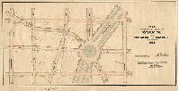
| 325-02 MTD |
|
Plan establishing lines and grades on a portion of City Plan No. 325, Thirty-fifth Ward, Philadelphia [Ordinance July 20, 1907; survey returned May 21, 1909; confirmed July 19, 1909] | Webster, Clement B. | 1909 |
Mounted
57 x 41 in.
|
Northeast Philadelphia. Bounded by Horrocks St. to Brous Ave., Rhawn St. to Lexington Ave.
Topography, Roosevelt Boulevard, building footprints
|
| 326-01 MTD |
|
Plan of the revision of lines and grades upon a portion of Plan No. 247 and of the lines and grades upon Plan No. 326, Fortieth Ward, Philadelphia [Ordinance Dec. 28, 1895; confirmed 1899, 1907 and 1909] | Not named | 1899 |
Mounted
68 x 50 in.
1 inch = 100 feet
|
Southwest Philadelphia
Building footprints, river banks, railroads, and other features
|
| 326-357-368-375 CP |

|
Plan showing proposed revisions on City Plan Nos. 326, 357, 368 and 375, 40th Ward, Philadelphia ["…Corrected to 8/10/51"] | Not named | 1951 |
Tracing, Paper
33 x 83 in.
1 inch = 200 feet
|
Southwest Philadelphia. Schuylkill River to Essington Ave., Penrose Ave. to Passyunk Ave.
Many named streams
|
| 327-05 CP |
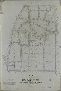
|
Plan revising the lines and grades and establishing new streets on City Plan No. 327… 35th Ward, Philadelphia. [Ordinance July 20, 1907, and 1916 and 1927; confirmed 1927 and 1928] | Blankley, William W. | 1927 |
Tracing
60 x 39 in.
1 inch = 100 feet
|
Northeast Philadelphia. Bounded by Bustleton Ave., Trevose Ave., Bucks County line, Stevens Rd., Herschel Rd., Worthington Rd., and Byberry Rd.
Topography, streams
|
| 328-01 MTD |
|
Plan of the revision of lines and grades on City Plan between Whitaker St. and Castor Ave. and between Adams Ave. and Vankirk St., Thirty Fifth Ward Philadelphia [Ordinances July 17, 1891 and June 2, 1892; survey returned April 6, 1901; confirmed June 3, 1901] | Webster, John H., Jr. | 1901 |
Mounted
48 x 63 in.
|
Northeast Philadelphia. Bounded by Whitaker St. to Castor Ave., Adams Ave. to Vankirk St.
Topography, stream, springs, building footprints, railroad
|
| 328-03 MTD |
|
Plan revising the lines and grades of Castor Ave. from Oxford Ave. to Vankirk St., Thirty-fifth Ward, Phila. [Ordinance Nov. 4, 1908; survey returned May 21, 1909; confirmed June 28, 1909] | Webster, John H., Jr. | 1909 |
Mounted
21 x 39 in.
1 inch = 100 feet
|
Northeast Philadelphia. Bounded by Vankirk St., Large St., Sanger St. and Summerdale Ave.
Topography, building footprints, stream, Roosevelt Boulevard, Oxford Circle
|
| 329-01 CP |
|
Plan of the revision of lines and grades on City Plan No. 329….Twenty-third and Thirty-fifth Wards Philadelphia [Ordinances 1891, 1892 and two in 1900; survey returned April 6, 1901; confirmed June 3, 1901] | Webster, John H., Jr. | 1901 |
Tracing
52 x 50 in.
|
Northeast Philadelphia. Bounded by Castor Ave., Vankirk St., Frankford Ave., Dyre St, Penn St., Harrison St., Leiper St. and Foulkrod St.
Topography, streams, building footprints, old roads
|
| 329-04 MTD |
|
Revision of lines and grades and placing The Boulevard upon City Plan No. 329, 23rd & 35th Wards, Phila. [Ordinance Dec. 24, 1902; survey returned Feb. 21. 1903; confirmed Nov. 2, 1903] | Webster, John H., Jr. | 1903 |
Mounted
28 x 31 in.
|
Northeast Philadelphia. Bounded roughly by "R" St., Vankirk St., Horrocks St. and Pratt St.
Topography
|
| 329-04 MTD tracing |
|
Revision of lines and grades and placing The Boulevard upon City Plan No. 329, 23rd & 35th Wards, Phila. [Ordinance Dec. 24, 1902; survey returned Feb. 21, 1903; confirmed Nov. 2, 1903] | Webster, John H., Jr. | 1903 |
Tracing
28 x 31 in.
|
Northeast Philadelphia. Bounded roughly by "R" St., Vankirk St., Horrocks St. and Pratt St.
Topography
|
| 329-10 MTD |
|
Plan revising the lines and grades of Castor Ave. from Oxford Ave. to Vankirk St., Thirty-fifth Ward, Phila. [Ordinance Nov. 4, 1908; survey returned May 21, 1909; confirmed June 28, 1909] | Webster, John H., Jr. | 1909 |
Mounted
21 x 39 in.
1 inch = 100 feet
|
Northeast Philadelphia. Bounded by Vankirk St., Large St., Sanger St. and Summerdale Ave.
Topography, building footprints, stream, Roosevelt Boulevard, Oxford Circle
|
| 330 CP |
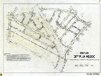
|
Compiled City Plan No. 330, covers portions of former City Plans Nos. 241 and 250 [Includes confirmations to 1941] | Not named | 1941 ca. |
Tracing
29 x 40 in.
|
Northeast Philadelphia. Bounded roughly by Adams Ave., Algon St., Ruscomb St., F St., and Tabor Rd.
Topography, streams
|