
Philadelphia Streets Department Surveys
2755 result(s). Showing results 1251 to 1300.
View page: 1 2 3 4 5 6 7 8 9 10 11 12 13 14 15 16 17 18 19 20 21 22 23 24 25 26 27 28 29 30 31 32 33 34 35 36 37 38 39 40 41 42 43 44 45 46 47 48 49 50 51 52 53 54 55 56 (Show all on one page)
| Identifer | Preview | Title | Surveyor | Date | Media / Size / Scale | Area / Map Features |
| 331-01.5 MTD |
|
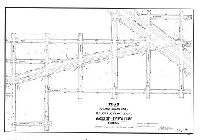
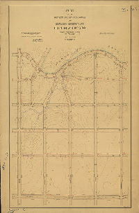
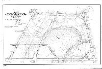
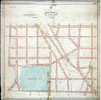
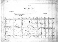
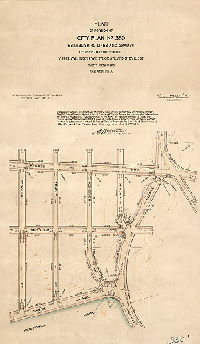
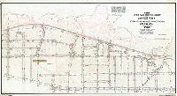
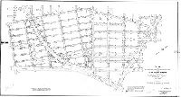
Plan of the revision of lines and grades of Bustleton Ave. from Vankirk St. to The Boulevard, Thirty-fifth Ward, Phila. [Ordinances July 26, 1904 and March 29, 1905; survey returned Dec. 16, 1904; no confirmation date] | Webster, John H., Jr. | 1905 |
Mounted
23 x 33 in.
|
Northeast Philadelphia. Bounded roughly by Eastwood to Farnsworth Sts., Levick Ave. to Vankirk St.
Topography, building footprints
|
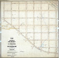
| 331-01 MTD |
|
Plan of the revision of lines and grades and placing the Boulevard upon City Plan No. 331 (part of former Plan 259), Thirty-fifth Ward Philadelphia [Ordinance Dec. 24, 1902; survey returned Dec. 7, 1903; confirmed July 11, 1904] | Webster, John H., Jr. | 1903 |
Mounted
38 x 58 in.
|
Northeast Philadelphia. Bounded by Castor Ave., Vankirk St., Leonard St. and Magee Ave.
Topography, Little Tacony Creek and tributary streams, building footprints, marshland; "E.M.E 1904" (probably the draftsman)
|
| 331-02 MTD |
|
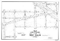
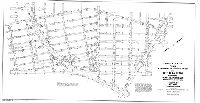
Plan of the revision of lines and grades of Bustleton Ave. from Vankirk St. to The Boulevard, Thirty-fifth Ward, Phila. [Ordinances July 26, 1904 and March 29, 1905; survey returned June 16, 1905; confirmed Feb. 5. 1906] | Webster, John H., Jr. | 1905 |
Mounted
23 x 33 in.
|
Northeast Philadelphia. Bounded roughly by Eastwood to Farnsworth Sts., Levick Ave. to Vankirk St.
Topography, building footprints
|
| 331-03 MTD |
|
Plan revising the lines and grades of Castor Ave. from Vankirk St. to Magee Ave., Thirty-fifth Ward, Phila. [Ordinance Nov. 4, 1908; survey returned May 21, 1909; confirmed June 28, 1909] | Webster, John H., Jr. | 1909 |
Mounted
13 x 56 in.
|
Northeast Philadelphia. Castor Ave. and vicinity from Vankirk St. to Magee Ave.
Topography, building footprints, streams. Shows diagonal of Everett St. through low marshy ground, to capture Little Tacony Creek.
|
| 332-01 MTD |
|
Plan of the revision of lines and grades and placing the Boulevard upon City Plan No. 332 (parts of former Plans 259 and 260), Thirty-fifth Ward Philadelphia [Ordinance Dec. 24, 1902; survey returned Dec. 7, 1903; confirmed July 11, 1904 and July 3, 1905] | Webster, John H., Jr. | 1903 |
Mounted
46 x 46 in.
|
Northeast Philadelphia. Bounded by Frankford Ave., Vankirk St., Leonard St., Roosevelt Blvd., and Magee Ave.
Topography, building footprints, streams, ponds, spring house
|
| 332-03 MTD |
|
Plan of the revision of the lines and grades of Frankford Ave. between Comly St. and Magee Ave. 35th and 41st Wards, Phila. [Ordinance March 15, 1911; confirmed June 19, 1916] | Webster, John H., Jr. | 1916 |
Mounted
21 x 55 in.
1 inch = 100 feet
|
Northeast Philadelphia. Frankford Ave. and adjacent area between Magee to Cottman Aves.
Topography, stream, building footprints
|
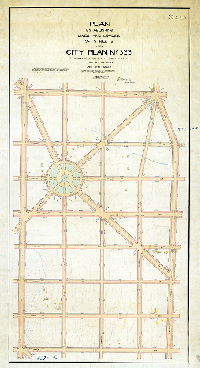
| 333-01 MTD |
|
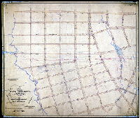
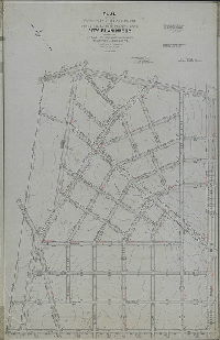
Plan establishing lines and grades of streets upon City Plan No. 333 (portions of former City Plans 259 and 315), Thirty-fifth Ward Philadelphia [Ordinances 1877, 1902 and 1908; confirmed June 28, 1909] | Webster, John H., Jr. | 1909 |
Mounted
60 x 40 in.
|
Northeast Philadelphia. Bounded by Cottman Ave, Bustleton Ave., Magee Ave., and Castor Ave.
Topography, streams, building footprints; large traffic circle at intersection of Elgin, Godfrey and Princeton Aves.
|
| 334-01 MTD |
|
Plan of the revision of lines and grades and placing The Boulevard upon City Plan No. 334 (parts of former Plans 259, 260 and 276), Thirty-fifth Ward Philadelphia [Ordinance Dec. 24, 1902; survey returned Dec. 7, 1903; confirmed July 11, 1904] | Webster, John H., Jr. | 1903 |
Mounted
32 x 60 in.
|
Northeast Philadelphia. Bounded by Bustleton, Cottman, Brous and Magee Aves.
Topography, streams, building footprints
|
| 335-01 MTD |
|
Plan of the revision of lines and grades of City Plan No. 335 (parts of former Plans 260 and 276), Thirty-fifth Ward Philadelphia [Ordinances Dec. 24, 1902 and Dec. 31, 1903; survey returned March 10, 1905; confirmed July 3, 1905] | Webster, John H., Jr. | 1905 |
Mounted
48 x 48 in.
|
Northeast Philadelphia. Bounded by Cottman to Magee Aves., Brous to Frankford Aves.
Topography, building footprints, streams, pond
|
| 335-02 MTD |
|
Plan of the revision of the lines and grades of Frankford Ave. between Magee Ave. and Cottman Ave. 35th and 41st Wards, Phila. [Ordinance March 15, 1911; confirmed June 19, 1916] | Webster, John H., Jr. | 1916 |
Mounted
21 x 52 in.
1 inch = 100 feet
|
Northeast Philadelphia. Frankford Ave. and adjacent area between Magee Ave. and Comly St.
Topography, stream, building footprints
|
| 337-01 MTD |
|
Plan of the revision of lines and grades and placing the Boulevard upon City Plan No. 337 (parts of former Plans 276, 277 and 325) Thirty-fifth Ward Philadelphia [Ordinance Dec. 24, 1902; survey returned Dec. 7, 1903; confirmed July 11, 1904] | Webster, Clement B. | 1903 |
Mounted
47 x 45 in.
|
Northeast Philadelphia. Bounded by Bustleton Ave. to Brous Ave., Cottman Ave. to Borbeck Ave.
Topography, Sandy Run and tributary streams, building footprints
|
| 338-01 MTD |
|
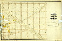
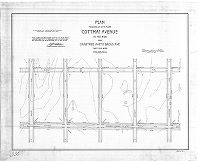
Plan placing on City Plan Cottman Avenue 100 feet wide from Crabtree Ave. to Brous Ave., Thirty-fifth Ward, Philadelphia [Ordinance Dec. 31, 1903; survey returned March 17, 1905; confirmed July 3, 1905] | Webster, Clement B. | 1905 |
Mounted
26 x 32 in.
1 inch = 100 feet
|
Northeast Philadelphia. Bounded by Bleigh Ave. to Cottman Ave., Brous Ave. to Crabtree Ave.
Topography, building footprints
|
| 338-02 HP |
|
Plan of the revision of lines and grades and establishing new streets upon City Plan No. 338 (parts of former Plans Nos. 276 & 277), Thirty-fifth Ward, Philadelphia [Ordinances April 7, 1893 and Dec. 24, 1902; survey returned May 15, 1908; confirmed March 15, 1909] | Webster, Clement B. | 1908 |
Mounted
48 x 31 in.
1 inch = 100 feet
|
Northeast Philadelphia. Bounded by Hartel Ave., Brous Ave., Cottman Ave. and Crabtree St.
Topography, Sandy Run and tributary, Holmesburg Water Co. and reservoir, building footprints
|
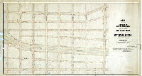
| 339-01 MTD |
|
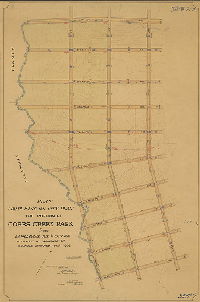
Plan establishing lines and grades of streets on City Plan No. 339, Thirty-fifth Ward, Philadelphia [Ordinances April 7, 1893 and Dec. 24, 1902; survey returned Jan. 15, 1909; confirmed March 15, 1909] | Webster, Clement B. | 1909 |
Mounted
29 x 60 in.
1 inch = 100 feet
|
Northeast Philadelphia. Bounded by Brous Ave., Rhawn St., Rowland Ave. and Hartel Ave.
Topography, Pennypack Park and creek, Sandy Run, building footprints, marshland, factories, mill race and pond, dam
|
| 340-01 MTD |
|
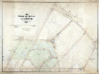
Plan 340 of the revised survey and regulation of a portion of the 24th (now 34th) Ward covering a portion of Plan 170. Bounded by Belmont Avenue on the east, City Avenue on the north, The Schuylkill Valley Rail-Road on the west and Fairmount Park on the south. [Resolution Feb. 16, 1869; confirmed 1906 and 1908] | Johnson, Joseph | 1906 |
Mounted
39 x 64 in.
|
West Philadelphia. Bounded roughly by Bryn Mawr Ave., City Ave., Belmont Ave. and Parkside Ave.
Topography, George's Run headwaters, other streams, building footprints, railroad
|
| 342-02 MTD |
|
Plan showing revision of lines and grades on portions of Plans Nos. 19, 161 & 169, 34th Ward "Now [Plan] 342" [Ordinance Nov. 23, 1905; survey returned March 2, 1907; confirmed Jan. 4, 1909] | Johnson, Joseph | 1907 |
Mounted
54 x 49 in.
|
West Philadelphia. Bounded roughly by City Ave., 65th St., Lansdowne Ave. and 69th St.
Topography, Indian Creek, mill races
|
| 342-03 MTD |
|
Plan revising the grade of City Avenue from Lancaster Ave. to Sixty-sixth St. on Plan 342 [and] from Lancaster Ave. to Haverford Ave. ... to carry into effect the terms and conditions of ... an offer of the Girard Trust Co. et al. to dedicate and convey to the City of Phila. land contained within the boundaries of Morris Park ... and for placing on the City Plan Church Road [Ordinances Dec. 2, 1911, May 9, 1912, and June 21, 1915; confirmed Dec. 29, 1915] | Johnson, Joseph | 1915 |
Mounted
17 x 43 in.
1 inch =- 100 feet
|
West Philadelphia. Bounded by City Ave., Lancaster Ave., Sherwood Rd. and 66th St.
Curb elevations; hand-drawn seal of Bureau of Surveys. This plan seems to have been added to several times, as evidenced by the title block and erasures where Church Road intersects other streets.
|
| 343-01 MTD |
|
Plan showing revision of lines and grades on portions of Plans Nos. 198, 161 (now 343), 34th Ward [Ordinance Jan. 23, 1905; survey returned March 12, 1907; confirmed Jan. 4, 1909] | Johnson, Joseph | 1907 |
Mounted
52 x 50 in.
|
West Philadelphia. Bounded roughly by City Ave., 66th St., Lansdowne Ave. and Callowhill St.
Topography, Indian Creek, mill races, mill ponds, building footprints, man fishing with pole as north arrow
|
| 343-01b MTD |
|
Plan to place on city plan as a public park certain tracts of land in the Thirty-fourth Ward as additions to Cobb's Creek Park and Morris Park and to make the necessary revision of lines and grades of streets. [Ordinances Dec. 2, 1911, March 14, 1912, May 9, 1912, and June 21, 1915; "revised 8-9-15"; confirmed Dec. 29, 1915] {This plan originally misfiled as 342-1; it falls in City Plan 343 and should be numbered 343] | Johnson, Joseph | 1915 |
Mounted
62 x 44 in.
|
West Philadelphia. Bounded by City Ave., 66th St., Haverford and Lansdowne Aves., and Callowhill St.
Topography, Indian Creek and tributary streams, mill races, building footprints, pond, "Lake"
|
| 343-02 MTD |
|
Plan for placing on the City Plan Morris Parkas authorized by ordinance of Councils approved July 7th, 1908 [Confirmed Feb. 7, 1910] | Johnson, Joseph | 1910 |
Mounted
49 x 40 in.
1 inch = 100 feet
|
West Philadelphia. Bounded by City Ave., 66th St., Haverford Ave. and 73rd St.
Topography, Indian Creek, mill races, mill ponds, building footprints
|
| 344-01 MTD |
|
Plan for placing on the City Plan Tacony Creek Park, 35th & 42nd Wards, Phila. [Ordinance June 20, 1908; survey returned Aug. 21, 1908; confirmed Nov. 16, 1908] | Webster, Clement B. | 1908 |
Mounted
27 x 41 in.
1 inch = 100 feet
|
Tacony Creek Park. Bounded by Ruscomb St., K St., Wyoming Ave. and Whitaker Ave.
Topography, Tacony Creek and tributary streams, ponds, building footprints
|
| 344-02 MTD |
|
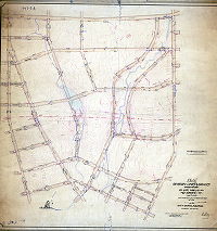
Plan of the revision of lines and grades of city plan no 344 (parts of former city plans 232, 241 and 256) 23rd, 35th and 42nd Wards Phila. [Five ordinances from 1891 to 1902; confirmed June 21, 1909] | Webster, John H., Jr. | 1909 |
Mounted
46 x 61 in.
|
Northeast Philadelphia. Bounded by Whitaker Ave., Wyoming Ave., Adams Ave., Roosevelt Blvd., Algon Ave., and Ruscomb St.
Topography, Tacony Creek Park, Tacony and Frankford Creek and tributary streams, railroad, building footprints
|
| 345-01 MTD |
|
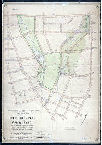
Plan of the Revision of lines and grades of City Plan No. 345 (Parts of Former City Plans 222, 223, 241 and 256) 23rd, 33rd, 42nd and 35th Wards Philadelphia [Ordinances 1891 to 1902; confirmed June 28, 1909] | Webster, John H., Jr. | 1909 |
Mounted
38 x 68 in.
|
Bounded by Algon Ave. to Adams Ave., Cayuga St. to Wyoming Ave.
Topography, Wingohocking Creek, Tacony Creek, Rock Run, Frankford Creek, building footprints, mill races, Tacony Creek Park, Juniata Park
|
| 345-02 MTD |
|
Plan for placing on the City Plan Tacony Creek Park, 33rd, 35th & 42nd Wards, Phila. [Ordinance June 20, 1908; survey returned Aug. 21, 1908; confirmed Nov. 16, 1908] | Webster, Clement B. | 1908 |
Mounted
31 x 29 in.
1 inch = 100 feet
|
Tacony Creek Park. Bounded by Wyoming Ave., L St., Cayuga St. and H. St.
Topography, confluence of Tacony, Wingohocking and Frankford Creeks, tributary streams, mill race and factory building footprints
|
| 346-01 MTD |
|
Plan of the revision of lines and grades and establishing new streets upon City Plan No. 346 (portion of former Plan No. 294) Thirty-fifth Ward. [Ordinance March 30, 1905; Confirmed Sept. 21, 1908] | Webster, Clement B. | 1908 |
Mounted
52 x 52 in.
|
Northeast Philadelphia. Bounded by Borbeck Ave., Rising Sun Ave., Cottman Ave., and Fillmore St.
Topography, streams, ponds, building footprints, railroad, Burholme Park
|
| 346-02 MTD |
|
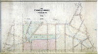
Plan showing avenue leading to Burholme Park, Thirty-fifth Ward, Philadelphia [Survey returned Jan. 2, 1906] | Webster, Clement B. | 1906 |
Mounted
26 x 41 in.
1 inch = 100 feet
|
Northeast Philadelphia. Burholme Park. Bounded roughly by Shelmire St. to Cottman Ave., C St. to Oxford Ave.
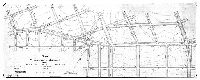
Driveway lined with trees, building footprints labeled mansion, stable, green house, property lines and owners
|
| 346-03 MTD |
|
Plan to place on City Plan an extension of Burholme Park, Thirty-fifth Ward Philadelphia. Area 21 282/1000 aces. [Ordinance Nov. 30, 1908; confirmed Feb. 15, 1909] | Webster, Clement B. | 1909 |
Mounted
28 x 28 in.
|
Northeast Philadelphia. Bounded by Montgomery County line, Shelmire Ave., Central Ave., and Cottman Ave.
Topography, building footprints, streams, pond
|
| 347-01 MTD |
|
Plan of the revision of lines and grades and establishing new streets upon City Plan No. 347 (portion of former Plan No. 294), Thirty-fifth Ward, Philadelphia. [Ordinances 1905 and 1907; confirmed March 15, 1915] | Webster, Clement B. | 1915 |
Mounted
69 x 42 in.
1 inch = 100 feet
|
Northeast Philadelphia. Bounded by Fillmore St. to Rising Sun Ave., Borbeck Ave. to Strahle St.
Topography "taken from old City Plan No. 294"; building footprints, streams, ponds, railroad
|
| 347-02 MTD |
|
Plan of portion of City Plan No. 347 (a portion of former Plan No. 294) revising the lines and grades of territory bounded by Ferndale Ave., Rising Sun Ave., Strahle St. and Borbeck Ave. Thirty-fifth Ward, Philadelphia [Ordinance March 23, 1905; survey returned Dec. 17, 1909; confirmed April 3, 1911] | Webster, Clement B. | 1909 |
Mounted
31 x 41 in.
1 inch = 100 feet
|
Northeast Philadelphia. Bounded by Ferndale Ave., Rising Sun Ave., Strahle St. and Borbeck Ave.
Topography, building footprints, streams, springs
|
| 348-01 MTD |
|
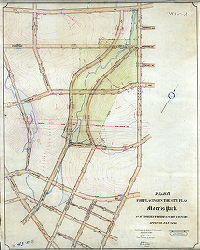
Plan showing revision of lines and grades on a portion of Plan No. 19 (now [Plan] 348) Thirty-fourth Ward [Ordinance Nov. 23, 1905; survey returned March 12, 1907; confirmed Jan. 4, 1909] | Johnson, Joseph | 1907 |
Mounted
57 x 66 in.
1 inch = 100 feet
|
West Philadelphia. Bounded roughly by City Ave. to Carter Street and 68th St., Cobb's Creek to Indian Creek
Topography, streams, Indian Creek, mill races, pond, dam, building footprints, railroad, fountain pen as north arrow, elevations of proposed bridge crossings of Cobb's Creek
|
| 348-02 MTD |
|
Plan for placing on City Plan the portion of Cobbs Creek Park from Lansdowne Ave. to City Ave [Ordinance Nov. 5, 1909; survey returned Dec. 23, 1909; confirmed March 2, 1910] | Johnson, Joseph | 1909 |
Mounted
55 x 36 in.
1 inch = 100 feet
|
West Philadelphia. Bounded roughly by City Ave., Race St., Lansdowne Ave., and Cobb's Creek
Topography, Cobbs Creek and tributaries, railroad
|
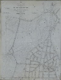
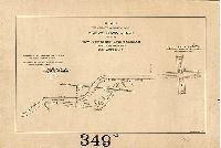
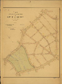
| 349-01 MTD |
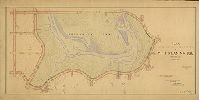
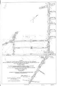
|
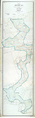
Plan for placing Pennypack Park from Frankford Avenue to Pine Road upon the City Plan, Thirty-fifth Ward Philadelphia [Ordinance March 20, 1905; confirmed March 15, 1909] | Webster, Clement B. | 1909 |
Mounted
42 x 141 in.
1 inch = 200 feet
|
Northeast Philadelphia. Pennypack Park from Frankford Ave. to Pine Road
Topography, streams, building footprints
|
| 349-02 CP |
|
Plan of the revision of lines and grades and establishing new streets upon City Plan No. 349 and City Plan No. 350… and to place upon the City Plan an addition to Pennypack Park, Thirty-fifth Ward, Philadelphia. [Ordinances July 20,1907; March 29 and May 4, 1927] | Blankley, William W., Kohler, George F., and [Daumer?], Edward J. | 1927 ca. |
Tracing
71 x 54 in.
|
Northeast Philadelphia. Bounded roughly by Moredun, Bloomfield, Verree, Tabor, and Strahle Aves., and the Montgomery County line.
Topography, Pennypack Creek and tributaries, springs, building footprints
|
| 349-02 MTD |
|
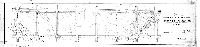
Plan to vacate a portion of Krewstown Road at the New York Short Line Railroad, Thirty-fifth Ward, Philadelphia [Ordinance June 24, 1905; survey returned Sept. 16, 1905; confirmed Nov. 6, 1905] | Webster, Clement B. | 1905 |
Mounted
14 x 21 in.
1 inch = 100 feet
|
Northeast Philadelphia. Krewstown Road.
Curb elevations, railroad
|
| 349-03 MTD |
|
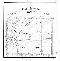
Plan of Pennypack Park showing properties selected and appropriated for Park purposes between Verree Road and Pine Road, Thirty-fifth Ward, Philadelphia. Prepared for the Board of view in the matter of the condemnation thereof under ordinance approved July 16th, 1915. [Survey returned May 25, 1916; confirmed; | Webster, Clement B. | 1916 |
Mounted
27 x 50 in.
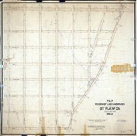
|
Northeast Philadelphia. Bounded roughly by Pine Rd., Verree Rd., Susquehanna Rd. and Pennypack Park
Topography, Penny Creek and tributary streams, property lines, ownership and acreage, building footprints and driveways. Plan "made by C. S. Funk; checked by J. A. Walsh". Note from July 16, 1935: "This plan was formerly framed and hung in the Chief Engineer's office in City Hall."
|
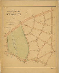
| 350 CP blueprint |
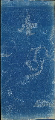
|
[No title. Topography of parts of City Plans 349 and 350, including Pennypack Creek valley] | Not named | 1900 ca. |
Blueprint
42 x 94 in.
|
Northeast Philadelphia. Pennypack Creek valley in vicinity of Pine Road, Strahle St. and Verree Road, near Montgomery County line.
Topography, trees and woodland, Pennypack Creek and tributary streams, building footprints. Note on plan: "Tracing in 349 Tube," but that tracing was not found. Topography on plan seems to end abruptly at edges, but adjoining plans not found.
|
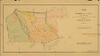
| 350-01 MTD |
|
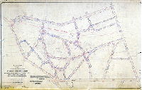
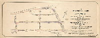
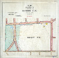
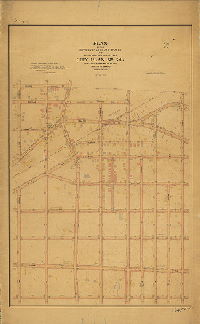
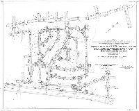
Plan of portion of City Plan No. 350 establishing lines and grades of territory bounded by Verree Ave., Tustin Ave., Tabor Ave. and Strahle St. Thirty-fifth Ward, Philadelphia [Ordinance July 20, 1907; survey returned Dec. 17, 1909; confirmed April 3, 1911] | Webster, Clement B. | 1909 |
Mounted
34 x 20 in.
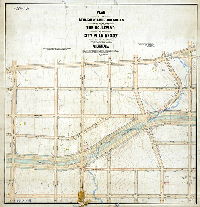
1 inch = 100 feet
|
Northeast Philadelphia. Bounded by Verree Ave., Tustin Ave., Tabor Ave. and Strahle St.
Topography, streams, spring, Pennypack Park
|
| 350-02 MTD |
|
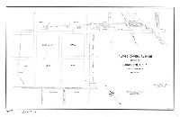
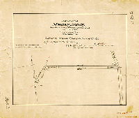
Plan placing Moredun Avenue, Pine Road to the Montgomery Co. line, on City Plan. Twenty-third Ward, Philadelphia [Ordinance Sept,. 24, 1889; confirmed Feb. 17, 1890] | Webster, George S. | 1890 |
Mounted
17 x 20 in.
1 inch = 100 feet
|
Northeast Philadelphia. Moredun Avenue
Curb elevations
|
| 352-01 MTD |
|
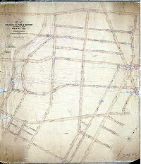
Plan establishing lines and grades on City Plan No. 352, Thirty-fifth Ward, Philadelphia. [Ordinances 1902, 1907, 1908; confirmed April 7, 1913] | Webster, Clement B. | 1913 |
Mounted
43 x 60 in.
1 inch = 100 feet
|
Northeast Philadelphia. Bounded by Poquessing, Willits, Ashton, Holme and Lexington Aves
Topography, Pennypack Creek and tributaries, marshland, building footprints, updates through 1930s
|
| 353-01 MTD |
|
Plan establishing lines and grades on City Plan No. 353, Thirty-fifth Ward, Philadelphia. [Ordinances 1902, 1907, 1908; confirmed April 7, 1913] | Webster, Clement B. | 1913 |
Mounted
45 x 58 in.
1 inch = 100 feet
|
Bounded by Bensalem Ave. (Roosevelt Blvd.) to Poquessing Ave., Lexington Ave. to Welsh Rd.
Topography, Pennypack Creek and tributaries, marshland, building footprints, updates through 1930s
|
| 354-01 CP |
|
Plan establishing lines and grades on City Plan No. 354 and the revision of lines and grades adjacent thereto on a portion of City Plan No. 253, Thirty-fifth Ward Phila. [Ordinance Dec. 2, 1916; confirmed Oct. 1, 1923] | Webster, John H., Jr. | 1917 |
Tracing
38 x 68 in.
|
Northeast Philadelphia. Bounded by Tacony Creek, Longshore Ave., Rising Sun Ave. and Cheltenham Ave.
Topography, Tacony Creek and tributary streams, Wentz Farm Reservoir, building footprints
|
| 355-01 CP |
|
Plan placing upon City Plan No. 355 certain streets, avenues, roads, circles, places, drainage right-of-way and a marginal park strip along Northeast Avenue … pursuant to Section 11-405 of the Code. Thirty-fifth Ward, Philadelphia. [Ordinance Aug 22, 1956; confirmed Nov. 5, 1956] | McDevitt, John J. | 1956 |
Tracing
34 x 42 in.
1 inch = 100 feet
|
Northeast Philadelphia. Bounded by Northeast Ave., property line northeast of Delray St., Bustleton Ave, and a property line 1,082 ft. southwest of Woodhaven Rd.
Topography (part of City Plan area)
|
| 355-02 CP |
|
Plan for placing Verree Road from Bustleton Ave. to Byberry Road on City Plan No. 355, Thirty-fifth Ward, Philadelphia [Ordinance Aug. 3, 1916; confirmed Dec. 15, 1919] | Webster, Clement B. | 1919 |
Tracing
12 x 81 in.
|
Northeast Philadelphia. Verree Rd. from Bustleton Ave. to Byberry Rd.
Topography, building footprints, streams
|
| 355-10 CP |
|
Plan to revise the lines and grades and the establishment of lines and grades upon that portion of the City Plan which includes the territory lying northwest of the New York Short Line Railroad and southwest of Byberry Road … Portion of City Plan No. 355, Thirty-fifth Ward, Philadelphia [Ordinances Nov. 30, 1949 and Nov. 15, 1950; confirmed Dec. 3, 1951] | Engle, Amos B. | 1950 |
Tracing
38 x 26 in.
1 inch = 100 feet
|
Northeast Philadelphia
Topography (part of City Plan area), railroad
|
| 356-01-02 CP |
|
Plan to establish the lines and grades upon City Plan No. 356, bounded by Island Ave., Penrose Ave., Essington Ave. 90th St., and Tinicum Ave. 40th Ward Philadelphia. [Ordinance Oct. 4, 1916; confirmed Dec. 18, 1922 | Gillingham, J. Harvey | 1922 |
Tracing
36 x 66 in.
|
Southwest Philadelphia. Bounded by Island Ave., Penrose Ave., Essington Ave. 90th St., and Tinicum Ave.
Curb elevations at "stones"; many elevations are negative.
|
| 356-05 CP |
|
Plan revising the lines and grades of such portions of City Plans # 356, 357, 368 & 387 as may be necessary to permit the improvement of Essington Ave. from 90th St. to Island Ave. and the construction of a traffic circle at the intersection of Essington Ave. and Island Ave. 40th Ward, Philadelphia [Ordinance March 19, 1943; confirmed June 1, 1943] | Shegog, George T. | 1943 |
Tracing
24 x 95 in.
|
Southwest Philadelphia
M. H. Goldich, draftsman.
|
| 356-07 CP |
|
Compilation of plan establishing the lines and grades upon City Plan No. 356 bounded by Island Ave., Penrose Ave., 90th St., and Tinicum Ave. [Ordinance Oct. 4, 1916; confirmed Dec. 8, 1922 and Oct. 5, 1931] | Not named | 1922 |
Tracing
36 x 69 in.
1 inch = 100 feet
|
Southwest Philadelphia. Bounded by Island Ave., Penrose Ave., Essington Ave. 90th St., and Tinicum Ave.
Drainage streets
|
| 358-01 CP |
|
Plan of the revision of lines and grades and establishing new streets upon City Plan No. 358… Thirty-fifth Ward, Philadelphia [Ordinance July 20, 1907; confirmed Jan. 3, 1927] | Blankley, William W. | 1927 |
Tracing
67 x 42 in.
|
Northeast Philadelphia. Bounded by Lott Ave., New York Short Line Railroad, Bensalem Ave. and Red Lion Rd.
Topography, building footprints, railroad, streams
|
| 358-01 MTD |
|
Plan to establish lines and grades and to place upon City Plan No. 358 Bensalem Avenue from Lott Ave. Red Lion Road, Thirty-fifth Ward Philadelphia [Ordinance March 2, 1921; confirmed May 2, 1921] | Webster, Clement B. | 1921 |
Mounted
18 x 67 in.
1 inch = 100 feet
|
Northeast Philadelphia. Bensalem Ave. and adjacent area from Lott Ave. to Red Lion Rd.
Topography, stream, Roosevelt Boulevard
|
| 359-01 CP |
|
Plan of the revision of lines and grades and establishing new streets upon City Plan No. 359… Thirty-fifth Ward, Philadelphia [Ordinance July 20, 1907; confirmed Dec. 19, 1927] | Blankley, William W. | 1927 |
Tracing
41 x 86 in.
1 inch = 100 feet
|
Northeast Philadelphia. Bounded by Byberry Rd., New York Short Line Railroad, Bensalem Ave. and Red Lion Rd.
Topography, streams, building footprints, driveways
|