
Philadelphia Streets Department Surveys
2755 result(s). Showing results 1701 to 1750.
View page: 1 2 3 4 5 6 7 8 9 10 11 12 13 14 15 16 17 18 19 20 21 22 23 24 25 26 27 28 29 30 31 32 33 34 35 36 37 38 39 40 41 42 43 44 45 46 47 48 49 50 51 52 53 54 55 56 (Show all on one page)
| Identifer | Preview | Title | Surveyor | Date | Media / Size / Scale | Area / Map Features |
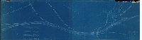
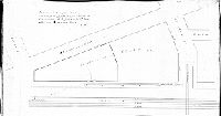
| RC-023-d |
|
Plan showing proposed location of the Twelfth and Sixteenth Sts. Pass. R.W. Co. | Close, Charles W. | 1891 |
Blueprint
12 x 39 in.
|
Street railway tracks on Snyder Ave. and 12th St.
Street Railway
|
| RC-023-x |
|
Proposed extension of the Empire Pass. Railway Co. | Fuller, H. M. | 1894 |
Blueprint
14 x 15 in.
1 inch = 100 feet
|
Street railway Street railway tracks on 16th and Huntingdon Sts.
Street Railway
|
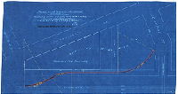
| RC-023-y |
|
Plan of extension of tracks of Empire Passenger Railway Co. on 16th St. from Morris St. to Snyder Ave. | Daly, Thomas | 1891 |
Blueprint
28 x 8 in.
1 inch = 100 feet
|
Street railway tracks on 16th St. from Morris St. to Snyder Ave.
Street Railway
|
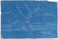
| RC-023-z |

|
Plan of extension of tracks on Jackson St. from Broad to Sixteenth Street, on Fifteenth St. from Jackson to Mifflin Street, and on Sixteenth St. from Jackson to Snyder Avenue, for Philadelphia Traction Company in the Twenty-sixth Ward, Philadelphia [Approved by Board of Surveyors Oct. 23, 1893] | Daly, Thomas | 1893 |
Mounted
38 x 26 in.
|
Street railway tracks on Jackson, 15th and 16th Sts.
Street Railway
|
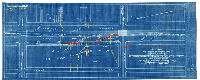
| RC-023-z attachment |
|
Plan for proposed extension of tracks of the Philadelphia Traction Co. [Approved by Board of Surveyors Oct. 23, 1893] | Close, Charles W. | 1893 |
Blueprint
10 x 21 in.
|
Street railway tracks on Jackson St. from Broad St. to 12th Street
Street Railway
|
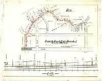
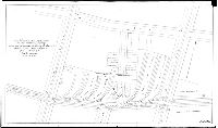
| RC-024 Woodlands |
|
[No title. Plan showing topography and profile of University Ave. from Woodland Ave. and Vintage Ave. and vicinity. This plan correlates to a series of before and after photographs showing the extension of University Avenue through Woodlands Cemetery property.] | Not named | 1936 |
Blueprint
30 x 44 in.
1 inch = 50 feet
|
West Philadelphia. Extension of 38th Street / University Avenue through property of the Woodlands Cemetery
Topography. Shows the street being cut through Woodland Cemetery property.
|
| RC-024 Woodlands grayscale |
|
[No title. Plan showing topography and profile of University Ave. from Woodland Ave. and Vintage Ave. and vicinity. This plan correlates to a series of before and after photographs showing the extension of University Avenue through Woodlands Cemetery property.] | Not named | 1936 |
Blueprint (inverted)
30 x 44 in.
1 inch = 50 feet
|
West Philadelphia. Extension of 38th Street / University Avenue through property of the Woodlands Cemetery
Topography. Shows the street being cut through Woodland Cemetery property.
|
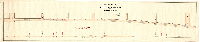
| RC-024-a |

|
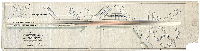
Plan of the Philadelphia and Trenton Railroad Company's Road on Howard Street. James P. Davis, Sur. & Reg. 6th Dist., John F. Wolf, Sur. & Reg. 5th Dist. Approved December 1, 1862 | Davis, James P; Wolf, John F. | 1862 |
Mounted
15 x 42 in.
1 inch = 100 feet
|
Howard Street from Girard Ave. to Montgomery Ave.
Profile and corner elevations; Price J. Patton approved this plan for the railroad company
|
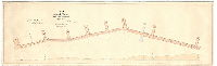
| RC-024-b |
|
Plan of the proposed extension of the North Pennsylvania Rail-road [in Master Street] | Haines, Henry; Wolf, John F. | 1861 |
Mounted
12 x 64 in.
1 inch = 50 feet
|
Master St., from Ninth St. to American St.
Includes profile of route
|
| RC-024-c |

|
Draft of a proposed railroad on Oak and Thirtieth Streets, 24th Ward, Philada. Jas. Miller, Surveyor 12 Dist. Approved May 16th 1859 Strickland Kneass, Chief Eng. & Sur. [Attachment: report from Surveyor on rail types] | Miller, James | 1859 |
Paper
13 x 23 in.
1 inch = 100 feet
|
Railroad on Oak and 30th Sts., 24th Ward. Schuylkill River to 31st, Chestnut to Market Sts.
Wharves, profile of proposed railroad route
|
| RC-025-b |
|
Plan of proposed siding on the north side of Green Street in front of the property of the Philada. and Reading Rail-Road Company, and curves at Eighth Street [Ordinance July 1, 1879; survey returned July 19, 1879; approved July 21, 1879] | Roberts, Edward D. | 1879 |
Mounted
12 x 31 in.
|
Street railway, Green and 9th Sts.
Street Railway
|
| RC-026-b |
|
Map of the proposed improvement of the P. W. & B. R. R. , Jan. 25th, 1882. No. 681 | Not named | 1882 |
Blueprint
21 x 70 in.
1 inch = 100 feet
|
Philadelphia, Wilmington and Baltimore Railroad
Railroad
|
| RC-026-f |

|
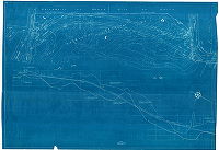
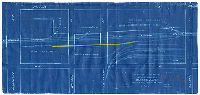
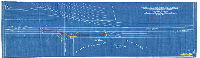
39368. The Pennsylvania Railroad Eastern Region - Phila. Terminal Division. Plan showing proposed changes in location of the Sixtieth Street Branch and Chester and Philadelphia Branch, Philadelphia, PA. .. Plan to accompany agreement between the Philadelphia, Baltimore and Washington railroad Company and the Pennsylvania Railroad Company, Lessee, and the City of Philadelphia as authorized by ordinance approved May 6, 1947. Plan and profile approved by Board of Surveyors July 21, 1947 | Not named | 1947 |
Tracing
30 x 121 in.
|
Pennsylvania Railroad
Railroad. Southwest Philadelphia Airport, rail lines, streams, pumping station, Mingo Creek, and many other features
|
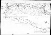
| RC-027-01 |
|
Plan and Profile, River Front Railroad from Dock to Vine Street, June 1887 | Shedaker, David Hudson | 1877 |
Mounted
12 x 56 in.
1 inch = 80 feet
|
River Front Railroad along Delaware Ave. from Dock St. to Vine St.
Railroad
|
| RC-027-02 |

|
General plan of the Riverfront Rail Road and Reading R.R. Extension, as authorized by Select & Common Councils of the City of Philada by ordinance app'd. May 31st 1877. Approved by Board of Surveyors June 4th, 1877 | Not named | 1877 |
Tracing
21 x 66 in.
1 inch = 270 feet
|
River Front Railroad, from Dock St. to Lehigh Ave.
Wharves, creeks, other railroad depots and lines, Attachment: Cross section of rail
|
| RC-027-a |
|
Plan of the River Front Railroad from Vine to Laurel Street, August 1877. [Approved August 20, 1877] | French, Andrew | 1877 |
Mounted
16 x 53 in.
1 inch = 80 feet
|
River Front Railroad along Delaware Ave. from Vine St. to Laurel St.
Railroad, Cohocksink Canal, "Profile of Delaware Avenue"
|
| RC-027-b |

|
Plan of the River Front Railroad from Laurel St. to Trenton Ave, approved August 1877 [Approved by Board of Surveyors August 20, 1877] | Davis, James P. | 1877 |
Mounted
26 x 96 in.
1 inch = 80 feet
|
River Front Railroad, from Laurel St. to Trenton Ave.
Drawbridge at Aramingo Canal, profile of the railroad
|
| RC-027-c |
|
Proposed Canal Street Branch of River Front Railroad [Authorized July 1884; approved Dec. 8, 1884] | Trik, Carl | 1884 |
Tracing
25 x 31 in.
1 inch = 60 feet
|
Canal Street, from Delaware Ave. to Laurel St.
Canal Street (following course of Cohocksink Creek), profile of sewer, property lines and ownership, railroad
|
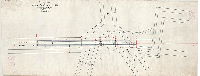
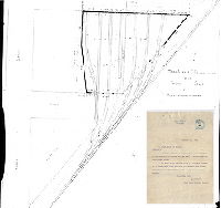
| RC-028-a1 |

|
[No title. From Railroad Plan Index (City Archives Record Group 90.14), p. 370: "Penna. R.R. - Miscellaneous. Topographical sheets. Banks of Schuylkill River at Girard Ave." No date] | Not named | 1876 ca. |
Tracing
20 x 55 in.
|
Schuylkill River, Girard Avenue Bridge and surrounding area.
Topography (3-foot contours), trees, building footprints, basin of Spring Garden Water Works
|
| RC-028-a2 |

|
[No title. From Railroad Plan Index (City Archives Record Group 90.14), p. 370: "Penna. R.R. - Miscellaneous. Topographical sheets. Banks of Schuylkill River at Girard Ave." No date. Embossed seal: "Engineer's Office, Fairmount Park"] | Not named | 1876 ca. |
Tracing
24 x 45 in.
|
Schuylkill River, Girard Avenue Bridge and surrounding area.
Topography (3-foot contours), trees, building footprints,
|
| RC-028-c |

|
[Handwritten title on reverse: "Junction of P.R.R. [Pennsylvania Railroad] and Connecting R.R." From 90.14 index, p. 354: "Penna R.R. - Connecting R.R. Tracing of connection of New York Branch with Western Main Line of P.R.R." Date stamp from "Office of Consulting Engineer, P.R.R., Philad'a. Sep. 28, 1874] | Not named | 1874 |
Tracing
30 x 49 in.
1 inch = 200 feet
|
Railroad lines across Schuylkill River above Girard Avenue, and vicinity
Pennsylvania Railroad, Connecting Railroad, Junction Railroad, Philadelphia and Reading railroad
|
| RC-028-d |

|
[No title. From Railroad Plan Index (City Archives Record Group 90.14), p. 354: "Tracing showing Connecting R.R. & right-of-way"] | Not named | 1875 ca. |
Tracing
15 x 120 in.
|
Connecting Railroad from Pennsylvania Railroad in West Philadelphia to North Pennsylvania Railroad near Third St. and Venango St. and then to Philadelphia and Trenton Railroad at Wheatsheaf Lane
Railroad
|
| RC-028-g |

|
Pennsylvania Rail Road. Branch Line. From Arsenal Bridge to West Chester R.R. Location of Feb. 21st, 1876. Scale 100 ft. to an inch. Geo. W. Leuffer, Engineer. | Leuffer, George W. | 1876 |
Tracing
19 x 38 in.
|
Pennsylvania Railroad
Railroad
|
| RC-028-h |

|
[No title. From Railroad Plan Index (City Archives Record Group 90.14), p. 355: "Penna R.R. - Schuylkill Valley R.R. - Compartment 28-h. Blue print of Penna. Schuylkill Valley R.R. from City Ave. to Elm Ave." | Johnson, Joseph | 1890 ca. |
Blueprint
18 x 55 in.
|
Schuylkill Valley Railroad in West Philadelphia.
Railroad
|
| RC-028-j |
|
Location map of High St. Elevated R.R., Manayunk Division, P. S. V. R.R. | Not named | 1880 ca. |
Tracing
13 x 33 in.
1 inch = 20 feet
|
Schuylkill Valley Railroad, Manayunk Division
Railroad
|
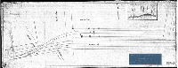
| RC-028-k |
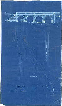
|
Proposed arch across Girard Avenue, Phila, on line of Connecting Railway | Not named | 1885 |
Blueprint
32 x 18 in.
1 inch = 8 feet
|
Connecting Railway, arched bridge crossing of Girard Avenue.
Railroad
|
| RC-028-L |

|
[No title on plan. From City Archives RG 90.14 Index, p. 354: "Plan showing property of Connecting Railroad transferred to P.R.R. [Pennsylvania Railroad]"] | Not named | 1876 |
Tracing
23 x 62 in.
1 inch = 100 feet
|
Street railway tracks paralleling Mantua Avenue to the north, between 36th and 44th Sts.
Railroad
|
| RC-028-o small |
|
P. & T. R. R. P. T. Div. Westmoreland St. Branch, Valuation Section No. 1, Phila., Pa. Ontario & Janney Sts. Sidetrack for Purity Fibre Products Corp. | Not named | 1931 |
Blueprint
8 x 14 in.
1 inch = 100 feet
|
Philadelphia and Trenton Railroad
Railroad
|
| RC-028-o2 |

|
Connecting Ry., P.T. Div. Frankford Street Branch, Erie Ave. siding, Ward 45, Philadelphia, Pa. | Not named | 1915 |
Blueprint
36 x 21 in.
1 inch = 100 feet
|
Connecting Railway
Railroad
|
| RC-028-p |
|
Conn. Ry., P.T. Div., Engelside Branch, Phila., Pa. 30th and Jefferson Sts., siding for Philadelphia Electric Co. [With attached letter] | Not named | 1931 |
Blueprint
8 x 14 in.
1 inch = 100 feet
|
Connecting Railway
Railroad
|
| RC-028-w |

|
Conn. Ry., P.T. Div., Engelside Branch. Rearrangement of siding for American Stores Company, Master & 31st Streets, Ward 29, Philadelphia, Pa. | Not named | 1922 |
Blueprint
8 x 32 in.
1 inch = 20 feet
|
Connecting Railway
Railroad
|
| RC-028-x |
|
Philadelphia & Trenton Railroad. Proposed siding for William E. Cooper, Trenton & Allegheny Avenues, Ward 45, Phila., Pa. Wm Cooper | Not named | 1911 |
Blueprint
8 x 18 in.
1 inch = 100 feet
|
Philadelphia and Trenton Railroad
Railroad
|
| RC-028-y |

|
[No title. From Railroad Plan Index (City Archives Record Group 90.14), p. 370: "Pennsylvania R.R. - Miscellaneous. Center line, Philadelphia, Bustleton & Trenton R.R., Erie Av. to Loudon St." No date] | Not named | 1885 ca. |
Blueprint
19 x 87 in.
|
Philadelphia, Bustleton and Trenton Railroad, Erie Ave. to Loudon St.
Railroad
|
| RC-029-01 |

|
Plan showing tracks of the P. & R. Ry. on Willow St. between Front St. & Second St. Phila., Pa. [Two attachments: Memorandum and ordinance regarding permission for railroad siding, dated Dec. 31, 1901, from O[scar] Thompson, special agent of the Philadelphia & Reading Railway Co.] | Not named | 1901 |
Blueprint
32 x 42 in.
|
Philadelphia and Reading Railway
Railroad
|
| RC-029-02 |

|
[Handwritten title on reverse: "Proposed freight house and tracks at Front and Willow Sts." Attachment: Memorandum from R. M. Downing to "Chief" regarding Oscar Thompson's visit to office, dated Jan. 27, 1898] | Not named | 1898 |
Blueprint
32 x 32 in.
1 inch = 20 feet
|
Philadelphia and Reading Railway
Railroad
|
| RC-029-03 |
|
Track layout & connections for the tanking shop of the Baldwin Locomotive Works [On reverse: "Filed Nov. 1st 1900"] [Attachment: Letter from J[oseph] H. Paist, Chief Clerk of Select Council, to George S. Webster, Chief, Bureau of Surveys, regarding blueprint of sidings, dated Nov. 1, 1900] | Not named | 1900 |
Blueprint
26 x 26 in.
|
Philadelphia and Reading Railway
Railroad
|
| RC-029-04 |
|
P. & R. Ry. - Philadelphia Div. - Plan of tracks and property in the blocks bounded by Willow St., Fifth St., Noble St. and Sixth St., Phila. | Not named | 1906 |
Blueprint
25 x 42 in.
1 inch = 20 feet
|
Philadelphia and Reading Railway
Railroad
|
| RC-029-05 |
|
Proposed siding into new building for the Acme Tea Co., York Ave. & Willow St. [Approved July 11, 1907] | Not named | 1907 |
Blueprint
16 x 42 in.
1 inch = 8 feet
|
Philadelphia and Reading Railway
Railroad
|
| RC-029-06 |
|
Plan showing location of present siding and desired extension for the Crane Co. on American St. between Master and Jefferson in the 17th Ward of the City of Philadelphia, Penna. | Not named | 1907 ca. |
Blueprint
16 x 31 in.
1 inch = 20 feet
|
Philadelphia and Reading Railway
Railroad
|
| RC-029-07 |
|
Philadelphia & Reading Ry. - Phila. Division - Bethlehem Br. Plan showing location of proposed siding for the Crane Co. on American St. between Master and Jefferson in the 17th Ward of the City of Philadelphia, Pennsylvania [Ordinance May 12, 1905] | Not named | 1905 |
Blueprint
14 x 27 in.
1 inch = 20 feet
|
Philadelphia and Reading Railway
Railroad
|
| RC-029-08 |
|
P. & R. Ry. - Phila. Div. - Proposed rearrangement of tracks in yard of S. L. Allen & Co., Glenwood Ave., Bethlehem Branch, 33rd Ward, Phila. [Ordinance Dec. 29, 1913] | Not named | 1913 |
Blueprint
15 x 22 in.
1 inch = 20 feet
|
Philadelphia and Reading Railway
Railroad
|
| RC-029-09 |

|
P. & R. RY - Phila. Div. - Chester Branch. Plan showing location of additional sidings at 58th St., Gibson's Point, 40th Ward, Philadelphia, for the Gulf Refining Company. | Not named | 1913 |
Blueprint
12 x 38 in.
1 inch = 50 feet
|
Philadelphia and Reading Railway
Railroad
|
| RC-029-10 |

|
P. & R. RY - Phila. Div. Plan of proposed siding for Freihofer Vienna Baking Co., 19th and Clearfield Sts., Phila. | Not named | 1905 |
Blueprint
12 x 20 in.
1 inch = 50 feet
|
Philadelphia and Reading Railway
Railroad
|
| RC-029-11 |
|
P. & R. RY - Phila. Div. Plan showing proposed siding for A. M. Collins Mfg. Co. at Columbia Ave. & American St., 19th Ward Phila. | Not named | 1908 |
Blueprint
8 x 21 in.
1 inch = 50 feet
|
Philadelphia and Reading Railway
Railroad
|
| RC-029-12 |
|
Northern Liberties & Penn Twp. Br. of P. & R. Ry. Plan showing proposed siding for Hoopes & Townsend at Twelfth & Noble Sts, 14th Ward, Phila. Pa. [Ordinance Dec. 4, 1909; approved by Board of Surveyors Jan. 27, 1910] | Not named | 1909 |
Blueprint
8 x 29 in.
1 inch = 20 feet
|
Philadelphia and Reading Railway
Railroad
|
| RC-029-13 |

|
P. & R. RY - Phila. Div. Plan showing proposed siding for Lansing Wheelbarrow Co. at American & Willow Sts, 11th Ward, Phila, Pa. [Ordinance March 30, 1908] | Not named | 1907 |
Blueprint
8 x 27 in.
1 inch = 20 feet
|
Philadelphia and Reading Railway
Railroad
|
| RC-029-14 |

|
P. & R. RY - Phila. Div. Plan showing proposed extension of siding for Freihofer Vienna Baking Company at 20th and Clearfield Sts., 38th Ward, Phila. [Ordinance March 13, 1908] | Not named | 1908 |
Blueprint
9 x 27 in.
1 inch = 50 feet
|
Philadelphia and Reading Railway
Railroad
|
| RC-029-15 |
|
Plan showing the position of the Philadelphia & Reading R.R. tracks after the completion of the Baltimore & Ohio R.R. Tunnel on Pennsylvania Ave., Phila. | Not named | 1895 ca. |
Tracing
11 x 44 in.
|
Philadelphia and Reading Railway
Railroad
|
| RC-029-16 |

|
Plan of a proposed switch for Mr. Horace P. Serrill … To accompany ordinance [approved Nov. 25, 1905]. Surveyed Oct. 1905. J. H. Young, Engineer. F. H. Keisker, Architect. | Not named | 1905 |
Blueprint
14 x 9 in.
1 inch = 20 feet
|
Philadelphia and Reading Railway, switch at intersection of American St. and Willow St.
Railroad
|
| RC-029-17 |

|
P. & R. Ry. - Phila Div. Plan showing proposed siding for Chas. Heiber, at Willow and Marshall Sts., Phila, Pa. [Ordinance approved Sept. 12, 1905] | Not named | 1905 |
Blueprint
13 x 21 in.
1 inch = 20 feet
|
Philadelphia and Reading Railway
Railroad
|