
Philadelphia Streets Department Surveys
2755 result(s). Showing results 1751 to 1800.
View page: 1 2 3 4 5 6 7 8 9 10 11 12 13 14 15 16 17 18 19 20 21 22 23 24 25 26 27 28 29 30 31 32 33 34 35 36 37 38 39 40 41 42 43 44 45 46 47 48 49 50 51 52 53 54 55 56 (Show all on one page)
| Identifer | Preview | Title | Surveyor | Date | Media / Size / Scale | Area / Map Features |
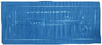
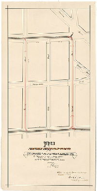
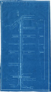
| RC-029-18 |
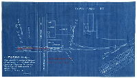
|
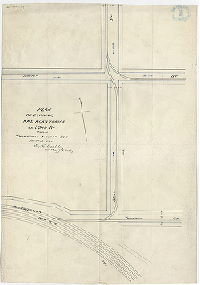
P. & R. Ry. Co. - Main Line - Philada. Div. Plan showing proposed extension of coal siding at J. & P. Baltz Brew. Co. across Thompson St., west of Thirty-first St., to be used as a delivery track. 29th Ward, Philada, Pa. [Ordinance July 28, 1910; approved Aug. 11, 1910] | Not named | 1909 |
Blueprint
8 x 14 in.
1 inch = 50 feet
|
Philadelphia and Reading Railway
Railroad
|
| RC-029-19 |
|
[No title. Philadelphia and Reading Railway Co. - Bethlehem Branch. Siding into Rex & Co., at American and York Sts. Note on plan says "Plan and Ordinance do not agree". Ordinance Nov. 28, 1905] | Not named | 1905 ca |
Blueprint
8 x 14 in.
|
Philadelphia and Reading Railway
Railroad
|
| RC-029-20 |
|
Proposed extension of siding for the Haas Baking Co., 9t St. between Thomson & Girard Aves., Phila. | Not named | 1901 |
Blueprint
8 x 16 in.
1 inch = 50 feet
|
Philadelphia and Reading Railway
Railroad
|
| RC-029-21 |
|
Plan showing proposed siding for Delaware Freezing Co. on American St. below Willow St., Phila. Pa. | Not named | 1909 |
Blueprint
8 x 14 in.
1 inch = 50 feet
|
Philadelphia and Reading Railway
Property lines and owners
|
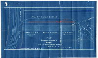
| RC-029-a |
|
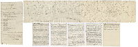
Draft of the Pennsylvania Avenue or Road [This eventually became the Philadelphia and Reading Railroad. Three parts: 1. Plan. 2. Written description, and 3. Transcription of Indenture from Deed Book G.W.C., No. 74, page 332 etc. Morris Longstreth, Israel Painter, and John A. Gamble, Canal Commissioners of the Commonwealth of Pennsylvania to the Philadelphia and Reading Rail Road Company, Dec. 27, 1850] | Fox, Joseph | 1834 |
Mounted
11 x 57 in.
|
Pennsylvania Avenue / Reading Railroad from Fairmount to bridge crossing the Schuylkill River.
Attached draft showing compass bearings, and five-page handwritten transcription of the deed.
|
| RC-029-aa1 |
|
Plan of existing rail road tracks on 32nd St. from Thompson to Master St. | Carlile, William K. | 1892 |
Paper
19 x 13 in.
|
Philadelphia and Reading Railway
Railroad
|
| RC-029-aa2 |
|
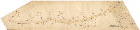
Proposed siding to Theis' Brewery, Engelside | Not named | 1892 |
Tracing
14 x 38 in.
|
Philadelphia and Reading Railway
Railroad
|
| RC-029-b |
|
Plan of Union Canal [Pennsylvania Avenue] | Fox, Joseph | 1830 ca. |
Mounted
14 x 67 in.
|
Union Canal (Pennyslvania Ave., Reading Railroad)
Shows route of Union Canal, which became in part the bed of Pennsylvania Avenue and the Reading Railroad.
|
| RC-029-g |

|
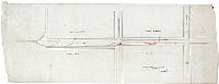
Plan showing proposed additional tracks along Pennsylvania Avenue between Fairmount Ave. and 33rd St., Phila. [Attachment: Memorandum from James H. Windrim, Director of Public Works, to George S. Webster, Chief Engineer, Bureau of Surveys, regarding "plan of tracks on Pennsylvania Avenue," dated Philadelphia, Dec. 12, 1893] | Not named | 1893 |
Blueprint
18 x 105 in.
1 inch = 50 feet
|
Philadelphia and Reading Railway
Railroad
|
| RC-029-h |
|
Plan of track across Hamilton St. for Hoopes and Townsend | Bloch, Frits | 1893 |
Blueprint
9 x 20 in.
1 inch = 40 feet
|
Philadelphia and Reading Railway. Hamilton St. between 13th and Broad Sts.
Railroad
|
| RC-029-l |
|
Plan showing a proposed siding for the Bergner & Engel Br'w'g Co. on 33rd St. Phila. | Not named | 1894 |
Blueprint
8 x 13 in.
|
Philadelphia and Reading Railway
Railroad, siding into brewery
|
| RC-029-m |
|
P. & R. Ry. - Phila. Div. - Plan showing proposed siding for Phila. Warehousing & Cold Storage Co. at Front & Noble Sts., 11th Ward, Phila., Pa. | Not named | 1909 |
Blueprint
8 x 18 in.
1 inch = 50 feet
|
Philadelphia and Reading Railway
Railroad
|
| RC-029-n |
|
[No title. From Railroad Plan Index (City Archives Record Group 90.14), p. 309: "Philadelphia and Reading Railroad. Plan showing proposed siding at 12th and Noble - Ordinance Nov. 16, 1908." Part of plan may be missing] | Not named | 1908 |
Blueprint
15 x 19 in.
|
Philadelphia and Reading Railway
Railroad
|
| RC-029-p |
|
P. & R. Ry. - Phila. Div. - Plan showing proposed tracks crossing Willow & Darien Sts., 13th Ward, Phila., Pa. | Not named | 1908 |
Blueprint
8 x 14 in.
1 inch = 20 feet
|
Philadelphia and Reading Railway
Railroad
|
| RC-029-q |
|
Phila. & Reading Ry. - Phila. Div. - Northern Liberties & Penn Township R.R. Plan showing location of siding at Ninth and Willow St., 13th Ward, City of Phila., for Wilson & Co. | Not named | 1917 |
Blueprint
12 x 21 in.
1 inch = 20 feet
|
Philadelphia and Reading Railway
Railroad
|
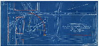
| RC-030-01 |
|
[No title. Plan showing route of railroad through Almshouse property on either side of the west approach to the South St. Bridge, now the site of the SEPTA University City railroad station] | Not named | 1880 ca. |
Blueprint
18 x 30 in.
1 inch = 100 feet
|
West Philadelphia, vicinity of Spruce St. and Schuylkill River
Railroad, Almshouse meadow, land and wharf
|
| RC-030-02 |
|
[No title. Plan showing City of Philadelphia property on the north side of the west approach to the South Street Bridge. | Not named | 1880 ca. |
Blueprint
22 x 29 in.
|
West Philadelphia, vicinity of Spruce St. and Schuylkill River
Property lines and owners
|
| RC-030-03 |
|
[No title: Property at intersection of Junction Railroad and Pennsylvania railroad, near the Almshouse Property along the Schuylkill River. Attachment: written description of metes and bounds of shaded property] | Not named | 1880 ca. |
Blueprint
17 x 26 in.
1 inch = 100 feet
|
West Philadelphia, Schuylkill River front south of South Street Bridge
Property lines and owners
|
| RC-030-04 |
|
[No title. Plan showing route of railroad through Almshouse property on either side of the west approach to the South St. Bridge, now the site of the SEPTA University City railroad station] | Not named | 1880 ca. |
Blueprint
26 x 30 in.
1 inch = 100 feet
|
West Philadelphia, vicinity of Spruce St. and Schuylkill River
Railroad, property lines and acreage
|
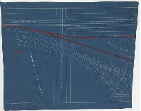
| RC-030-a |
|
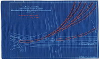
Plan and profile of Junction Railroad from Columbia Bridge to Haverford St. [Survey returned April 1862; approved by Board of Surveyors April 21, 1862] | Wilson, John A. | 1862 |
Mounted
32 x 64 in.
1 inch = 200 feet
|
Junction Railroad along Schuylkill River from Columbia Bridge to Haverford Ave.
Bridge, Sanger Hall, railroad lines. "Theo S. Heizman, Del., [delineator] 1862"
|
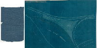
| RC-030-b |
|
Plan and profile of Junction Railroad from Haverford St. to Gray's Ferry Bridge [Survey returned April 1862; approved by Board of Surveyors April 21, 1862] | Wilson, John A. | 1862 |
Mounted
44 x 54 in.
1 inch = 200 feet
|
Junction Railroad along Schuylkill River from Haverford Ave. to Gray's Ferry Bridge
Bridges, building footprints, streams into Schuylkill River, Almshouse
|
| RC-030-b revised |
|
Revised plan of Junction Railroad from Haverford St. to Gray's Ferry, also of proposed location of Penna. R.R. from Spruce St. to Schuylkill River. [Survey returned Dec. 6, 1862; approved by Board of Surveyors Dec. 8, 1862] | Miller, James; Wilson, John A. | 1862 |
Mounted
44 x 54 in.
1 inch = 200 feet
|
Junction Railroad and Pennsylvania Railroad lines along Schuylkill River from Haverford Ave. to Gray's Ferry Bridge
Bridges, building footprints, streams into Schuylkill River, railroad sidings and other buildings at Market St. On reverse: "Junction R.R. and Delaware Extension P.R.R."
|
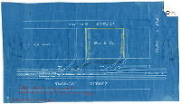
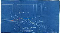
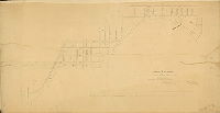
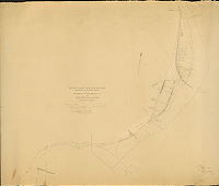
| RC-031-a |
|
Plan of People's [Passenger] R.R. and Hestonville [Passenger} R.R. tracks. July 7, [18]81, taken by S. Smedley [Plan also includes unrelated title block relating to Green St. - indicating that this was a draft and not a final survey] | Smedley, Samuel L. | 1881 |
Tracing
22 x 43 in.
|
Street railway lines in vicinity of 25th St. and Callowhill Street Bridge.
Street railway
|
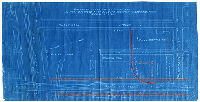
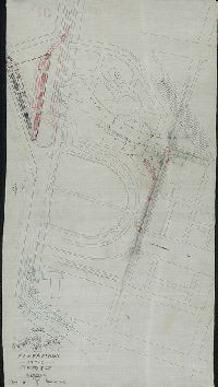
| RC-031-b |
|
[No title. Four street railway lines converging on Callowhill Street Bridge over the Schuylkill River] | Roberts, Edward D. | 1881 |
Mounted
36 x 131 in.
|
Race and Vine Street, Callowhill Street, Spruce and Pine Street, and Arch Street streetcar lines, along Callowhill Street from 25th and Hamilton Sts. to the Callowhill Street Bridge
Street Railway
|
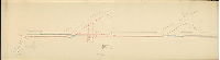
| RC-031-c |
|
Wm. Wharton Jr. & Co. Limited, Philadelphia, Pa. October 1st, '86, Drawing #1476, mcd. [Approved by Board of Surveyors, October 4, 1886] | Not named | 1886 |
Blueprint
23 x 33 in.
|
Street railway lines from 24th Street to Callowhill Street bridge
Street Railway
|
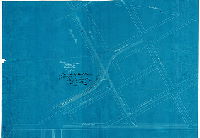
| RC-032-a |
|
Plan and profile of the Germantown Passenger Railway on Eighth Street from Columbia Avenue to Susquehanna Avenue [Approved by Board of Surveyors Nov. 20, 1882] | Albertson, William | 1882 |
Mounted
38 x 11 in.
1 inch = 100 feet
|
Germantown Passenger Railway Co.
Street Railway
|
| RC-032-b |
|
Plan and profile of the extension of the Germantown Passenger Railway, on Susquehanna Ave., Twenty-second and Norris Sts., City of Philadelphia [Approved by Board of Surveyors April 3, 1882] | Hibberd, Josiah | 1882 |
Mounted
21 x 20 in.
|
Germantown Passenger Railway Co.
Street Railway
|
| RC-032-c |
|
Plan and profile of the extension of the Germantown Passenger Railway on [numerous streets] [Approved by Board of Surveyors Sept. 18, 1882] | Not named | 1882 |
Mounted
78 x 26 in.
|
Germantown Passenger Railway Co.
Street Railway
|
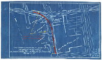
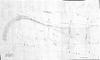
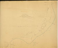
| RC-034-a |
|
Map of Balto. & Phila. R.R. from Cobb [Cobb's] Creek to Chester Br. of Reading R.R., Philadelphia, Pa. | Not named | 1885 |
Tracing
20 x 38 in.
1 inch = 400 feet
|
Baltimore and Philadelphia Railroad between Cobb's Creek and the Schuylkill River
Line of railroad, building footprints, other railroads, existing and proposed streets, Mt. Moriah Cemetery
|
| RC-034-b |
|
Plan of the wharf lines of the River Schuylkill from Gray's Ferry Road to Mifflin Street, showing the site of the Bridg [Bridge] to be built by the Schuylkill E.S. R.R. Co. January 30th, 1884 | Daly, Thomas; Jones, William H. | 1884 |
Tracing
26 x 43 in.
1 inch = 100 feet
|
Schuylkill River, both banks, between 53rd St. and Mifflin St. and Gray's Ferry Ave.
Gray's Ferry Bridge, wharves, rocks, stream entering Schuylkill River at 50th St., low water line
|
| RC-034-d |
|
Profile of the Schuylkill River East Side RR submitted to [?] Nov. 14, 1884. [On reverse: "Unfinished profile…"] | Not named | 1884 |
Paper
12 x 82 in.
|
Schuylkill River East Side Railroad
Railroad
|
| RC-034-e |
|
Plan showing location of Schuylkill River East Side R.R. between Chestnut St. and Pennsylvania Ave. [Ordinance July 3, 1885, section 16; survey returned Aug. 14, 1885. RC-34-h is companion to this plan] | Daly, Thomas | 1885 |
Tracing
38 x 86 in.
1 inch = 100 feet
|
Schuylkill River East Side Railroad between Chestnut St. and Pennsylvania Ave.
Wharves, Fairmount Reservoir, other railroad lines
|
| RC-034-f |

|
Proposed lines of Schuylkill River East Side R.R. to avoid a grade crossing of the P.W. and B. R.R. [Note on reverse: "Decr. 10, 1884. Rec'd from Wm. H. Brown, Chief Eng P.R.R. by request. This plan was submitted to the court in the injunction suit of the P.R.R. vs. the Sch. River E. Side RR in crossing Grays Ferry at grade. Saml. L. Smedley." ] | Not named | 1884 |
Blueprint
18 x 54 in.
1 inch = 200 feet
|
Schuylkill River East Side Railroad
Railroad
|
| RC-034-h |
|
Plan showing location of Schuylkill River East Side R.R. between Chestnut St. and Chester Br. Of P & R. R.R. [Ordinance July 3, 1885, section 16; survey returned Aug. 14, 1885. RC-34-e is companion to this plan] | Daly, Thomas | 1885 |
Tracing
38 x 122 in.
1 inch = 100 feet
|
Schuylkill River East Side Railroad between Chestnut St. and 53rd St.
Wharves, streams entering Schuylkill River, other railroad lines
|
| RC-035-01 |
|
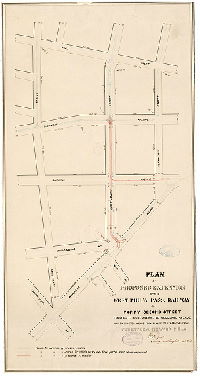
Plan of proposed extension of the West Phil'a. Pass. Railway in the Twenty-seventh Ward, Phil'a. [Survey returned March 8, 1885] | Jones, William H. | 1885 |
Tracing
21 x 11 in.
1 inch = 100 feet
|
West Philadelphia Passenger Railway Co.
Street Railway
|
| RC-035-02 |

|
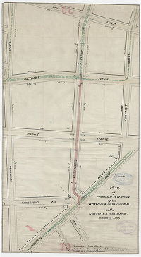
Plan showing proposed line of the Elmwood and Fairmount Park Pass'r. R.W. CO. on 52nd St. from Market St. to Baltimore Av., 27th Ward, Phila. [Approved by Board of Surveyors May 22nd 1893] | Jones, William H. | 1893 |
Blueprint
11 x 54 in.
1 inch = 100 feet
|
Elmwood and Fairmount Park Passenger Railway
Street Railway
|
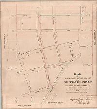
| RC-035-03 |
|
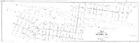
Plan of proposed extension of the West Phil'a. Pass. Railway on Forty-second Street Baltimore Avenue to Woodland Avenue, and on Chester Avenue from 42nd St. to Woodland Avenue. Twenty-seventh Ward, Phil'a. [Date stamp: March 19, 1885; no approval noted. See RC-035-c for approved version of plan] | Jones, William H. | 1885 |
Mounted
30 x 160 in.
1 inch = 100 feet
|
West Philadelphia Passenger Railway Co.
Street Railway
|
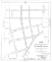
| RC-035-a |
|
Plan for extension of tracks of the West Phila. Passenger Railway on [various streets] [Survey returned Dec. 15, 1883; approved by Board of Surveyors April 21, 1884] | Johnson, Joseph | 1883 |
Mounted
29 x 95 in.
1 inch = 100 feet
|
West Philadelphia Passenger Railway Co.
Street Railway
|
| RC-035-b |
|
Plan of proposed extension of tracks of the West-Phila. Passr. Railway Company on [various streets] [Approved by Board of Surveyors March 16, 1885] | Johnson, Joseph; Jones, William H. | 1885 |
Mounted
17 x 85 in.
1 inch = 100 feet
|
West Philadelphia Passenger Railway Co.
Street Railway
|
| RC-035-c |
|
Plan of proposed extension of the West Phil'a. Pass. Railway on Forty-second St. from Spruce St. to Woodland Ave., Chester Ave. from 42nd St. to Woodland Ave., Forty-first St. from Chester Ave. to Spruce St., in the Twenty-seventh Ward, Phil'a. [Survey returned May 23, 1885; approved by Board of Surveyors June 1, 1885] | Jones, William H. | 1885 |
Mounted
28 x 24 in.
1 inch = 100 feet
|
West Philadelphia Passenger Railway Co.
Street Railway
|
| RC-035-c tracing |
|
Plan of proposed extension of the West Phil'a. Pass. Railway on Forty-second St. from Spruce St. to Woodland Ave., Chester Ave. from 42nd St. to Woodland Ave., Forty-first St. from Chester Ave. to Spruce St., in the Twenty-seventh Ward, Phil'a. [Survey returned May 23, 1885; approved by Board of Surveyors June 1, 1885] | Jones, William H. | 1885 |
Tracing
29 x 25 in.
|
West Philadelphia Passenger Railway Co.
Street Railway
|
| RC-035-d |
|
Plan of extension of tracks of the West Phila. Passr. Railway Co. on [numerous streets] [Survey returned Jan. 2, 1885; approved by Board of Surveyors June 1, 1885] | Johnson, Joseph | 1885 |
Mounted
27 x 25 in.
|
West Philadelphia Passenger Railway Co.
Street Railway
|
| RC-035-e |
|
Plan of proposed extension of tracks of the West Phila. Passenger Railway Co. on Brown Street from 40th St. to Lancaster Ave., 24th Ward [Survey returned March 9, 1885; approved by Board of Surveyors June 1, 1885] | Johnson, Joseph | 1885 |
Mounted
18 x 31 in.
|
West Philadelphia Passenger Railway Co.
Street Railway
|
| RC-035-f |
|
Plan of proposed extension of tracks of the West-Phila. Passenger Railway Company on Wyoming and 40th Streets between Baring and Haverford Streets, in the Twenty-fourth Ward [Survey returned and approved by Board of Surveyors March 1, 1886] | Johnson, Joseph | 1886 |
Mounted
31 x 16 in.
|
West Philadelphia Passenger Railway Co.
Street Railway
|
| RC-035-g |
|
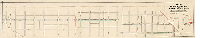
Plan of the proposed extension of the tracks of the West Philadelphia Passenger R.W. Company on 46th and 47th Streets from Chester Avenue to Woodland Avenue in the 27th Ward, Philadelphia [Survey returned April 29, 1889; approved by Board of Surveyors July 1, 1889] | Jones, William H. | 1889 |
Blueprint
33 x 25 in.
|
West Philadelphia Passenger Railway Co.
Street Railway
|
| RC-035-h |
|
Plan of the extension of the tracks of the West Phila. Passenger Railway Co. on Chester Avenue from 42nd to 47th Streets in the 27th Ward, Philadelphia [Survey returned June 29, 1889; approved by Board of Surveyors July 1, 1889] | Jones, William H. | 1889 |
Blueprint
20 x 27 in.
1 inch = 100 feet
|
West Philadelphia Passenger Railway Co.
Street Railway
|
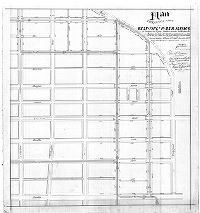
| RC-035-i |
|
Plan of the extension of the double track of the West Philad'a. Passenger Railway Company on Baltimore Avenue from 42nd to 60th St., 27th Ward Philad'a. [ Survey returned June 19, 1890 and approved by Board of Surveyors June 23, 1890] | Jones, William H. | 1890 |
Blueprint
25 x 117 in.
1 inch = 100 feet
|
West Philadelphia Passenger Railway Co.
Street Railway
|
| RC-035-k |

|
Plan of route of West Philadelphia Passenger Railway Co. on 52nd St. from Elm Ave. to Market St. Sheet No. 1 [Approved by Board of Surveyors Feb. 20, 1893] | Johnson, Joseph | 1893 |
Blueprint
12 x 81 in.
1 inch = 100 feet
|
West Philadelphia Passenger Railway Co.
Street Railway
|
| RC-035-k2 |
|
Plan of route of West Philadelphia Passenger Railway Co. on 52nd St. from Elm Ave. to Market St. Sheet No. 2 [Approved by Board of Surveyors Feb. 20, 1893] | Johnson, Joseph | 1893 |
Blueprint
13 x 23 in.
1 inch = 100 feet
|
West Philadelphia Passenger Railway Co.
Street Railway
|
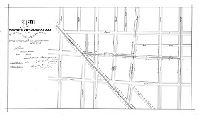
| RC-035-L |

|
Plan showing location of the proposed extension of double tracks of the West Phila. Pass'r R'way Co. on 52nd St. from Market St. to Balto. Av., 27th Ward, Phila. [Approved by Board of Surveyors Feb. 20, 1893] | Jones, William H. | 1893 |
Blueprint
11 x 54 in.
1 inch = 100 feet
|
West Philadelphia Passenger Railway Co.
Street Railway
|