
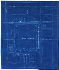
Philadelphia Streets Department Surveys
2755 result(s). Showing results 2101 to 2150.
View page: 1 2 3 4 5 6 7 8 9 10 11 12 13 14 15 16 17 18 19 20 21 22 23 24 25 26 27 28 29 30 31 32 33 34 35 36 37 38 39 40 41 42 43 44 45 46 47 48 49 50 51 52 53 54 55 56 (Show all on one page)
| Identifer | Preview | Title | Surveyor | Date | Media / Size / Scale | Area / Map Features |
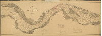
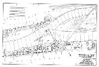
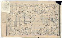
| RC-Q DelRiver2 |
|
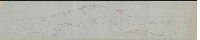
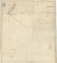
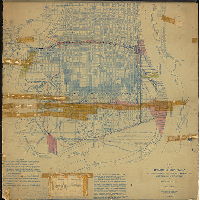
Chart of the Delaware River in front of the City of Philadelphia from Bridesburg to Fort Mifflin [With triangulation stations and ranges added in 1884] | USCGS | 1884 |
Mounted
28 x 82 in.
1:9600, or 1 inch = 800 feet
|
Delaware River
Location of triangulation points used to create accurate surveys; and many other topographic features
|
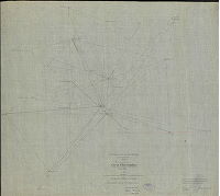
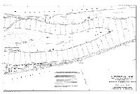
| RC-Q-01 |
|
Triangulation points of the U.S. Coast and Geodetic Survey in Philadelphia and vicinity | Not named | 1885 ca. |
Mounted
60 x 41 in.
1:20000, or 1 inch = 1666 feet
|
Philadelphia and vicinity
Location of triangulation points used to create accurate surveys
|
| RC-Q-03 |
|
Triangulation, City of Philadelphia. U.S. Coast and Geodetic Survey, J. E. Hilgard, Supt. Observations made by C. H. VanOrden, Assistant, C. H. Sinclair, Assistant, under the direction of Spencer McCorkle, Assistant. | McCorkle, Spencer C. | 1885 |
Tracing
31 x 36 in.
1:20000, or 1 inch = 1666 feet
|
Philadelphia and vicinity
Location of triangulation points used to create accurate surveys
|
| RC-Q-04 |
|
Tracing No. 2. U. S. Advisory Commission for Port of Philada. Capt. Geo. B. White U.S.A., chairman. Project for location of monuments for reference to turning Points in the Port Warden Line of 1884. Prepared by H. L. Marindin, Secretary. Washington, D.C., Oct. 27th, 1885 | Marindin, H. L. | 1885 |
Tracing
29 x 37 in.
1 inch = 400 feet
|
Delaware River front
Location of triangulation points used to create accurate surveys; also shows wharves and other riverfront landmarks
|
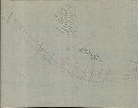
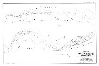
| RC-Q-05 |
|
[Handwritten title on reverse: "Triangulation of the Delaware River from Coast Survey notes - 1883"] | USCGS | 1883 |
Tracing
22 x 111 in.
|
Delaware River, from below Chester to Navy Yard on League Island
Location of triangulation points used to create accurate surveys; also shows shoreline, wharves and other riverfront landmarks
|
| RC-Q-06 |
|
Triangulation, Petty's Island to Poquessink [Poquessing] Creek, Delaware River. Made by request for the City of Philadelphia. U.S. Coast and Geodetic Survey, J. E. Hilgard, Supt. - F. Walley Perkins, Chief of Party, C. H. Van Orden, Assistant. | Perkins, F. Walley; Orden, C. H. | 1884 |
Tracing
21 x 47 in.
1:20000, or 1 inch = 1666 feet
|
Delaware River, Petty's Island to Poquessing Creek
Location of triangulation points used to create accurate surveys
|
| RC-Q-07 |
|
[No title. Triangulation centered on Pier 70 at the foot of Morris Street] | Not named | 1889 |
Mounted
24 x 18 in.
|
South Philadelphia, Pier 70 at Morris St.
Location of triangulation points used to create accurate surveys
|
| RC-Q-09a |
|
[No title. Triangulation. On reverse: "Location of flagstaffs on City Hall"] | Not named | 1884 |
Blueprint
26 x 22 in.
|
Philadelphia, City Hall
Location of triangulation points used to create accurate surveys
|
| RC-Q-09b |
|
[No title. Sketch related to triangulation and City Hall] | Not named | 1884 ca. |
Paper
22 x 28 in.
|
Philadelphia. City Hall
Location of triangulation points used to create accurate surveys
|
| RC-Q-09c |
|
[Handwritten title on reverse: "Triangulations to flag staff on City Hall & League Island"] | Not named | 1884 ca. |
Paper
22 x 25 in.
|
Philadelphia. City Hall
Location of triangulation points used to create accurate surveys
|
| RC-Q-09d |
|
[No title. Triangulation. Cryptic sketch. Note in corner, in pencil: "Stations put in 11-21-84 by M. Evans"] | Not named | 1884 |
Paper
22 x 28 in.
|
Philadelphia
Location of triangulation points used to create accurate surveys
|
| RC-Q-10 |
|
[No title. Triangulation. On reverse: "Kensington Ave., Tulip St., &c., intersecting Broad St."] | Dye, John H. | 1884 |
Paper
28 x 22 in.
1 inch = 1500 feet
|
Philadelphia
Location of triangulation points used to create accurate surveys
|
| RC-Q-11 |
|
[No title. Measurement near 65th and Market Sts., with various triangulation stations noted] | Johnson, Joseph | 1888 |
Paper
23 x 21 in.
|
West Philadelphia, 65th and Market Sts.
Location of triangulation points used to create accurate surveys
|
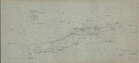
| RC-R Schuylkill 01 |
|
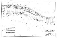
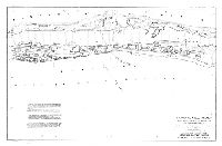
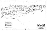
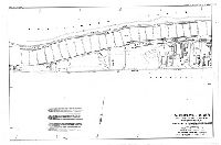
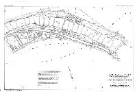
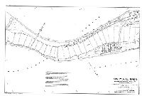
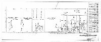
Schuylkill River. Wissahickon Creek, Phila., Pa. to Norristown, Pa. Surveyed by J. W. Thompson, Junior Engineer, Aug. to Dec. 1913. L. D. Shuman, Assistant Engineer. In 18 sheets. [Includes Index map (Sheet 14), descriptions of triangulation stations (Sheets 15, 16 and 17) and Freshet Data (Sheet 18) listing all the major floods affecting this section of the river to 1913.] | Thompson, J. W.; Shuman, L. D. | 1913 |
Blueprint
18 x 27 in.
1 inch = 200 feet
|
Schuylkill River, Wissahickon Creek to Norristown
Topography of shoreline, soundings, footprints of riverfront buildings, railroads, canal, locks, dams, tributary streams, and many other details.
|
| RC-R Schuylkill 02 |
|
Schuylkill River. Wissahickon Creek, Phila., Pa. to Norristown, Pa. Surveyed by J. W. Thompson, Junior Engineer, Aug. to Dec. 1913. L. D. Shuman, Assistant Engineer. In 18 sheets. [Includes Index map (Sheet 14), descriptions of triangulation stations (Sheets 15, 16 and 17) and Freshet Data (Sheet 18) listing all the major floods affecting this section of the river to 1913.] | Thompson, J. W.; Shuman, L. D. | 1913 |
Blueprint
18 x 27 in.
1 inch = 200 feet
|
Schuylkill River, Wissahickon Creek to Norristown
Topography of shoreline, soundings, footprints of riverfront buildings, railroads, canal, locks, dams, tributary streams, and many other details.
|
| RC-R Schuylkill 03 |
|
Schuylkill River. Wissahickon Creek, Phila., Pa. to Norristown, Pa. Surveyed by J. W. Thompson, Junior Engineer, Aug. to Dec. 1913. L. D. Shuman, Assistant Engineer. In 18 sheets. [Includes Index map (Sheet 14), descriptions of triangulation stations (Sheets 15, 16 and 17) and Freshet Data (Sheet 18) listing all the major floods affecting this section of the river to 1913.] | Thompson, J. W.; Shuman, L. D. | 1913 |
Blueprint
18 x 27 in.
1 inch = 200 feet
|
Schuylkill River, Wissahickon Creek to Norristown
Topography of shoreline, soundings, footprints of riverfront buildings, railroads, canal, locks, dams, tributary streams, and many other details.
|
| RC-R Schuylkill 04 |
|
Schuylkill River. Wissahickon Creek, Phila., Pa. to Norristown, Pa. Surveyed by J. W. Thompson, Junior Engineer, Aug. to Dec. 1913. L. D. Shuman, Assistant Engineer. In 18 sheets. [Includes Index map (Sheet 14), descriptions of triangulation stations (Sheets 15, 16 and 17) and Freshet Data (Sheet 18) listing all the major floods affecting this section of the river to 1913.] | Thompson, J. W.; Shuman, L. D. | 1913 |
Blueprint
18 x 27 in.
1 inch = 200 feet
|
Schuylkill River, Wissahickon Creek to Norristown
Topography of shoreline, soundings, footprints of riverfront buildings, railroads, canal, locks, dams, tributary streams, and many other details.
|
| RC-R Schuylkill 05 |
|
Schuylkill River. Wissahickon Creek, Phila., Pa. to Norristown, Pa. Surveyed by J. W. Thompson, Junior Engineer, Aug. to Dec. 1913. L. D. Shuman, Assistant Engineer. In 18 sheets. [Includes Index map (Sheet 14), descriptions of triangulation stations (Sheets 15, 16 and 17) and Freshet Data (Sheet 18) listing all the major floods affecting this section of the river to 1913.] | Thompson, J. W.; Shuman, L. D. | 1913 |
Blueprint
18 x 27 in.
1 inch = 200 feet
|
Schuylkill River, Wissahickon Creek to Norristown
Topography of shoreline, soundings, footprints of riverfront buildings, railroads, canal, locks, dams, tributary streams, and many other details.
|
| RC-R Schuylkill 06 |
|
Schuylkill River. Wissahickon Creek, Phila., Pa. to Norristown, Pa. Surveyed by J. W. Thompson, Junior Engineer, Aug. to Dec. 1913. L. D. Shuman, Assistant Engineer. In 18 sheets. [Includes Index map (Sheet 14), descriptions of triangulation stations (Sheets 15, 16 and 17) and Freshet Data (Sheet 18) listing all the major floods affecting this section of the river to 1913.] | Thompson, J. W.; Shuman, L. D. | 1913 |
Blueprint
18 x 27 in.
1 inch = 200 feet
|
Schuylkill River, Wissahickon Creek to Norristown
Topography of shoreline, soundings, footprints of riverfront buildings, railroads, canal, locks, dams, tributary streams, and many other details.
|
| RC-R Schuylkill 07 |
|
Schuylkill River. Wissahickon Creek, Phila., Pa. to Norristown, Pa. Surveyed by J. W. Thompson, Junior Engineer, Aug. to Dec. 1913. L. D. Shuman, Assistant Engineer. In 18 sheets. [Includes Index map (Sheet 14), descriptions of triangulation stations (Sheets 15, 16 and 17) and Freshet Data (Sheet 18) listing all the major floods affecting this section of the river to 1913.] | Thompson, J. W.; Shuman, L. D. | 1913 |
Blueprint
18 x 27 in.
1 inch = 200 feet
|
Schuylkill River, Wissahickon Creek to Norristown
Topography of shoreline, soundings, footprints of riverfront buildings, railroads, canal, locks, dams, tributary streams, and many other details.
|
| RC-R Schuylkill 08 |
|
Schuylkill River. Wissahickon Creek, Phila., Pa. to Norristown, Pa. Surveyed by J. W. Thompson, Junior Engineer, Aug. to Dec. 1913. L. D. Shuman, Assistant Engineer. In 18 sheets. [Includes Index map (Sheet 14), descriptions of triangulation stations (Sheets 15, 16 and 17) and Freshet Data (Sheet 18) listing all the major floods affecting this section of the river to 1913.] | Thompson, J. W.; Shuman, L. D. | 1913 |
Blueprint
18 x 27 in.
1 inch = 200 feet
|
Schuylkill River, Wissahickon Creek to Norristown
Topography of shoreline, soundings, footprints of riverfront buildings, railroads, canal, locks, dams, tributary streams, and many other details.
|
| RC-R Schuylkill 09 |
|
Schuylkill River. Wissahickon Creek, Phila., Pa. to Norristown, Pa. Surveyed by J. W. Thompson, Junior Engineer, Aug. to Dec. 1913. L. D. Shuman, Assistant Engineer. In 18 sheets. [Includes Index map (Sheet 14), descriptions of triangulation stations (Sheets 15, 16 and 17) and Freshet Data (Sheet 18) listing all the major floods affecting this section of the river to 1913.] | Thompson, J. W.; Shuman, L. D. | 1913 |
Blueprint
18 x 27 in.
1 inch = 200 feet
|
Schuylkill River, Wissahickon Creek to Norristown
Topography of shoreline, soundings, footprints of riverfront buildings, railroads, canal, locks, dams, tributary streams, and many other details.
|
| RC-R Schuylkill 10 |
|
Schuylkill River. Wissahickon Creek, Phila., Pa. to Norristown, Pa. Surveyed by J. W. Thompson, Junior Engineer, Aug. to Dec. 1913. L. D. Shuman, Assistant Engineer. In 18 sheets. [Includes Index map (Sheet 14), descriptions of triangulation stations (Sheets 15, 16 and 17) and Freshet Data (Sheet 18) listing all the major floods affecting this section of the river to 1913.] | Thompson, J. W.; Shuman, L. D. | 1913 |
Blueprint
18 x 27 in.
1 inch = 200 feet
|
Schuylkill River, Wissahickon Creek to Norristown
Topography of shoreline, soundings, footprints of riverfront buildings, railroads, canal, locks, dams, tributary streams, and many other details.
|
| RC-R Schuylkill 11 |
|
Schuylkill River. Wissahickon Creek, Phila., Pa. to Norristown, Pa. Surveyed by J. W. Thompson, Junior Engineer, Aug. to Dec. 1913. L. D. Shuman, Assistant Engineer. In 18 sheets. [Includes Index map (Sheet 14), descriptions of triangulation stations (Sheets 15, 16 and 17) and Freshet Data (Sheet 18) listing all the major floods affecting this section of the river to 1913.] | Thompson, J. W.; Shuman, L. D. | 1913 |
Blueprint
18 x 27 in.
1 inch = 200 feet
|
Schuylkill River, Wissahickon Creek to Norristown
Topography of shoreline, soundings, footprints of riverfront buildings, railroads, canal, locks, dams, tributary streams, and many other details.
|
| RC-R Schuylkill 12 |
|
Schuylkill River. Wissahickon Creek, Phila., Pa. to Norristown, Pa. Surveyed by J. W. Thompson, Junior Engineer, Aug. to Dec. 1913. L. D. Shuman, Assistant Engineer. In 18 sheets. [Includes Index map (Sheet 14), descriptions of triangulation stations (Sheets 15, 16 and 17) and Freshet Data (Sheet 18) listing all the major floods affecting this section of the river to 1913.] | Thompson, J. W.; Shuman, L. D. | 1913 |
Blueprint
18 x 27 in.
1 inch = 200 feet
|
Schuylkill River, Wissahickon Creek to Norristown
Topography of shoreline, soundings, footprints of riverfront buildings, railroads, canal, locks, dams, tributary streams, and many other details.
|
| RC-R Schuylkill 13 |
|
Schuylkill River. Wissahickon Creek, Phila., Pa. to Norristown, Pa. Surveyed by J. W. Thompson, Junior Engineer, Aug. to Dec. 1913. L. D. Shuman, Assistant Engineer. In 18 sheets. [Includes Index map (Sheet 14), descriptions of triangulation stations (Sheets 15, 16 and 17) and Freshet Data (Sheet 18) listing all the major floods affecting this section of the river to 1913.] | Thompson, J. W.; Shuman, L. D. | 1913 |
Blueprint
18 x 27 in.
1 inch = 200 feet
|
Schuylkill River, Wissahickon Creek to Norristown
Topography of shoreline, soundings, footprints of riverfront buildings, railroads, canal, locks, dams, tributary streams, and many other details.
|
| RC-R Schuylkill 14 |
|
Schuylkill River. Wissahickon Creek, Phila., Pa. to Norristown, Pa. Surveyed by J. W. Thompson, Junior Engineer, Aug. to Dec. 1913. L. D. Shuman, Assistant Engineer. In 18 sheets. [Includes Index map (Sheet 14), descriptions of triangulation stations (Sheets 15, 16 and 17) and Freshet Data (Sheet 18) listing all the major floods affecting this section of the river to 1913.] | Thompson, J. W.; Shuman, L. D. | 1913 |
Blueprint
18 x 27 in.
1 inch = 200 feet
|
Schuylkill River, Wissahickon Creek to Norristown
Topography of shoreline, soundings, footprints of riverfront buildings, railroads, canal, locks, dams, tributary streams, and many other details.
|
| RC-R Schuylkill 15 |
|
Schuylkill River. Wissahickon Creek, Phila., Pa. to Norristown, Pa. Surveyed by J. W. Thompson, Junior Engineer, Aug. to Dec. 1913. L. D. Shuman, Assistant Engineer. In 18 sheets. [Includes Index map (Sheet 14), descriptions of triangulation stations (Sheets 15, 16 and 17) and Freshet Data (Sheet 18) listing all the major floods affecting this section of the river to 1913.] | Thompson, J. W.; Shuman, L. D. | 1913 |
Blueprint
18 x 27 in.
1 inch = 200 feet
|
Schuylkill River, Wissahickon Creek to Norristown
Topography of shoreline, soundings, footprints of riverfront buildings, railroads, canal, locks, dams, tributary streams, and many other details.
|
| RC-R Schuylkill 16 |
|
Schuylkill River. Wissahickon Creek, Phila., Pa. to Norristown, Pa. Surveyed by J. W. Thompson, Junior Engineer, Aug. to Dec. 1913. L. D. Shuman, Assistant Engineer. In 18 sheets. [Includes Index map (Sheet 14), descriptions of triangulation stations (Sheets 15, 16 and 17) and Freshet Data (Sheet 18) listing all the major floods affecting this section of the river to 1913.] | Thompson, J. W.; Shuman, L. D. | 1913 |
Blueprint
18 x 27 in.
1 inch = 200 feet
|
Schuylkill River, Wissahickon Creek to Norristown
Topography of shoreline, soundings, footprints of riverfront buildings, railroads, canal, locks, dams, tributary streams, and many other details.
|
| RC-R Schuylkill 17 |
|
Schuylkill River. Wissahickon Creek, Phila., Pa. to Norristown, Pa. Surveyed by J. W. Thompson, Junior Engineer, Aug. to Dec. 1913. L. D. Shuman, Assistant Engineer. In 18 sheets. [Includes Index map (Sheet 14), descriptions of triangulation stations (Sheets 15, 16 and 17) and Freshet Data (Sheet 18) listing all the major floods affecting this section of the river to 1913.] | Thompson, J. W.; Shuman, L. D. | 1913 |
Blueprint
18 x 27 in.
1 inch = 200 feet
|
Schuylkill River, Wissahickon Creek to Norristown
Topography of shoreline, soundings, footprints of riverfront buildings, railroads, canal, locks, dams, tributary streams, and many other details.
|
| RC-R Schuylkill 18 |
|
Schuylkill River. Wissahickon Creek, Phila., Pa. to Norristown, Pa. Surveyed by J. W. Thompson, Junior Engineer, Aug. to Dec. 1913. L. D. Shuman, Assistant Engineer. In 18 sheets. [Includes Index map (Sheet 14), descriptions of triangulation stations (Sheets 15, 16 and 17) and Freshet Data (Sheet 18) listing all the major floods affecting this section of the river to 1913.] | Thompson, J. W.; Shuman, L. D. | 1913 |
Blueprint
18 x 27 in.
1 inch = 200 feet
|
Schuylkill River, Wissahickon Creek to Norristown
Topography of shoreline, soundings, footprints of riverfront buildings, railroads, canal, locks, dams, tributary streams, and many other details.
|
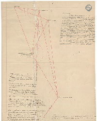
| RC-UU-01 |
|
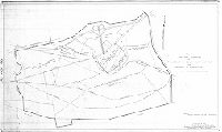
Plan of property belonging to the estate of Stephen Girard in the 26th & 36th Wards of the City of Philadelphia. July 1, 1908, revised to July 1, 1913. | Not named | 1913 |
Tracing
24 x 30 in.
|
South Philadelphia, Girard Estate.
Girard Estate property shown as shaded areas on larger map, which also shows riverfront marshland, railroads and other features
|
| RC-UU-02 |
|
Plan for the abolishment of grade crossings, the change, relocation and elevation of railroad lines and the revision of the city plan in South Philadelphia. Department of Public Works, Bureau of Surveys, Grade Crossing Division. Nov. 1922. Feb. 1925. [] | Not named | 1925 |
Blueprint, Mounted
31 x 31 in.
|
South Philadelphia, revision of city plan.
Railroads, wharves, Navy Yard, parks. Shows many diagonal streets that were never built. Pencil annotations indicate legal status of some parcels, and a typed list of ordinances and their dates of execution, up to 1941, is affixed.
|
| RC-U-z |
|
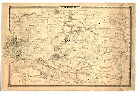
Plan of the roads [in] Blockley Township north of the West Chester Road and West Philadelphia. Surveyed 1852 by John Levering. | Levering, John | 1852 |
Mounted
41 x 73 in.
|
West Philadelphia, Blockley Township, north of Market St.
Streams, roads
|
| RC-V-01 |
|
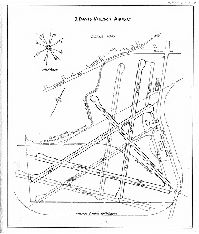
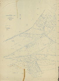
S. Davis Wilson Airport | Not named | 1935 ca. |
Paper
17 x 14 in.
1 inch = 500 feet
|
Southwest Philadelphia. Airport
Runways and building footprints, Church Creek, wind rose, "existing Chester Branch [railroad] line to be removed"
|
| RC-V-02 |
|
Map of Philadelphia Airport and vicinity | Not named | 1936 |
Paper
29 x 23 in.
|
Southwest Philadelphia. Airport
Runways and building footprints, wind rose, Philadelphia, Baltimore and Washington (60th St. Branch) Railroad, wharves, Southwest Sewage Treatment Works, Delaware County line, "line of former Hog Island shipways"
|
| RC-V-03 |
|
Plan of a portion of Philadelphia Southwest Airport, Delaware County, Pennsylvania | Damon & Foster | 1947 |
Paper
20 x 48 in.
1 inch = 50 feet
|
Southwest Philadelphia. Airport
Property lines, owners, acreage, and "cubic contents of buildings", building footprints with type of construction and use. "Views also noted with arrows and numbered, indicating that this may have been the key to photographs of these properties.
|
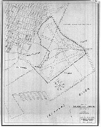
| RC-V-04 |
|
Plan showing boundary of Philadelphia Southwest Airport and methods of acquisition. Total area - 2,341.16 +- acres. | Not named | 1946 |
Paper
24 x 40 in.
|
Southwest Philadelphia. Airport
Property lines and acreage, with method and date of acquisition
|
| RC-V-05 |
|
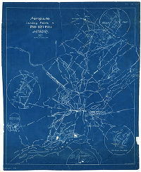
Aeroplane landing fields in Philadelphia and vicinity. | Not named | 1927 |
Blueprint
29 x 24 in.
|
Philadelphia and vicinity.
Airports in Philadelphia and New Jersey and Pennsylvania suburbs
|
| RC-V-06 |
|
Topographical Plan (Preliminary) of a portion of Philadelphia Southwest Airport in Philadelphia & Delaware Counties, Pennsylvania. Damon & Foster, Civil Engineers, Sharon Hill, Pa. November 6, 1947 | Damon & Foster | 1947 |
Blueprint
53 x 70 in.
|
Southwest Philadelphia and adjacent parts of Delaware County
Topography. Contour lines and spot elevations, areas of hydraulic fill, the meadow bank, and how the low water lines have changed over the years.
|
| RC-VV-y |
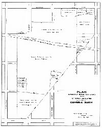
|
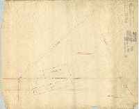
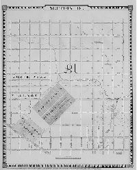
Plan of ground in the 28th Ward of the City of Philadelphia taken for the Cambria Basin | Hibberd, Josiah | 1883 |
Tracing
26 x 21 in.
|
28th Ward. Bounded by Clearfield St. to Lehigh Ave., 27th St. to 31st St.
Property lines, owners and acreage, including Deborah F. Wharton; Lamb Tavern Road
|
| RC-VV-z |
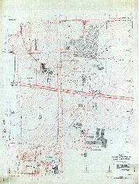
|
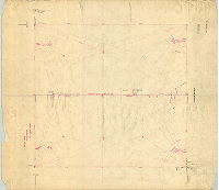
Plan showing topography, test bores, etc. at site of Cambria Reservoir, Twenty-eighth Ward. Survey commenced June 25, 1883. Survey finished July 26, 1883. | Darrach, Charles H. | 1883 |
Tracing
53 x 43 in.
1 inch = 60 feet
|
28th Ward. Bounded by 26th to 31st Sts., Lehigh to Allegheny Aves.
Topography, test bores, building footprints and uses, fences, property lines, streams, springs, ponds, vegetation, "offal and manure pit", "C. Henry Ott, delineator"
|
| RC-WW-01 |
|
[Photostat copy of "Map of farms and lots embraced within the limits of Fairmount Park as appropriated for public use by Act of Assembly, approved the 14th day of April, A.D. 1868," lacking title block and inset, but annotated with prices paid for each Park parcel.] | Smedley, Samuel L. | 1870 ca. |
Paper
22 x 30 in.
|
Fairmount Park
Fairmount Park, annotated with prices paid for properties
|
| RC-WW-02 |
|
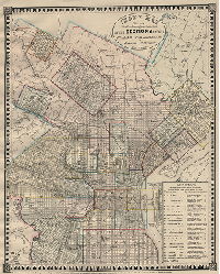
Map of Philadelphia and Camden … Mack Publishing Co. Copyright 1929 by Geo. R. Mackenzie. [Old roads in Philadelphia overdrawn in red, with date of opening, date vacated, width, and road docket numbers in black ink] | Not named | 1929 |
Mounted
56 x 45 in.
|
Philadelphia and vicinity
Old roads and information related to them
|
| RC-WW-04 |
|
[No title. Map with handwritten annotations showing vacated roads in vicinity of Nicetown section of Philadelphia] | Not named | 1932 ca. |
Blueprint
27 x 42 in.
|
Bounded roughly by Ruscomb St., Frankford Ave., Allegheny Ave. and Broad St.
Vacated roads delineated, including Old Front St. Road, Nicetown Lane and Powder Mill Lane. Attachment: Act of Assembly, April 4, 1865, relating to Nicetown Lane and Juniata Avenue.
|
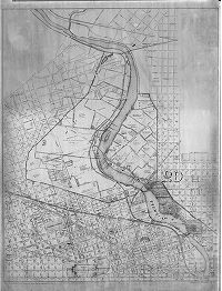
| RC-X-01 |
|
Index Map showing the numbering and location of the sections in the Atlas of Philadelphia by Samuel L. Smedley, City Surveyor, 35th St. and Lancaster Ave. | Bonsall, Joseph H.; Smedley, Samuel L. | 1860 |
Paper
20 x 16 in.
|
Philadelphia
Many creeks and other city institutions. The complete atlas is available elsewhere on this Web site.
|
| RC-X-02 |
|
Section 18, from "A complete Atlas of the City of Philadelphia, Joseph H. Bonsall and Samuel L. Smedley, Surveyors & Draftsmen, 1860" | Bonsall, Joseph H.; Smedley, Samuel L. | 1860 |
Paper
22 x 18 in.
|
Bounded by Somerset St. to Montgomery St., 17th to 28th Sts.
Cohocksink Creek, North Penn Village, Odd Fellows Cemetery, Glenwood Cemetery
|
| RC-X-03 |
|
Section 25, from "A complete Atlas of the City of Philadelphia, Joseph H. Bonsall and Samuel L. Smedley, Surveyors & Draftsmen, 1860" | Bonsall, Joseph H.; Smedley, Samuel L. | 1860 |
Mounted
|
Northeast Philadelphia (23rd Ward), from Frankford to Poquessing Creek, and including adjacent sections of Bucks County and New Jersey
Creeks, marshland, city institutions, villages. A street grid for a large portion of this then-rural area is overlaid in pencil. This may have been Samuel L. Smedley's working copy. Handwritten on reverse: "S. L. S.. 23rd Ward"
|
| RC-Z-01 |
|
Sketch showing proposed location of conduits on Mt. Vernon St. near Power House. Phila., Pa. Sept. 30th, 1893. Phila. Traction Company, Electrical Department. F. W. Darlington, Chief Engr. No. 1201. | Darlington, F. W. | 1893 |
Blueprint
15 x 36 in.
|
Mt. Vernon St., from 12th to 13th Sts.
Plan for running sixty-six underground conduits to power the Philadelphia Traction Company's streetcars.
|
| RC-Z-02 |
|
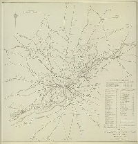
Map of Philadelphia Municipal Airport and vicinity. Air Obstructions. May 24, 1940. | Not named | 1940 |
Paper
41 x 42 in.
|
Philadelphia and surrounding areas in New Jersey and Pennsylvania
Airports and landing fields, list and location of "air obstructions," which include tall buildings, radio transmission towers, cranes, water towers, electric towers, smokestacks, and others.
|