
Philadelphia Streets Department Surveys
2755 result(s). Showing results 201 to 250.
View page: 1 2 3 4 5 6 7 8 9 10 11 12 13 14 15 16 17 18 19 20 21 22 23 24 25 26 27 28 29 30 31 32 33 34 35 36 37 38 39 40 41 42 43 44 45 46 47 48 49 50 51 52 53 54 55 56 (Show all on one page)
| Identifer | Preview | Title | Surveyor | Date | Media / Size / Scale | Area / Map Features |
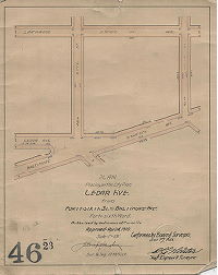
| 046-23 MTD |
|
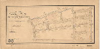
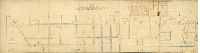
Plan for placing on the City Plan Cedar Ave. from Forty-sixth St. to Baltimore Ave. Forty-sixth Ward. | Gillingham, J. Harvey | 1910 |
Mounted
14 x 12 in.
1 inch = 100 feet
|
West Philadelphia
Curb elevations
|
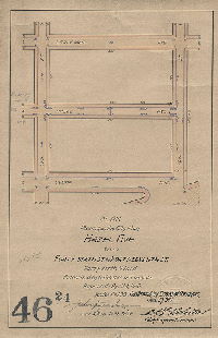
| 046-24 MTD |
|
Plan for placing on the City Plan Hazel Ave. from Forty-sixth St. to Forty-seventh St. Forty Sixth Ward. | Gillingham, J. Harvey | 1910 |
Mounted
14 x 9 in.
1 inch = 100 feet
|
West Philadelphia
Curb elevations
|
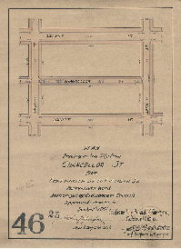
| 046-25 MTD |
|
Plan for placing on the City Plan Chancellor St. from Forty-ninth St. to Fiftieth St. Forty-sixth Ward. | Gillingham, J. Harvey | 1910 |
Mounted
13 x 10 in.
1 inch = 100 feet
|
West Philadelphia
Curb elevations
|
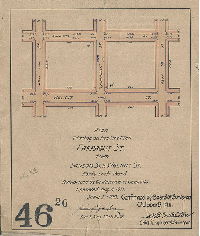
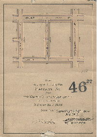
| 046-26 MTD |
|
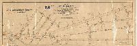
Plan for placing on the City Plan Farragut St. from Sansom St. to Walnut St. Forty-sixth Ward. | Gillingham, J. Harvey | 1911 |
Mounted
11 x 9 in.
1 inch = 100 feet
|
West Philadelphia
Curb elevations
|
| 046-27 MTD |
|
Plan for placing on City Plan Hanson St. from Walnut St. to Locust St. Forty-sixth Ward. | Gillingham, J. Harvey | 1912 |
Mounted
14 x 10 in.
1 inch = 100 feet
|
West Philadelphia
Curb elevations
|
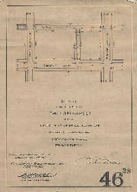
| 046-28 MTD |
|
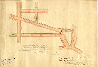
Plan for placing Fallon Street from Chestnut St. to Ludlow St on City Plan No. 46. Forty-sixth Ward, Philadelphia. | Gillingham, J. Harvey | 1913 |
Mounted
14 x 10 in.
1 inch = 100 feet
|
West Philadelphia
Curb elevations
|
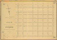
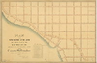
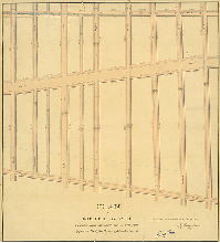
| 047-01 MTD |
|
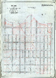
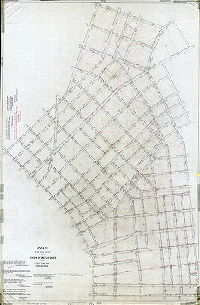
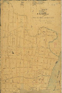
Plan of the Third Section of a survey of the District of West Philadelphia and Township of Blockley, made in pursuance of an Act of Assembly of the Commonwealth of Pennsylvania, approved April 3rd 1851. | Lightfoot, Francis | 1854 |
Mounted
37 x 54 in.
1 inch = 133 feet
|
West Philadelphia and Blockley, Third Section. Bounded by 57th St. to Delaware County line, Market St. to South [Cedar] St.
Building footprints (roofs), old roads; James M Price, draftsman; Cobb's Creek
|
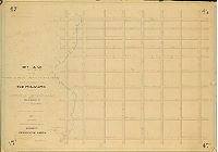
| 047-02 MTD |
|
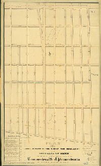
Plan of the Third Section of a survey and regulation of the District of West Philadelphia and Township of Blockley, made in pursuance of an Act of Assembly of the Commonwealth of Pennsylvania, approved April 3rd 1851, with curb heights fixed thereon by order of the Department of Surveys. [Survey returned 1854; curb regulations determined 1857; confirmed by Court 1871] | Lightfoot, Francis; Miller, James; Fox, Joseph | 1857 |
Mounted
37 x 53 in.
|
West Philadelphia and Blockley, Third Section. Bounded by 57th St. to 64th St., Market St. to Cedar St.
Cobb's Creek, sewers, curb elevations, old roads, streets on Delaware County side of creek added in pencil, ca. 1882
|
| 047-04b MTD tracing |
|
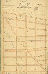
Plan of the revision of lines and grades on Plan No. 47. in the 27th Ward, Phila. Pa. [Ordinance April 7, 1893; survey returned and confirmed April 5, 1897] | Gillingham, J. Harvey | 1897 |
Tracing
58 x 42 in.
|
West Philadelphia. Bounded by South St. (now Cedar St.), 57th St., Market St. and Cobb's Creek
Topography, building footprints, clay pits and brickyards. Tracing made in 1912.
|
| 048-01 HP |
|
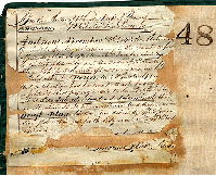
Plan of the First Division of the survey and regulation of the District of Penn agreeably to an Act of the General Assembly of the Commonwealth of Pennsylvania passed the nineteenth day of April anno Domini 1843. Surveyed and returned Oct. 7th 1843, by Joseph Fox, Henry Haines. [Attachment: Authorizing the recording of the plan] | Fox, Joseph; Haines, Henry | 1843 |
Mounted
50 x 30 in.
1 inch = 80 feet
|
Penn District, 1st Division. Bounded by Columbia Ave. to Poplar St., 6th to 11th Sts.
Railroad, sewers
|
| 048-01 HP attachment |
|
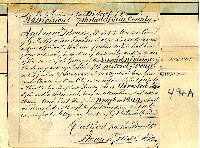
[Court confirmation, attached to reverse side of plan 048-01_HP] | 1843 |
Paper
|
Penn District, 1st Division. Bounded by Columbia Ave. to Poplar St., 6th to 11th Sts.
Attachment
|
|
| 049-01 HP |
|
Plan of the Second Division of the survey and regulation of the District of Penn, agreeably to an Act of the General Assembly of the Commonwealth of Pennsylvania passed the nineteenth day of April anno Domini 1843. Surveyed and returned Decr. 5th 1843, by Joseph Fox, Henry Haines. [Attachment: 1844 attachment directing recording of the plan] | Fox, Joseph; Haines, Henry | 1843 |
Mounted
49.5 x 30 in.
1 inch = 80 feet
|
Penn District, 2nd Division. Bounded by Columbia Ave. to Poplar St., 11th to 15th Sts.
Sewers
|
| 049-01 HP attachment |
|
[Court confirmation of plan 049-1_HP] | 1844 |
Paper
|
Penn District, 2nd Division. Columbia to Poplar, 11th to 15th
Attachment
|
|
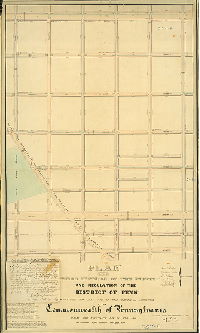
| 050-01 HP |
|
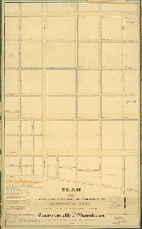
Plan of the Third Division of the survey and regulation of the District of Penn agreeably to an Act of the General Assembly of the Commonwealth of Pennsylvania passed the nineteenth day of April A.D. One thousand eight hundred and forty three. Surveyed and returned Decr. 19th 1843, by Joseph Fox, Henry Haines. | Fox, Joseph; Haines, Henry | 1843 |
Mounted
50 x 30 in.
1 inch = 80 feet
|
Penn District, 3rd Division. Poplar to Columbia, 15th to 20th
Curb elevations, drainage divides, Girard College property
|
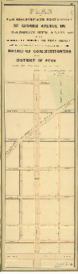
| 050-02 HP |
|
Plan of the resurvey and regulation of Girard Avenue in conformity with a late Act of the Legislature reducing the width thereof and in accordance with a resolution of the Board of Commissioners of the District of Penn, passed the twentieth day of May A.D. 1844. Surveyed and returned June 17th 1844 by Joseph Fox, Henry Haines | Fox, Joseph; Haines, Henry | 1844 |
Mounted
48 x 14 in.
1 inch = 80 feet
|
Penn District. Girard Ave., 20th St. to Broad St.
Girard College, sewers
|
| 051-01 HP |
|
Plan of the Fourth Division of the survey and regulation of the District of Penn, agreeably to an Act of the General Assembly of the Commonwealth of Pennsylvania passed the nineteenth day of April anno Domini 1843. Surveyed and returned Feby 17th, 1845, by Joseph Fox, Henry Haines | Fox, Joseph; Haines, Henry | 1843 |
Mounted
50 x 29 in.
1 inch = 80 feet
|
Penn District, 4th Division. Columbia Ave. to Susquehanna Ave., 6th to 11th Sts.
Philadelphia, Germantown and Norristown Railroad, sewers, curb elevations
|
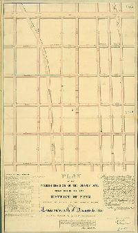
| 052-01 HP |
|
Plan of the Sixth Division of the survey and regulation of the District of Penn, agreeably to an Act of the General Assembly of the Commonwealth of Pennsylvania passed the twenty-seventh day of February A.D. 1847 MDCCCXLVII. Surveyed and returned 12th Mo. 1848 by Henry Haines | Haines, Henry | 1848 |
Mounted
33 x 51 in.
1 inch = 120 feet
|
Penn District, 6th section. Bounded by Columbia Ave. to Poplar St., 29th St. to Schuylkill River (Columbia Bridge)
Spring north of Girard Avenue added in pencil, sewers, curb elevations
|
| 052-02 HP |
|
Plan of the Third Division of the survey and regulation of the District of Penn, agreeably to an Act of the General Assembly of the Commonwealth of Pennsylvania passed the nineteenth day of April A.D. 1843. Surveyed and returned May 17th 1847 by Henry Haines | Haines, Henry | 1847 |
Mounted
49 x 37 in.
1 inch = 120 feet
|
Penn District, 5th division. Bounded by Poplar St. to Columbia Ave., 20th to 29th Sts.
Girard College property; sewers, curb elevations
|
| 053-01 HP |
|
Plan of the re-survey and regulation of parts of the First, Second and Fourth Divisions of the District of Penn, agreeably to an Act of the General Assembly of the Commonwealth of Pennsylvania passed the fifteenth day of April A.D. 1846. Surveyed and returned June 15th 1846 by Joseph Fox, Henry Haines. [Attachment] | Fox, Joseph; Haines, Henry | 1846 |
Mounted
51 x 36 in.
1 inch = 120 feet
|
Penn District. Bounded by Poplar St. to Montgomery Ave., 6th to Broad Sts.
Sewers, curb elevations
|
| 053-01 HP attachment |
|
[Approval of plan 053-01_HP by Penn District commissioners, Oct. 29, 1826; date should be 1846; on reverse a note says the plan was filed Nov. 21, 1846] | Not named | 1846 |
Penn District. Bounded by Poplar St. to Montgomery Ave., 6th to Broad Sts.
Attachment
|
|
| 053-02 HP |
|
Plan of Girard Avenue as changed by Act of Assembly approved the fifteenth day of March A.D. 1847. Surveyed and returned 2nd Mo. 21st 1848 by Henry Haines | Haines, Henry | 1848 |
Mounted
27 x 25 in.
1 inch = 80 feet
|
Girard Ave. Bounded by Poplar St. to Thompson St., 6th to 10th Sts.
Sewers, curb elevations
|
| 054-01 HP |
|
Plan of the Eastern Part of the District of the Northern Liberties in the County of Philadelphia. Being the revision of so much of a certain plan filed in the office of the Clerk of the Court of Quarter Sessions of the County of Philadelphia on the twenty-second day of October anno Domini 1850 as lies north of Willow Street in the said District. Made by order of the Board of Commissioners in pursuance of an Act of the General Assembly of the Commonwealth of Pennsylvania approved the 24th day of February anno domino 1852, by Joseph H. Siddall, Recording Surveyor, October 23rd, 1852. | Siddall, Joseph H. | 1852 |
Mounted
40 x 22 in.
1 inch = 80 feet
|
Northern Liberties District, Eastern Part. Bounded by Vine to Brown Sts., Front St. to Delaware River
Wharf line
|
| 054-01 HP attachment |
|
[Resolutions of Board of Commissioners of District of Northern Liberties, approving plan 054-1_HP, July 1, 1852 and Aug. 3, 1852] | Not named | 1852 |
Paper
|
Northern Liberties District, Eastern Part. Bounded by Vine to Brown Sts., Front St. to Delaware River
Attachment
|
| 054-02 HP |
|
Plan of Delaware Avenue from Vine St. to Cohocksink Creek in the District of the Northern Liberties. By Joseph H. Siddall, September 27, 1850. Filed October 22nd, 1850 [Marked in pencil, "superseded," probably by plan 054-1_HP] | Siddall, Joseph H. | 1850 |
Mounted
44 x 20 in.
1 inch = 80 feet
|
Northern Liberties. Delaware Ave. from Vine St. to Cohocksink Creek
Pennypot landing, Cohocksink Canal, wharves, wharf line
|
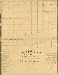
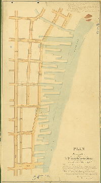
| 055-06 MTD |

|
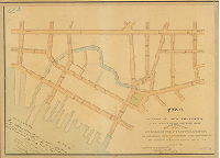
Plan of the First Section of the revision of lines and grades of the Twenty-third Ward Philadelphia. Ordinances June 5, 1877 and April 7, 1890; various confirmations from 1890 to 1898] | Not named | 1890 |
Mounted
48 x 76 in.
|
23rd Ward, 1st Section. Bounded by Frankford Creek, Tacony St. and Bridge St.
Topography. Streams, ponds, actual and proposed Frankford Creek channels, building footprints, Little Tacony Creek, Aramingo Canal
|
| 055-56 CP |
|
Plan striking from City Plans Nos. 55 and 306 Frankford Creek from Bridge Street to the northeast line of the new channel of Frankford Creek, located southwest of Adams Avenue and extending southwestwardly from Aramingo Avenue to the Delaware River; the placing upon the city plan, in lieu thereof, of certain drainage rights-of-way along the lines of existing sewers, and the revision of the lines and grades of intersecting and adjacent streets and the lines of certain existing drainage rights-of-way affected by said striking. 23rd & 45th Wards, Philadelphia. [Ordinance April 4, 1961; confirmed June 19, 1961] | Kramer, Raymond M. | 1961 |
Tracing
27 x 68 in.
|
Frankford Creek, former course "stricken from the City Plan," from new channel of the creek to Bridge St.
Frankford Creek, old channel
|
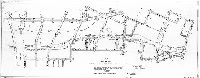
| 056 MTD |
|
Topographical plan showing one foot contours of a portion of City Plans Nos. 56 and 222, Twenty-third and Thirty-fifth Wards, Phila. | Witmer, N. J. | 1900 |
Mounted
31 x 26 in.
1 inch = 40 feet
|
Frankford Creek and vicinity. Bounded roughly by Adams Ave., Torresdale Ave., Juniata Ave. and Kensington Ave.
Topography around Frankford Creek, showing old channel and new proposed channel; color coded building footprints, mill races,
|
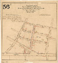
| 056-07 FLAT |
|
Plan for revising the lines and grades of the streets between Ruan and Adams St and between Penn St. and Kensington and Frankford Aves., Twenty-third Ward, Philadelphia [Ordinance March 12, 1889; confirmed Feb. 17, 1890 and Nov. 2, 1891] | Webster, George S. | 1889 |
Mounted
16 x 15 in.
1 inch = 100 feet
|
Bounded by Penn St., Ruan St., Frankford Ave. and Adams St.
Topography, building footprints
|
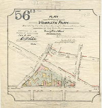
| 056-13 FLAT |
|
Plan for placing Womrath Park … on the City Plan, Twenty-third Ward, Philadelphia [Ordinances March 10 and June 22, 1892; confirmed Nov. 21, 1892] | Webster, John H., Jr. | 1892 |
Paper
12 x 13 in.
1 inch = 100 feet
|
Frankford. Womrath Park. Bounded by Frankford Ave., Kensington Ave., and Adams Ave.
Footprints of the many buildings that once stood within the park boundaries
|
| 056-27 MTD |
|
Plan for placing Trenton Avenue on the City Plan between Church and Margaret Sts., Twenty-third Ward, Philadelphia [Ordinance June 15, 1896; survey returned July 27, 1896; confirmed July 27, 1896] | Webster, John H., Jr. | 1896 |
Mounted
17 x 34 in.
1 inch = 100 feet
|
Frankford. Bounded roughly by Torresdale Ave., Margaret St., Tacony St. and Church St.
Stream (Little Tacony Creek), building footprints, railroad
|
| 056-30 MTD |
|
Part of City Plan No. 56, revising the lines and grades of Torresdale Avenue from Frankford Avenue to Womrath Street and striking from the City Plan Trenton Avenue from Church Street to Orthodox Street, Twenty-third Ward, Philadelphia [Ordinance April 5, 1902; confirmed Jan. 19, 1903] | Webster, John H., Jr. | 1903 |
Mounted
19 x 48 in.
1 inch = 100 feet
|
Frankford. Torresdale Ave. and vicinity, from Gillingham St. to Frankford Ave.
Frankford Creek, railroad
|
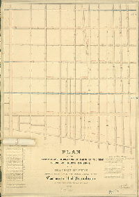
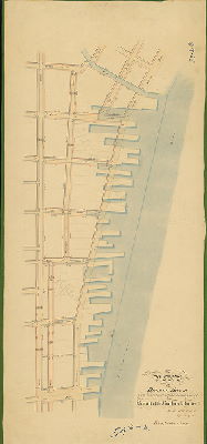
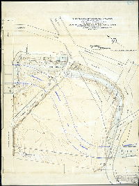
| 057 CP |
|
Plan of the Third Section of the revision of lines and grades of the Twenty-third Ward Philadelphia [Ordinance June 5, 1877; confirmed various dates 1888 to 1895] | Not named | 1888 |
Tracing
78 x 52 in.
1 inch = 100 feet
|
23rd Ward, 3rd Section. Bounded by Tacony St., Bridge St., Bustleton Ave., Somerville Ave., Leiper St., and Orthodox St.
Topography, Little Tacony Creek and tributary streams, mill races, building footprints
|
| 060-01 HP |
|
Plan of the Fourth Division of the survey and regulation of the district of Spring Garden agreeably to an Act of the General Assembly of the Commonwealth of Pennsylvania, passed the twenty-second day of March, anno Domini One thousand eight hundred and thirteen. Surveyed and returned Dec. 11th, 1820 By Joseph H. Siddall. [Attachment: authorization for the plan] | Siddall, Joseph H. | 1820 |
Mounted
50 x 32 in.
1 inch = c. 67 feet
|
Spring Garden District, 4th Division. Bounded by Callowhill St. to Fairmount Ave., 10th to Broad Sts.
Source of Pegg's Run, buildings in street lines, benchmark buildings, property ownership
|
| 060-01 HP attachment |
|
[Court confirmation of plan 060-01_HP] | 1821 |
Paper
|
Spring Garden District, 4th Division. Bounded by Callowhill St. to Fairmount Ave., 10th to Broad Sts.
Attachment
|
|
| 060-02 HP |
|
Plan of the First Division of the survey and regulation of the District of Spring Garden agreeably to an Act of the General Assembly of the Commonwealth of Pennsylvania passed the twenty-second day of March, anno Domini 1813. Surveyed and returned September 7, 1818 pr. Robt. Brooke, Joseph H. Siddall | Brooke, Robert; Siddall, Joseph H. | 1818 |
Mounted
51 x 30 in.
1 inch = c. 67 feet
|
Spring Garden District, 1st Division. Bounded by Vine St. to Callowhill St., 10th St. to Broad St.
Bush Hill Estate, Common Sewer [Pegg's Run], sewers and inlets, benchmark buildings, curb elevations
|
| 061-01 HP |
|
Plan of the Third Division of the survey and regulation of the district of Spring Garden, agreeably to an Act of the General Assembly of the Commonwealth of Pennsylvania passed the twenty-second day of March anno Domini One thousand eight hundred and thirteen. Surveyed and Returned February 14th 1820 by Joseph H. Siddall. [Attachment: Court confirmation] | Siddall, Joseph H. | 1820 |
Mounted
27 x 40 in.
1 inch = c. 70 feet
|
Spring Garden District, 3rd Division. Bounded by 6th to 10th Sts., Buttonwood to Coates Sts.
Benchmark buildings, curb elevations, property lines and ownership, sewers
|
| 061-01 HP attachment |
|
[Court confirmation of plan 061-01_HP] | 1822 |
Paper
|
Spring Garden District, 3rd Division. Bounded by 6th to 10th Sts., Buttonwood to Coates Sts.
Attachment
|
|
| 062-01 HP |
|
Plan the Thirteenth Division of the survey and regulation of the District of Spring Garden, agreeably to an Act of the General Assembly of the Commonwealth of Pennsylvania passed the 22nd day of March anno Domini 1813 and a supplement thereto passed the 2nd day of March A.D. 1827. Surveyed and returned October 10th, 1835 by Joseph Fox, Philip M. Price. | Fox, Joseph; Price, Philip M. | 1835 |
Mounted
29 x 43 in.
1 inch = 80 feet
|
Spring Garden District, 13th Division. Bounded by Landing Ave. to Schuylkill River, Pratt to Poplar Sts.
Public Landing, Henry Pratt property [Lemon Hill], new streets into wharf line, sewers and inlets, curb elevations, property owners
|
| 062-02 HP |

|
Plan the Thirteenth Division of the survey and regulation of the District of Spring Garden, agreeably to an Act of the General Assembly of the Commonwealth of Pennsylvania passed the 22nd day of March anno Domini 1813 and a supplement thereto passed the 2nd day of March A.D. 1827. Surveyed and returned October 10th, 1835 by Joseph Fox, Philip M. Price | Fox, Joseph; Price, Philip M.; R. M. Sexton, draughtsman | 1835 |
Mounted
28 x 44 in.
1 inch = 80 feet
|
Spring Garden District, 13th Division. Bounded by Landing Ave. to Schuylkill River, Pratt to Poplar Sts.
Public Landing, Henry Pratt property [Lemon Hill], new streets into wharf line, sewers and inlets, property owners
|
| 063 CP |
|
Plan of the revision of lines and grades on a portion of City Plan No. 63, Fifteenth Ward, Philadelphia. Made necessary by the construction of the Pennsylvania Avenue Subway, authorized by ordinance of Councils approved March 17, 1894 | Not named | 1894 ca. |
Tracing
51 x 22 in.
|
Bounded by Broad St. to 22nd St., Vine St. to Spring Garden St.
Curb elevations
|
| 063-14 MTD |
|
Plan to strike from the City Plan and The Parkway so far as it affects a certain property occupied by the Niles-Bement-Pond Company, corner of Twenty-first and Callowhill Streets [Ordinance May 13, 1913; confirmed Nov. 3, 1913] | Bloch, Frits | 1913 |
Mounted
16 x 23 in.
1 inch = 100 feet
|
Benjamin Franklin Parkway
Curb elevations
|
| 063-15 MTD |
|
Plan to strike from the City Plan and vacate Uber St. from Pearl St. to Wood St., Pearl St. from 19th St. to The Parkway, and the street along the northeast side of The Parkway and within the boundaries thereof from Vine St. to Wood St. [Ordinance Dec. 2, 1911; confirmed May 20, 1912] | Bloch, Frits | 1912 |
Mounted
16 x 23 in.
1 inch = 100 feet
|
Benjamin Franklin Parkway
Curb elevations
|
| 064-01 HP |
|
Plan of part of the Northern Liberties on the south side of Pegg's Run, survey'd & regulat'd agreeable to an Act of the General Assembly of the Commonwealth of Pennsylvania, pass'd the 17th Day of April 1795 . . . Robt. Brooke, John Keen, Casper Schneider, surs.[?] [On verso: "First Division of Survey N Liberties So. Side of Pegg's run." Attachment: watercolor drawing of route of Del & Schuylkill Canal, 1803, Robt. Brooke, pasted on, 7.5 x 19 inch, owners' names and lots] | Brooke, Robert; Keen, John; Schneider, Casper | 1795 |
Mounted
28 x 100 in.
1 inch = 50 feet
|
Northern Liberties. Bounded by Delaware River to Wissahickon Rd. [Ridge Ave.], Vine St. to above Callowhill St.
Franklin Square, square at Callowhill & New Market, Pegg's Run, benchmark buildings, stairs to Water St., above ground watercourses with drainage direction, sewers, notes on each benchmark building
|
| 065-01 HP |
|
Plan of proposed change of grade in Canal; St. east of Front St. [Resolution May 16, 1871; confirmed Feb. 19, 1872] | Wolf, John F. | 1872 |
Mounted
13 x 18 in.
1 inch = 80 feet
|
Bounded by Front St. to Frankford Ave., Richmond to Laurel Sts.
curb elevations
|
| 065-02 HP |
|
Plan of the incorporated District of the Northern Liberties drawn for the Board of Commissioners November 30th, 1824, by Joseph H. Siddall. | Siddall, Joseph H. | 1824 |
Mounted
38 x 26 in.
1 inch = 150 feet
|
Northern Liberties District. Bounded by Cohocksink Creek to Vine St., Delaware River to 6th St.
Pegg's Run / Willow Street, Cohocksink Creek / Canal Street, Newmarket Square, mill pond and dam at 6th Street, watercourses
|
| 065-03 HP |
|
Plan of the revision of lines and grades in the vicinity of the Cohocksink Creek east of Front Strt. In the 16th Ward of the City of Philadelphia as authorised in Act of Assembly approved Feby. 25th. 1861 and resolution of Councils approved Mar. 22nd 1862. | Wolf, John F. | 1862 |
Mounted
26 x 36 in.
1 inch = 80 feet
|
16th Ward. Cohocksink Creek. Front St. to Delaware River, Coates to Otter to Frankford Rd.
Cohocksink Creek, square at Frankford Road and Laurel Street, curb elevations
|
| 065-t HP |
|
Plan of the regulation of Gray Street north of Poplar Street between Front and New-Market Streets in the Northern Liberties [Attachment: "Gray St., N. Liberties, filed May 24, 1852." Board of Commissioners of District of Northern Liberties records relating to this plan] | Siddall, Joseph H. | 1852 |
Paper
16 x 16 in.
|
Northern Liberties. Gray St., north of Poplar St. and west of Front St.
Curb elevations
|
| 065-u HP |
|
Plan of Penny-Pot Landing | Siddall, Joseph H. | 1850 |
Paper
10 x 16 in.
|
Penny-pot Landing, Delaware River
Wharf and dock, brick tavern, brick counting house, cake shop, wood-pile
|
| 065-v HP |
|
Draught of the regulation of Apple Street from George Street to Canal Street in the Northern Liberties | Siddall, Joseph H. | 1827 |
Paper
11 x 18 in.
|
Northern Liberties. Apple (Lawrence) Street, between George and Canal Sts.
Curb elevations
|
| 065-w HP |
|
Plan of the regulation of Noble Street from Front Street to Second Street in the Northern Liberties [Attachment not scanned: Extracts from minutes of the Commissioners of Northern Liberties. 9 pages] | Siddall, Joseph H. | 1852 |
Paper
10 x 22 in.
|
Northern Liberties. Noble St., Front to Second Sts.
Curb elevations
|