
Search the collection of historic surveys and plans from the Philadelphia Streets Department.

| Identifier | Preview | Title | Surveyor | Date | Media / Size / Scale | Area / Map Features |
|---|---|---|---|---|---|---|
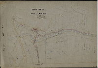
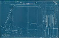
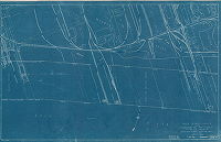
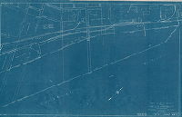
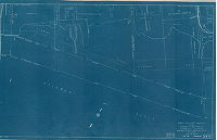
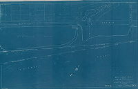
| SD9th-XVI-F-47 |
|
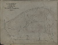
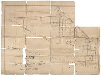
Proposed extension of Retta Avenue | Sundstrom, C. A. | 1892 |
Tracing Not noted
|
Wissahickon and East Falls
Building footprints, Wissahickon Station, Philadelphia and Reading Railroad, Wissahickon Creek and tributaries, property lines and owners
|
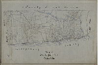
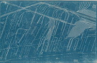
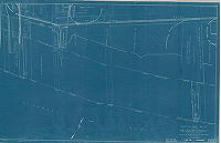
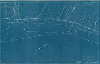
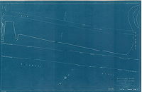
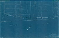
| SD9th-XVI-F-63 |
|
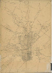
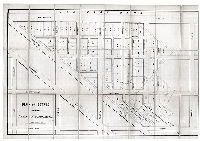
Map of Twenty-first Ward, Philadelphia | Not named | 1900 ca. |
Tracing Not noted
|
Northwest Philadelphia
Most of the streets in Roxborough, shown with dotted lines, are yet to be built
|
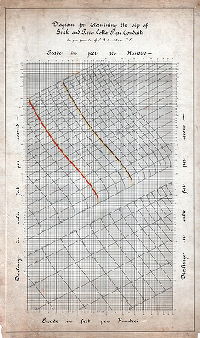
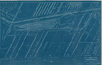
| SD9th-XXV-1 |
|
Diagram for determining the size of brick and terra-cotta pipe conduits as per formula of C. A. Sundstrom, C.E. | Sundstrom, C. A. |
Tracing Not noted
|
N/A
Sewer
|
|
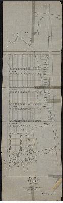
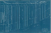
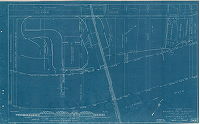
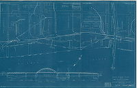
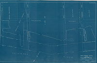
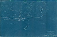
| SD9th-XXV-22 |
|
Plan of mill properties in the Twenty-first Ward surveyed for Charles McDowell | Manship, Horace H. (delineator) | 1910 |
Mounted 1 inch = 20 feet
|
Manayunk
Water pipes, footprints of factory buildings, Venice Branch of the Philadelphia and Reading Railroad, sewers
|
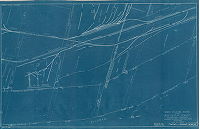
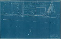
| SD9th-XXV-8 |
|
Plan of property in the 21st Ward, Philadelphia, made for the Roxborough Land Co. | Granlund, K. W. | 1918 |
Tracing Not noted
|
Northwest Philadelphia. Bounded by Gorgas Lane, Henry Ave., Gates St. and Ridge Ave.
Topography, woodland, stream and headwaters
|
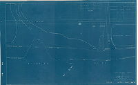
| SD9th-XXVIII-6 |
|
Plan of the estate of Samuel Levering dec'd. Philadelphia. Surveyed Aug. 1873 Jno. H. Levering, Surveyor 8th District. | Levering, John | 1873 |
Tracing Not noted
|
Manayunk. Mitchell St. to Terrace St., Penn St. to Shur's Lane
Property subdivision, unnamed stream running towards Shur's Lane
|
| Streets-10U-39T-1 |
|
[No title. On reverse: "Transit Com'n. Pop[ulation] Map." Handwritten at bottom: "Each dot = 100 persons. Transit Commission study of the 1910 C[ensus]." Stamped at bottom: Bureau of Surveys, Sewage Disposal Division" | Not named | 1910 ca. |
Paper Not noted
|
Philadelphia and surrounding area in Pennsylvania and New Jersey
Population density for Philadelphia and surrounding counties in Pennsylvania and New Jersey
|
| Streets-2H-15 |
|
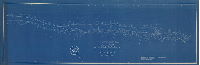
Map of the survey of Wissahickon Creek from its mouth to Paul's Mill Road, defining boundaries of land appropriated by the Commissioners of Fairmount Park for the protection of the purity of the water of said creek and the preservation of the beauty of its scenery. Declared to be a part of Fairmount Park by Act of the General Assembly of the Commonwealth of Pennsylvania approved the 14th day of April A.D. 1868. Adopted by the Commissioners of Fairmount Park this fifteenth day of May A.D. 1869. Attest: [Signed] Morton M. McMichael, President Park Commission; [signed] Joseph F. Mercer, Secretary Park Commission. | Cresson, John C. | 1869 |
Tracing Not noted.
|
Wissahickon Creek valley and adjoining lands
Topography, woodland, stream, bui8lding footprints, factories, mill ponds, dams, bridges, roads, property ownership. Signed by John C. Cresson, Morton M. McMichael, and Joseph F. Mercer. This is likely the original plan on which subsequent lithographs wer
|
| Streets-Bridge-H-196 |
|
Commonwealth of Pennsylvania, Water and Power Resources board. Channel lines, Schuylkill River, Wissahickon Creek to Flat Rock Dam in Lower Merion Township, Montgomery County and City of Philadelphia | Not named | 1926 |
Blueprint Not noted
|
Schuylkill River
See also SD9th-T-73-2 for another version of this map, with annotations.
|
| Streets-Bridges-WalnutLa |
|
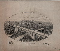
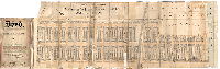
Walnut Lane Bridge over Wissahickon Creek, Philadelphia. (Original isometric drawing) | FB (Frits Bloch?] | 1906 |
Drawing Not noted
|
Walnut Lane Bridge
Beautiful details showing carriages on bridge, architectural details and woodland in the Wissahickon Creek valley.
|
| Streets-Deeds-0013-Cottage |
|
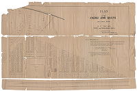
Plan of lots of the Cottage Home Society's 20 acres land in the First Ward City of Philadelphia. Surveyed by T. Daley, Regulator of First District West, September 10th, 1857. [Lithograph, filed with Deed 13 in Deeds File Cabinet, City Plans Unit] | Daly, Thomas | 1857 |
Paper
|
South Philadelphia.
Property subdivision.
|
| Streets-Deeds-0329 |
|
Dedication of Allegheny Avenue by William W. Ball & Benjamin Ball to the Commissioners & inhabitants of the District of Richmond. 6th District. [Plan attached to deed] | Not named | 1851 |
Mounted Not noted
|
Richmond District, Allegheny Avenue and Delaware River
Street plan
|
| Streets-Deeds-0507 |
|
Plan of estate of Rebecca C. Pemberton Dec'd. | Not named | 1890 ca. |
Mounted
|
North Philadelphia; Strawberry Mansion
Property subdivision
|
| Streets-Deeds-1610-PleasantHill1 |
|
Plan of building lots of the Pleasant Hill Land Asso., 23rd Ward, Philada, Pa. | Rhoads, C., | 1887 ca. |
Mounted 1 inch = 200 feet
|
Northeast Philadelphia. Torresdale.
Property subdivision.
|
| Streets-Deeds-1610-PleasantHill2 |
|
Plan of building lots of the Pleasant Hill Land Asso., 23rd Ward, Philada, Pa. | Hunter, C. M., Map Publisher, 2326 Master St., Philada. | 1887 ca. |
Mounted, Lithograph 1 inch = 200 feet
|
Northeast Philadelphia. Torresdale.
Property subdivision.
|
| Streets-Deeds-1618-Westminster |
|
Plan of Westminster in the Borough of West Philadelphia. | Not named | 1850 ca. |
Mounted Not noted
|
West Philadelphia
Property subdivision.
|
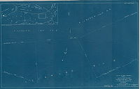
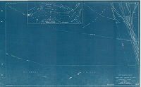
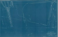
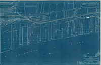
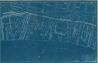
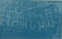
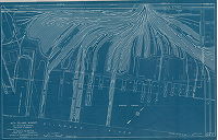
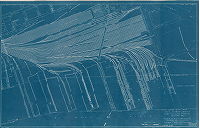
| Streets-DelR-1941-01 |
|
North and south wharves, Delaware River. Department of Wharves, Docks and Ferries, Philadelphia. [Cover sheet for set of 30 maps covering the Delaware River waterfront from Fort Mifflin to Poquessing Creek.] | CWA 51-0088 | 1941 |
Blueprint 1 inch = 100 feet
|
Delaware River waterfront
Wharves, railroads, factories, bulkhead line, building footprints, property owners, navigation aids
|
| Streets-DelR-1941-02 |
|
North and south wharves, Delaware River. Department of Wharves, Docks and Ferries, Philadelphia. SW-9. South Delaware wharves between Baltimore and Ohio Railroad yard and Philadelphia Navy Yard. | CWA 51-0088 | 1941 |
Blueprint 1 inch = 100 feet
|
Delaware River waterfront
Wharves, railroads, factories, bulkhead line, building footprints, property owners, navigation aids
|
| Streets-DelR-1941-03 |
|
North and south wharves, Delaware River. Department of Wharves, Docks and Ferries, Philadelphia. SW-8. South Delaware wharves below Pennsylvania Railroad coal pier. | CWA 51-0088 | 1941 |
Blueprint 1 inch = 100 feet
|
Delaware River waterfront
Wharves, railroads, factories, bulkhead line, building footprints, property owners, navigation aids
|
| Streets-DelR-1941-04 |
|
North and south wharves, Delaware River. Department of Wharves, Docks and Ferries, Philadelphia. SW7-2. South Delaware wharves between Hoyt Street and Baltimore and Ohio railroad yard, Point House Pier to Pennsylvania Railroad Coal Pier. | CWA 51-0088 | 1941 |
Blueprint 1 inch = 100 feet
|
Delaware River waterfront
Wharves, railroads, factories, bulkhead line, building footprints, property owners, navigation aids
|
| Streets-DelR-1941-05 |
|
North and south wharves, Delaware River. Department of Wharves, Docks and Ferries, Philadelphia. SW6-2. South Delaware wharves between Pier No. 105 (Publicker) and Hoyt Street, Pier No. 106 and Point House Pier. | CWA 51-0088 | 1941 |
Blueprint 1 inch = 100 feet
|
Delaware River waterfront
Wharves, railroads, factories, bulkhead line, building footprints, property owners, navigation aids
|
| Streets-DelR-1941-06 |
|
North and south wharves, Delaware River. Department of Wharves, Docks and Ferries, Philadelphia. SW5-2. South Delaware wharves between Porter Street to Bigler Street, Pier No. 92 to Pier No. 105. | CWA 51-0088 | 1943 |
Blueprint 1 inch = 100 feet
|
Delaware River waterfront
Wharves, railroads, factories, bulkhead line, building footprints, property owners, navigation aids
|
| Streets-DelR-1941-07 |
|
North and south wharves, Delaware River. Department of Wharves, Docks and Ferries, Philadelphia. SW4-2. South Delaware wharves between Mifflin Street and Porter Street, Pier No. 73 to Pier No. 84. | CWA 51-0088 | 1944 |
Blueprint 1 inch = 100 feet
|
Delaware River waterfront
Wharves, railroads, factories, bulkhead line, building footprints, property owners, navigation aids
|
| Streets-DelR-1941-08 |
|
North and south wharves, Delaware River. Department of Wharves, Docks and Ferries, Philadelphia. SW3. South Delaware wharves between Pier No. 53 (Washington Ave.) to Mifflin St. , Pier No. 55 to Pier No. 72-1/2. | CWA 51-0088 | 1944 |
Blueprint 1 inch = 100 feet
|
Delaware River waterfront
Wharves, railroads, factories, bulkhead line, building footprints, property owners, navigation aids
|
| Streets-DelR-1941-09 |
|
North and south wharves, Delaware River. Department of Wharves, Docks and Ferries, Philadelphia. South Delaware wharves between South St. and Washington Avenue, SW2. Pier No. 28 to Pier No. 53. | CWA 51-0088 | 1943 |
Blueprint 1 inch = 100 feet
|
Delaware River waterfront
Wharves, railroads, factories, bulkhead line, building footprints, property owners, navigation aids
|
| Streets-DelR-1941-10 |
|
North and south wharves, Delaware River. Department of Wharves, Docks and Ferries, Philadelphia. SW1. South Delaware wharves between Market Street and South Street, Pier No. 3 to Pier No. 24. | CWA 51-0088 | 1943 |
Blueprint 1 inch = 100 feet
|
Delaware River waterfront
Wharves, railroads, factories, bulkhead line, building footprints, property owners, navigation aids
|
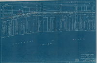
| Streets-DelR-1941-11 |
|
North and south wharves, Delaware River. Department of Wharves, Docks and Ferries, Philadelphia. NW1-2. North Delaware wharves between Market Street and Willow Street, Pier No. 3 to Pier No. 24. | CWA 51-0088 | 1943 |
Blueprint 1 inch = 100 feet
|
Delaware River waterfront
Wharves, railroads, factories, bulkhead line, building footprints, property owners, navigation aids, profile of the Philadelphia-Camden (Benjamin Franklin) Bridge
|
| Streets-DelR-1941-12 |
|
North and south wharves, Delaware River. Department of Wharves, Docks and Ferries, Philadelphia. NW2-2. North Delaware wharves between Willow Street and Laurel Street, Pier No. 25 to Pier No. 44. | CWA 51-0088 | 1943 |
Blueprint 1 inch = 100 feet
|
Delaware River waterfront
Wharves, railroads, factories, bulkhead line, building footprints, property owners, navigation aids
|
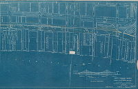
| Streets-DelR-1941-13 |
|
North and south wharves, Delaware River. Department of Wharves, Docks and Ferries, Philadelphia. NW3. North Delaware wharves between Laurel Street and Berks Street, Pier No. 45 to Pier No. 66. | CWA 51-0088 | 1941 |
Blueprint 1 inch = 100 feet
|
Delaware River waterfront
Wharves, railroads, factories, bulkhead line, building footprints, property owners, navigation aids, Penn Treaty Park
|
| Streets-DelR-1941-14 |
|
North and south wharves, Delaware River. Department of Wharves, Docks and Ferries, Philadelphia. NW4-3. North Delaware wharves between Berks Street and Cumberland Street. | CWA 51-0088 | 1943 |
Blueprint 1 inch = 100 feet
|
Delaware River waterfront
Wharves, railroads, factories, bulkhead line, building footprints, property owners, navigation aids, Cramp Shipbuilding Co.
|
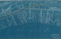
| Streets-DelR-1941-15 |
|
North and south wharves, Delaware River. Department of Wharves, Docks and Ferries, Philadelphia. NW5-2. North Delaware wharves, Port Richmond Terminal (Reading Company), Cumberland Street to Cambria Street, Pier No. 20 to Pier No. 1, (P.R.) | CWA 51-0088 | 1943 |
Blueprint 1 inch = 100 feet
|
Delaware River waterfront
Wharves, railroads, factories, bulkhead line, building footprints, property owners, navigation aids
|
| Streets-DelR-1941-16 |
|
North and south wharves, Delaware River. Department of Wharves, Docks and Ferries, Philadelphia. NW6. North Delaware wharves, Port Richmond Terminal (Reading Co.), Cambria Street to Allegheny Ave., Pier A to Pier J and Pier 127. | CWA 51-0088 | 1943 |
Blueprint 1 inch = 100 feet
|
Delaware River waterfront
Wharves, railroads, factories, bulkhead line, building footprints, property owners, navigation aids
|
| Streets-DelR-1941-17 |
|
North and south wharves, Delaware River. Department of Wharves, Docks and Ferries, Philadelphia. NW7. North Delaware wharves between Allegheny Ave. and Tioga St. | CWA 51-0088 | 1941 |
Blueprint 1 inch = 100 feet
|
Delaware River waterfront
Wharves, railroads, factories, bulkhead line, building footprints, property owners, navigation aids
|
| Streets-DelR-1941-18 |
|
North and south wharves, Delaware River. Department of Wharves, Docks and Ferries, Philadelphia. NW8. North Delaware wharves between Tioga St. and Wheatsheaf Lane. | CWA 51-0088 | 1941 |
Blueprint 1 inch = 100 feet
|
Delaware River waterfront
Wharves, railroads, factories, bulkhead line, building footprints, property owners, navigation aids
|
| Streets-DelR-1941-19 |
|
North and south wharves, Delaware River. Department of Wharves, Docks and Ferries, Philadelphia. NW9. North Delaware wharves between Wheatsheaf Lane and Bristol St. | CWA 51-0088 | 1941 |
Blueprint 1 inch = 100 feet
|
Delaware River waterfront
Wharves, railroads, factories, bulkhead line, building footprints, property owners, navigation aids, profile of Pennsylvania Railroad Delair Bridge, Philadelphia Electric Co. Richmond Generating Station
|
| Streets-DelR-1941-20 |
|
North and south wharves, Delaware River. Department of Wharves, Docks and Ferries, Philadelphia. NW10. North Delaware wharves between Bristol St. and Jenks St. | CWA 51-0088 | 1941 |
Blueprint 1 inch = 100 feet
|
Delaware River waterfront
Wharves, railroads, factories, bulkhead line, building footprints, property owners, navigation aids
|
| Streets-DelR-1941-21 |
|
North and south wharves, Delaware River. Department of Wharves, Docks and Ferries, Philadelphia. NW 11. North Delaware wharves between Jenks St. and Frankford Creek. | CWA 51-0088 | 1941 |
Blueprint 1 inch = 100 feet
|
Delaware River waterfront
Wharves, railroads, factories, bulkhead line, building footprints, property owners, navigation aids
|
| Streets-DelR-1941-22 |
|
North and south wharves, Delaware River. Department of Wharves, Docks and Ferries, Philadelphia. NW 12. North Delaware wharves between Frankford Creek and Comly St. | CWA 51-0088 | 1943 |
Blueprint 1 inch = 100 feet
|
Delaware River waterfront
Wharves, railroads, factories, bulkhead line, building footprints, property owners, navigation aids
|
| Streets-DelR-1941-23 |
|
North and south wharves, Delaware River. Department of Wharves, Docks and Ferries, Philadelphia. NW13. North Delaware wharves between Comly St. and Hellerman St. | CWA 51-0088 | 1943 |
Blueprint 1 inch = 100 feet
|
Delaware River waterfront
Wharves, railroads, factories, bulkhead line, building footprints, property owners, navigation aids, profile of Tacony-Palmyra Bridge, Lardner's Point Pumping Station
|
| Streets-DelR-1941-24 |
|
North and south wharves, Delaware River. Department of Wharves, Docks and Ferries, Philadelphia. NW14. North Delaware wharves between Hellerman St. and Tyson St. | CWA 51-0088 | 1941 |
Blueprint 1 inch = 100 feet
|
Delaware River waterfront
Wharves, railroads, factories, bulkhead line, building footprints, property owners, navigation aids, Disston Saw Works
|
| Streets-DelR-1941-25 |
|
North and south wharves, Delaware River. Department of Wharves, Docks and Ferries, Philadelphia. NW15. North Delaware wharves between Tyson St. and Bleigh St. | CWA 51-0088 | 1943 |
Blueprint 1 inch = 100 feet
|
Delaware River waterfront
Wharves, railroads, factories, bulkhead line, building footprints, property owners, navigation aids, Quaker City Yacht Club
|
| Streets-DelR-1941-26 |
|
North and south wharves, Delaware River. Department of Wharves, Docks and Ferries, Philadelphia. NW16-2. North Delaware wharves between Bleigh St. and House of Correction wharf. | CWA 51-0088 | 1941 |
Blueprint 1 inch = 100 feet
|
Delaware River waterfront
Wharves, railroads, factories, bulkhead line, building footprints, property owners, navigation aids
|
| Streets-DelR-1941-27 |
|
North and south wharves, Delaware River. Department of Wharves, Docks and Ferries, Philadelphia. NW17. North Delaware wharves between House of Correction wharf and Pennypack Creek. | CWA 51-0088 | 1941 |
Blueprint 1 inch = 100 feet
|
Delaware River waterfront
Wharves, railroads, factories, bulkhead line, building footprints, property owners, navigation aids
|
| Streets-DelR-1941-28 |
|
North and south wharves, Delaware River. Department of Wharves, Docks and Ferries, Philadelphia. NW18. North Delaware wharves between Pennypack Creek and Pennypack Street. | CWA 51-0088 | 1941 |
Blueprint 1 inch = 100 feet
|
Delaware River waterfront
Wharves, railroads, factories, bulkhead line, building footprints, property owners, navigation aids, Torresdale (Baxter) Filtration plant
|
| Streets-DelR-1941-29 |
|
North and south wharves, Delaware River. Department of Wharves, Docks and Ferries, Philadelphia. NW19. North Delaware wharves between Pennypack St. and Linden Ave. | CWA 51-0088 | 1941 |
Blueprint 1 inch = 100 feet
|
Delaware River waterfront
Wharves, railroads, factories, bulkhead line, building footprints, property owners, navigation aids, Pennsylvania State Fish Hatchery, Torresdale (Baxter) Filtration plant
|
| Streets-DelR-1941-30 |
|
North and south wharves, Delaware River. Department of Wharves, Docks and Ferries, Philadelphia. NW20. North Delaware wharves between Linden Ave. and Eden St. | CWA 51-0088 | 1941 |
Blueprint 1 inch = 100 feet
|
Delaware River waterfront
Wharves, railroads, factories, bulkhead line, building footprints, property owners, navigation aids, Pleasant Hill Beach
|
| Streets-DelR-1941-31 |
|
North and south wharves, Delaware River. NW21. Department of Wharves, Docks and Ferries, Philadelphia. North Delaware wharves between Eden St. and Poquessing Creek (County line). | CWA 51-0088 | 1941 |
Blueprint 1 inch = 100 feet
|
Delaware River waterfront
Wharves, railroads, factories, bulkhead line, building footprints, property owners, navigation aids, Delaware River Yacht Club
|
| SD7th-Eastwick-Brochure5 |
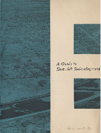
|
A guide to Eastwick redevelopment. The Citizens' Council on City Planning, 1717 Sansom Street, Philadelphia 3. [12-page pamphlet answering the questions, Where?, When? Why? How? and Who? regarding the redevelopment process in Eastwick. Includes 1954 map of existing land use in the redevelopment area, produced by the Philadelphia City Planning Commission.] | Not named | 1954 |
Southwest Philadelphia, Eastwick Redevelopment Area
|
|
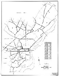
| Streets-HWY-1939 |
|
Map showing city streets on state highway system. City Plans Division, Bureau of Engineering and Zoning, Philadelphia | Not named | 1939 |
Paper Not noted
|
Philadelphia
State highways within Philadelphia. Includes "Tabulation of mileage."
|
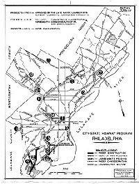
| Streets-HWY-1943 |
|
City-State Highway Program, Philadelphia. Plans and Registry Division, Bureau of Engineering, Surveys and Zoning, July 1943. | Not named | 1943 |
Paper Not noted
|
Philadelphia
State highways within Philadelphia. Includes projects under construction, and in other stages of completion.
|