
Philadelphia Streets Department Surveys
2755 result(s). Showing results 1101 to 1150.
View page: 1 2 3 4 5 6 7 8 9 10 11 12 13 14 15 16 17 18 19 20 21 22 23 24 25 26 27 28 29 30 31 32 33 34 35 36 37 38 39 40 41 42 43 44 45 46 47 48 49 50 51 52 53 54 55 56 (Show all on one page)
| Identifer | Preview | Title | Surveyor | Date | Media / Size / Scale | Area / Map Features |
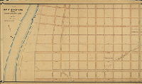
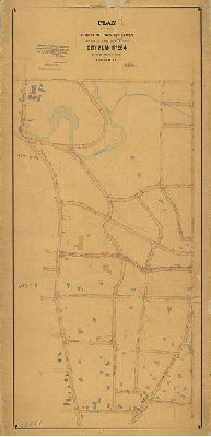
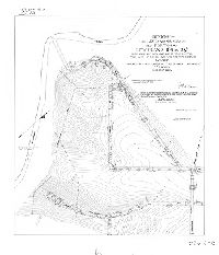
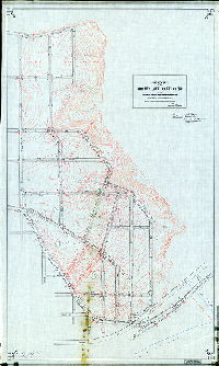
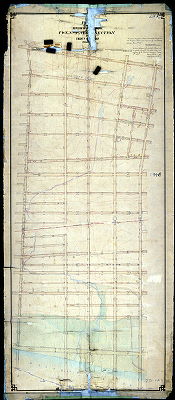
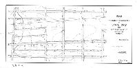
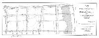
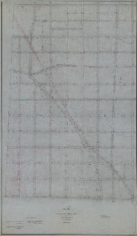
| 279-y MTD |
|
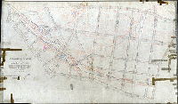
Plan of part of 26th now 36th Ward showing revision of lines and grades on Plan No. 279 Philadelphia. [Ordinance Dec. 19, 1892; approval date not noted] | Not named | 1892 |
Mounted
43 x 76 in.
1 inch = 100 feet
|
South Philadelphia. 25th St. to Schuylkill River, Tasker Ave. to Ritner St.
Topography, curb heights, creeks, houses, property lines, railroad, penciled annotations of later changes
|
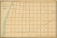
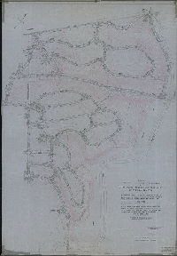
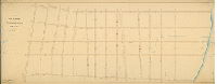
| 279-z HP |
|
Plan showing the revision of grades on Plan No. 279, authorised by Councils, Oct. 20, 1874 | Not named | 1874 ca. |
Mounted
47 x 71 in.
1 inch = 100 feet
|
South Philadelphia. 25th St. to Schuylkill River, Tasker to Ritner Sts.
Point Breeze Gas Works, curb heights, creeks, building footprints, property lines
|
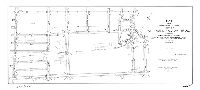
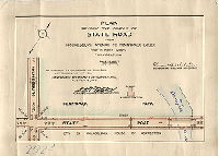
| 280-01 MTD |
|
Plan establishing lines and grades of streets on City Plan No. 280, Thirty-fifth Ward Philadelphia [Ordinances 1907 and 1908; confirmed March 15, 1909] | Webster, Clement B. | 1909 |
Mounted
58 x 40 in.
|
Bounded roughly by Rowland Ave. to Brous Ave., Rhawn St. to Welsh Rd. and Holme Ave.
Topography, Pennypack Creek and park, building footprints
|
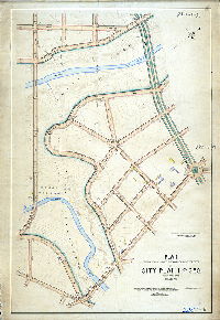
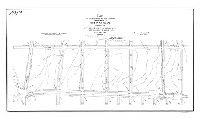
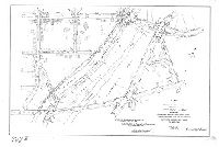
| 280-02 MTD tracing |
|
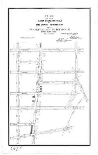
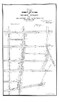
Plan for placing on the City Plan Rhawn Street from the Bustleton and Somerton Turnpike to Delaware Ave., Thirty-fifth Ward, Phila. [Ordinances March 27, 1888; Nov. 25, 1889; March 31, 1894; survey returned Nov. 16, 1897; confirmed Dec. 6, 1897. Covers parts of City Plans 280. 281, 290, and 325] | Webster, John H., Jr. | 1897 |
Tracing
84 x 35 in.
1 inch = 100 feet
|
Northeast Philadelphia. Rhawn Street from Bustleton Ave. to Crispin St. and adjacent area
Topography (contour lines and spot elevations), building footprints with key to building material, Pennypack Creek and tributaries including Sandy Run, Holmesburg Water Co. Pumping Station and reservoir, Lower Dublin Poor House, Pennypack Print Works and outbuildings, stone quarries
|
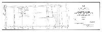
| 280-03 MTD |
|
Plan of the line and grade regulations of the Twenty-fifth Section of the Twenty-third Ward, Philadelphia [Resolution Dec. 13, 1873; no confirmation date] | Not named | 1873 ca |
Mounted
54 x 28 in.
1 inch = 100 feet
|
23rd Ward, 25th Section. Northeast Philadelphia. Bounded by Brous St. to Crabtree St., Hartel St. to Strahle St.
Topography, curb elevations. Shows street grid drawn over Pennypack Creek valley.
|
| 281-01 MTD |
|
Plan of the line and grade regulations of the Twenty-sixth Section, Twenty-third Ward Philadelphia [Resolution Dec. 13. 1873; no confirmation date] | Not named | 1873 ca. |
Mounted
46 x 42 in.
1 inch = 100 feet
|
23rd Ward, 26th Section. Northeast Philadelphia. Bounded by Blight St., Frankford Ave., Rhawn St. and Crabtree St.
Curb elevations. Shows street grid drawn over Pennypack Creek valley
|
| 281-04 MTD |
|
Plan of the revision of lines and grades and establishing new streets upon City Plan No. 281 (parts of former Plans No. 276 and 281) Thirty-fifth Ward Philadelphia [Ordinances 1893 and 1902; confirmed May 15, 1909] | Webster, Clement B. | 1908 |
Mounted
48 x 42 in.
|
Northeast Philadelphia. Bounded by Hartel Ave., Rhawn St., Frankford Ave. and Cottman Ave.
Topography, building footprints, Pennypack Park
|
| 281-05 MTD |
|
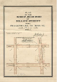
Plan of the revision of lines and grades of Rhawn Street from Frankford Ave. to Craig St., Thirty-fifth Ward, Phila. [Ordinance Nov. 10, 1900; survey returned Jan. 19, 1901; confirmed Feb. 4, 1901] | Webster, John H., Jr. | 1901 |
Mounted
18 x12 in.
|
Northeast Philadelphia. Bounded by Rhawn St. to Decatur St., Craig St. to Frankford Ave.
Curb elevations, building footprints
|
| 281-06 MTD |
|
Plan of the revision of lines and grades and establishing new streets upon portion of City Plan No. 281, Thirty-fifth Ward, Philadelphia [Three ordinances to Dec. 20, 1922; confirmed Feb. 5, 1923] | Webster, Clement B. | 1923 |
Mounted
27 x 67 in.
|
Northeast Philadelphia. Bounded by Rowland Ave. to Frankford Ave., Cottman Ave. to Rhawn St.
Topography
|
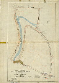
| 281-13 CP |
|
Plan revising lines and grades of Rhawn Street and all territory adjacent and contiguous to the bridges over Pennypack Creek as may be necessary on account of the construction of the said bridges and approaches thereto. Thirty-fifth Ward, Philadelphia. Portions of City Plans Nos. 281, 290, 325, 339 and 369 [Ordinance Aug. 6, 1926; advertised Sept. 6, 1927; confirmed Feb. 6, 1928] | Blankley, William W. | 1927 |
Tracing
22 x 61 in.
1 inch = 100 feet
|
Northeast Philadelphia. Rhawn Street in center, bounded roughly by Brous Ave. to Rowland Ave, and lines of Stanwood St. and Loney St., traversing section of Pennypack Park.
Topography, streams, dams, marshland, building footprints, two Pennypack Creek bridge crossings
|
| 282-05 MTD |
|
Plan of the revision of lines and grades on the Twenty-eighth Section of the Twenty-third Ward Philadelphia [Ordinances Dec. 31, 1880 and July 10, 1885; confirmed Nov. 21, 1887] | Webster, George S. | 1887 |
Mounted
34 x 83 in.
|
23rd Ward, 28th Section. Bounded by Frankford Ave. to Delaware River, Longshore St. to Cottman Ave.
Topography, tidal marshland, building footprints, streams
|
| 283-08-9 MTD |
|
Plan of the revision of lines and grades [of City Plan No. 283]. [Ordinances 1882 and 1893; confirmed 1894 and 1895] | Fuller, H. M. | 1894 |
Mounted
42 x 52 in.
1 inch = 100 feet
|
Bounded by Hunting Park Ave. to Berkley St., King St. to Germantown Ave.
Topography, Reading Railroad, streams, ponds, building footprints. This is a copy of plan 283-01_MTD made by "A. J. Z., 1905"
|
| 284-03 MTD |
|
Plan of the revision of lines and grades on a portion of City Plan No. 284, Twenty-second Ward, Philadelphia [Ordinance June 29, 1894; advertised cot. 21, 1895; confirmed Jan. 20, 1896 | Wagner, Joseph C. | 1895 |
Mounted
40 x 84 in.
1 inch = 100 feet
|
Chestnut Hill. Bounded by Northwestern Ave., Stenton Ave., Chestnut Hill Ave. and Perkiomen Turnpike (now Germantown Ave.)
Topography, streams, springs, ponds, mill races, curb elevations, Ravine Ave., building footprints
|
| 284-04 MTD tracing |
|
A revision of the lines and grades of a portion of City Plan 284, 22d Ward Philadelphia. [Ordinance June 29, 1894; survey returned March 1, 1897; confirmed Sept. 20, 1897] | Wagner, Joseph C. | 1897 |
Tracing
41 x 29 in.
1 inch = 100 feet
|
Chestnut Hill. Bounded by Northwestern Ave., Forbidden Drive, Bell's Mill Rd. and Germantown Ave.
Topography, Wissahickon Creek and tributary streams, building footprints
|
| 284-05 MTD |
|
An extension to Fairmount Park placed upon City Plan No. 284 [Ordinance Nov. 18, 1895; survey returned Jan. 18, 1897; approved by Board of Surveyors June 6, 1898] | Wagner, Joseph C. | 1897 |
Mounted
38 x 26 in.
|
Wissahickon Creek valley between Bells Mill Rd. and Northwestern Ave.
Wissahickon Creek and tributaries, park land delineated
|
| 284-06 MTD tracing |
|
A revision of the lines and grades of that portion of City Plan 284 lying westwardly from the Perkiomen Turnpike between Bell's Mill Road on the north and Chestnut Hill Avenue on the south. 22d Ward Philadelphia. [Ordinance Nov. 10, 1900; confirmed Dec. 5, 1904] | Wagner, Joseph C. | 1904 |
Tracing
49 x 50 in.
1 inch = 100 feet
|
Chestnut Hill. Bounded by Wissahickon Creek, Perkiomen Turnpike, Bell's Mill Rd. and Chestnut Hill Ave.
Topography, Wissahickon Creek and tributary streams, ponds
|
| 285-01 CP |
|
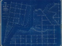
Revision of lines and grades on Plan No. 285 bounded by Nicetown Lane, Abbotsford Ave., Wissahickon Ave. and Schuylkill River, 28th Ward [Ordinance Feb. 11, 1889, survey returned Dec. 9, 1893; confirmed Feb. 19, 1894] | Fuller, H. M. | 1893 |
Tracing
40 x 67 in.
|
Bounded by Nicetown Lane, Abbotsford Ave., Wissahickon Ave. and Schuylkill River
Topography, streams, ponds, railroads, building footprints
|
| 286-02 CP |
|
Plan revising the lines and grades of portions of City Plans Nos. 286 and 287, bounded by Wissahickon Avenue, Clyde Lane, Drainage right-of-way, the lines of Fairmount Park and Cathedral Road, and revising the lines and grades of intersecting and adjacent streets affected thereby. 21st Ward, Philadelphia, Pa. [Ordinance Feb. 22, 1954; survey returned July 19, 1954; approved by Philadelphia City Planning Commission Nov. 3, 1954] | Franklin & Lindsey | 1954 |
Tracing
38 x 46 in.
1 inch = 100 feet
|
21st Ward
Topography
|
| 286-02 MTD blueprint |
|
Plan of the Sixth Section of the survey and regulation of Chestnut Hill, Twenty-second Ward, City of Philadelphia [Resolution Nov. 29, 1873; Confirmed July 1, 1889 and May 7, 1900] | Not named | 1873 |
Blueprint
50 x 64 in.
1 inch = 100 feet
|
Chestnut Hill. Bounded by Wissahickon Ave. to 29th St. (now Navajo St.), Union Ave. to line of Sunset Ave., on both sides of Wissahickon Creek
Topography, Wissahickon Creek and tributary streams, ponds, springs
|
| 286-05 MTD |
|
Plan of the revision of the lines and grades of that portion of Plans No. 165 and 286 bounded by Graver's Lane, the line of Cherokee St., Rex Ave. and Seminole St., 22nd Ward, Philadelphia. [Ordinance Nov. 10, 1900; confirmed May 4, 1903] | Wagner, Joseph C. | 1903 |
Mounted
1 inch = 100 feet
|
Chestnut Hill. Bounded Graver's Lane, the line of Cherokee St., Rex Ave. and Seminole St.
Topography, streams, springs
|
| 286-06 MTD |
|
A revision of the lines and grades of that portion of City Plans 165 and 286 bounded by Rex Avenue on the south, the line of Seminole Avenue on the east, and the Fairmount Park lines on the north and west. 22nd Ward, Philadelphia [Ordinance Nov. 10, 1900; confirmed Dec. 5, 1904] | Wagner, Joseph C. | 1904 |
Mounted
37 x 41 in.
1 inch = 100 feet
|
22nd Ward. Bounded by Rex. Ave., the line of Seminole Ave., and the lines of Fairmount Park
Topography
|
| 287 CP |
|
Plan revising the lines and grades of City Plan No. 287 and portion of City Plan No. 286 … 21st and 22nd Wards, City of Philadelphia. [Ordinance Sept. 14, 1949; survey returned April 18, 1951; confirmed June 18, 1951] | Franklin & Lindsey | 1951 |
Tracing
77 x 53 in.
1 inch = 100 feet
|
Chestnut Hill. Bounded by Northwestern Ave., Montgomery County line, Wissahickon Dr., Wissahickon Creek, Cathedral Rd., Wissahickon Ave., Manatawna Ave., Lykens La., and Seneca Rd.
Topography, Wissahickon Creek and tributary streams, old roads
|
| 287-01 MTD |
|
Plan of the Seventh Section of the survey and regulation of Chestnut Hill, Twenty-second Ward, City of Philadelphia, made under the direction of the Department of Surveys and in accordance with resolution of Councils Nov. 29th, 1873. [Confirmation date not noted] | Not named | 1873 ca. |
Mounted
63 x 52 in.
|
Chestnut Hill. Bounded by Wissahickon Ave. to Wissahickon Creek, Northwestern Ave. to Sunset Ave.
Topography, Wissahickon Creek and tributary streams
|
| 288-02 MTD |
|
Plan of the Fifth Section of the survey and regulation of Chestnut Hill, Twenty-second Ward, City of Philadelphia [Resolution Nov. 29, 1873; confirmed July 1, 1889] | Not named | 1889 |
Mounted
43 x 58 in.
|
22nd Ward, 5th Section, Chestnut Hill. Bounded by Union Ave., 32nd (now Towanda) St., Mermaid Ave. and Township Line and Fairmount Park line.
Topography, streams, bridges, pond, curb elevations
|
| 289-01 MTD tracing |
|
Plan of the survey and regulation of the Eighteenth Section of the Twenty-first Ward City of Philadelphia [Resolution Nov. 27, 1874; confirmed Dec. 18, 1876] | Levering, John H. | 1876 |
Tracing
61 x 36 in.
|
21st Ward, 18th Section. Bounded roughly by Jennett Ave., Oros St., Hermit St., and Ridge Ave.
Topography, streams, building footprints
|
| 289-02 MTD |
|
Plan of the revision of lines and grades of Plan No. 289 [Ordinance April 4, 1894; Confirmed 1912, 1913, and 1916] | Sundstrom, C. A. | 1912 |
Mounted
36 x 57 in.
1 inch = 100 feet
|
21st Ward. Bounded by Ridge Ave., Hermit St., Henry Ave. and Wissahickon Creek
Topography (partial), building footprints, dams in Wissahickon Creek
|
| 290-12 MTD tracing |
|
Plan of the revision of lines and grades with topography of a portion of Twenty-seventh Section of the Twenty-third Ward Philadelphia. [Ordinance March 27, 1888; confirmed various dates from 1891 to 1899] | Webster, George S. | 1889 |
Tracing
43 x 44 in.
|
23rd Ward, 27th Section. Bounded by Strahle St., Frankford Ave., Rhawn St. and Ryan Ave.
Topography, streams, building footprints, railroad, Pennypack Creek
|
| 290-13 MTD |
|
Plan of the revision of lines and grades and establishing new streets upon City Plan No. 290, Thirty-fifth Ward, Philadelphia. [Ordinances 1902, 1907 and 1909; confirmed July 10, 1916] | Webster, Clement B. | 1916 |
Mounted
42 x 60 in.
1 inch = 100 feet
|
Northeast Philadelphia. Bounded roughly by Rhawn St., Winchester Ave., the line of Hoffnagle St., and Frankford Ave.
Pennypack Creek and tributaries, building footprints, dams and other stream features, railroads
|
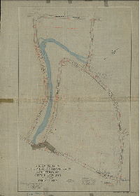
| 291-01 MTD |
|
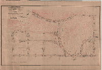
Plan of the revision of lines and grades of the Twenty-ninth Section of the Twenty-third Ward Philadelphia [Ordinances March 29, 1887 and March 27, 1888; confirmed June 1 and Dec. 7, 1891] | Webster, George S. | 1891 |
Mounted
89 x 38 in.
|
23rd Ward, 29th Section. Bounded by Frankford Ave., Hartel Ave., Delaware River and Cottman Ave.
Topography, tidal marshland, streams, Spewter's Run and its sources at ponds and springs, building footprints
|
| 291-02 MTD |
|
Plan of the survey and regulation of the Twenty-ninth Section of the Twenty-third Ward, City of Philadelphia [Resolution October 21, 1872; no confirmation date noted] | Not named | 1872 ca. |
Mounted
90 x 35 in.
|
23rd Ward, 29th Section. Bounded by Frankford Ave., Hartel Ave., Delaware River and Cottman Ave.
Curb elevations, stream, railroad
|
| 291-03 MTD |
|
Plan of the revision of lines and grades on portions of City Plans No. 291 and No. 292 [Ordinance April 16, 1920; advertised Jan. 3, 1921; confirmed May 16, 1921] | Webster, Clement B. | 1921 |
Mounted
27 x 57 in.
1 inch = 100 feet
|
Northeast Philadelphia. Bounded by Torresdale Ave., Cottman Ave., State Rd., and Rhawn St.
Curb elevations, building footprints
|
| 291-04 MTD |
|
Plan revising the lines and grades on a portion of City Plan No. 291 bounded by Frankford Ave., Torresdale Ave., Cottman St. and Bleigh St., Forty-first Ward, Philadelphia [Ordinance June 11, 1903; survey returned Aug. 3, 1903; confirmed Nov. 16, 1903] | Webster, Clement B. | 1903 |
Mounted
23 x 39 in.
|
Northeast Philadelphia. Bounded by Frankford Ave., Torresdale Ave., Cottman St. and Bleigh St.
Topography, building footprints
|
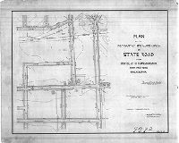
| 291-05 MTD |
|
Plan of the revision of the curb lines on State Road from Cottman St. to Hartel St., Forty-first Ward, Philadelphia. [Ordinance June 13, 1906; survey returned Aug. 10, 1906; confirmed Sept. 17, 1906] | Webster, Clement B. | 1906 |
Mounted
21 x 41 in.
1 inch = 100 feet
|
Northeast Philadelphia. Bounded by Cottman Ave. to Hartel St., Tulip St. to Wissinoming St.
Topography, building footprints, stream (Spewter's Run)
|
| 292-01 MTD |
|
Plan revising the grades of State Road from Holmesburg Avenue to Pennypack Creek, Forty-first Ward, Philadelphia [Ordinance June 24, 1913; confirmed Aug. 18, 1913] | Webster, Clement B. | 1913 |
Mounted
10 x 14 in.
1 inch = 100 feet
|
Northeast Philadelphia. State Rd. from Holmesburg Ave. to Pennypack Creek
Pennypack Sewage Pumping Station, Pennypack Park and Creek
|
| 292-02 MTD |
|
Plan of the revision of lines and grades of portion of City Plan No. 292 bounded by Frankford Avenue, Ashburner Street, Cottage Street and Welsh Street, Thirty-fifth and Forty-first Wards, Philadelphia [Ordinance July 7, 1914; confirmed Oct. 16, 1916 | Webster, Clement B. | 1916 |
Mounted
22 x 32 in.
1 inch = 100 feet
|
Northeast Philadelphia. Bounded by Frankford Ave., Ashburner St., Cottage St. and Welsh St.
Building footprints, railroad, Pennypack Creek
|
| 292-03 MTD tracing |
|
Plan striking from City Plan No. 292 Rhawn Street from State Road to Delaware River, also Wissinoming Street, Milnor Street and Eugene Street from Holmesburg Avenue to Hartel Street, Forty-first Ward, Philadelphia [Ordinance March 5, 1913; confirmed May 19, 1913] | Webster, Clement B. | 1913 |
Tracing
18 x 57 in.
1 inch = 100 feet
|
Northeast Philadelphia. Bounded by State Road to Delaware River, Hartel St. to Holmesburg Ave.
Building footprints, drainage ditches, marshland
|
| 292-04 MTD |
|
Plan of the revision of lines and grades of Rhawn Street from Frankford Ave. to Ditman St., Forty-first Ward, Phila. [Ordinance Nov. 10, 1900; survey returned Jan. 19, 1901; confirmed Feb. 4, 1901] | Webster, John H., Jr. | 1901 |
Mounted
36 x 23 in.
|
Bounded by Frankford Ave. to Ditman St., Decatur St. to Welsh Rd.
Building footprints, railroad
|
| 292-04 MTD tracing |
|
Plan of the revision of lines and grades of Rhawn Street from Frankford Ave. to Ditman St., Forty-first Ward, Phila. [Ordinance Nov. 10, 1900; survey returned Jan. 19, 1901; confirmed Feb. 4, 1901] | Webster, John H., Jr. | 1901 |
Mounted
36 x 23 in.
|
Northeast Philadelphia. Bounded by Frankford Ave. to Ditman St., Decatur St. to Welsh Rd.
Building footprints, railroad
|
| 292-05 MTD |
|
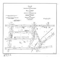
Plan of the revision of lines and grades of Mill Street from Erdrick St. to Holmesburg Ave. and Welsh Street from Erdrick St. to Walker St., Forty first Ward, Philadelphia [Ordinance July 11, 1907; survey returned Feb. 15, 1908; confirmed March 16, 1908] | Webster, Clement B. | 1908 |
Mounted
21 x 23 in.
|
Northeast Philadelphia. Bounded by Erdrick St. to Cottage St., Rhawn St. to Holmesburg Ave.
Building footprints, railroad
|
| 292-05 MTD tracing |
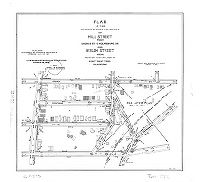
|
Plan of the revision of lines and grades of Mill Street from Erdrick St. to Holmesburg Ave. and Welsh Street from Erdrick St. to Walker St., Forty first Ward, Philadelphia [Ordinance July 11, 1907; survey returned Feb. 15, 1908; confirmed March 16, 1908] | Webster, Clement B. | 1908 |
Tracing
21 x 23 in.
|
Northeast Philadelphia. Bounded by Erdrick St. to Cottage St., Rhawn St. to Holmesburg Ave.
Building footprints, railroad
|
| 292-06 MTD |
|
Plan of the revision of lines and grades of Rhawn Street from State Road to Delaware River [Ordinance July 7, 1908; survey returned Aug. 21, 1908; confirmed Oct. 19, 1908] | Webster, Clement B. | 1908 |
Mounted
18 x 46 in.
|
Northeast Philadelphia. Bounded by State Road to Delaware River, Hartel St. to Holmesburg Ave.
Topography, building footprints
|
| 292-07 MTD |
|
Plan of the revision of the curb lines on State Road from Hartel St. to Holmesburg Ave., Forty-first Ward, Philadelphia. [Ordinance June 13, 1906; survey returned Aug. 10, 1906; confirmed Sept. 17, 1906] | Webster, Clement B. | 1906 |
Mounted
22 x 27 in.
|
Northeast Philadelphia. Bounded by Tulip St. to Wissinoming Ave., Hartel St. to Holmesburg Ave.
Topography, building footprints
|
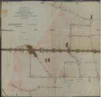
| 292-08 MTD |
|
Plan of the revision of lines and grades on the Thirtieth Section of the Twenty-third Ward Philadelphia [Ordinances March 29, 1887 and March 27, 1888; confirmed Dec. 7, 1891] | Webster, George S. | 1891 |
Mounted
87 x 47 in.
|
23rd Ward, 30th Section. Bounded by Frankford Ave., Ashburner and Wingate Sts., Delaware River and Hartel St.
Topography, Pennypack Creek, tidal marshland, House of Correction, Philadelphia County Prison property, ponds, railroad, building footprints, low water mark, Port Warden's Line
|
| 292-08 MTD tracing |
|
Plan of the revision of lines and grades on the Thirtieth Section of the Twenty-third Ward Philadelphia [Ordinances March 29, 1887 and March 27, 1888; confirmed Dec. 7, 1891] | Webster, George S. | 1891 |
Tracing
87 x 47 in.
|
23rd Ward, 30th Section. Bounded by Frankford Ave., Ashburner and Wingate Sts., Delaware River and Hartel St.
Topography, Pennypack Creek, tidal marshland, House of Correction, Philadelphia County Prison property, ponds, railroad, building footprints, low water mark, Port Warden's Line
|
| 292-09 MTD |
|
Plan of the revision of lines and grades in a portion of City Plan No. 292 and place upon the city plan an extension of Pennypack Park, Forty-first Ward Philadelphia [Ordinance July 2, 1908; confirmed Nov. 16, 1908] | Webster, Clement B. | 1908 |
Mounted
40 x 46 in.
|
Northeast Philadelphia. Bounded roughly by State Road to Frankford Ave., Rhawn St. to Ashburner St.
Topography, Pennypack Creek, mill and mill race, ponds, building footprints, Pennypack Park, Philadelphia County Prison
|
| 292-11 MTD tracing |
|
Plan of the revision of lines and grades on a portion of City Plan No. 292 bounded by Torresdale Ave., Wingate St., Delaware River and Holmesburg Ave., Forty-first Ward, Phila. [Ordinance Feb. 13, 1901; survey returned April 26, 1901; confirmed Jan. 20, 1902] | Webster, John H., Jr. | 1901 |
Tracing
64 x 34 in.
|
Northeast Philadelphia. Bounded by Torresdale Ave., Wingate St., Delaware River and Holmesburg Ave
Topography, building footprints, drainage ditches, ponds, Pennypack Creek, marshland, House of Correction, County Prison property, railroad
|
| 292-12 MTD tracing |
|
Plan for placing Rhawn Street between Hegerman St. and James St. on the City Plan and revising the lines and grades of streets affected thereby. Thirty-fifth Ward, Philadelphia [Ordinances Jan. 30 and Dec. 16, 1896; survey returned Jan. 15, 1897; confirmed March 1, 1897] | Webster, John H., Jr. | 1897 |
Tracing
38 x 34 in.
|
Bounded by Ditman St. to State Rd., Napfle St. to Pennypack Creek
Topography, color-coded building footprints with key, Pennypack Creek, ponds
|
| 292-27 MTD tracing |
|
Plan striking from City Plans Nos. 291 and 292 Wissinoming St, Eugene St. and Milnor St. from Shelmire St. to Hartel St., Forty-first Ward, Philadelphia [Ordinance Aug. 7, 1923] | Webster, Clement B. | 1923 |
Tracing
45 x 40 in.
1 inch = 100 feet
|
Northeast Philadelphia. Bounded by Holmesburg Ave. to Bleigh St., State Rd. to Delaware River
Topography, building footprints, drainage ditches, small stream emptying into Delaware at Bleigh St. (Spewter's Run?)
|
| 294-01 HP tracing |
|
Plan of the survey and regulation of the Thirty-First Section, Twenty-Third Ward Philadelphia | Shallcross, Isaac E. | 1876 |
Tracing
84 x 50 in.
1 inch = 100 feet
|
23rd Ward, 31st Section. Bounded by I St. [Rising Sun Ave.] to City line, Clifford St. [Cottman Ave.] to Strahle St.
Topography, curb elevations, creeks, building footprints
|
| 294-02 HP |
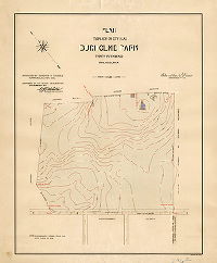
|
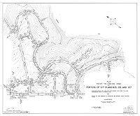
Plan to place on City Plan Burholme Park. 35th Ward Philadelphia. [Ordinance July 27, 1905; confirmed Nov. 6, 1905] | Webster, Clement B. | 1905 |
Mounted
26 x 32 in.
|
Burholme Park
Topography
|