
Philadelphia Streets Department Surveys
2755 result(s). Showing results 1951 to 2000.
View page: 1 2 3 4 5 6 7 8 9 10 11 12 13 14 15 16 17 18 19 20 21 22 23 24 25 26 27 28 29 30 31 32 33 34 35 36 37 38 39 40 41 42 43 44 45 46 47 48 49 50 51 52 53 54 55 56 (Show all on one page)
| Identifer | Preview | Title | Surveyor | Date | Media / Size / Scale | Area / Map Features |
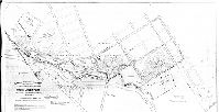
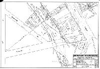
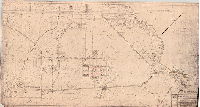
| RC-099 Cobbs1 |
|
Plan made for the Law Department of the City of Philadelphia in the matter of selecting for an extension of Cobbs Creek Park two tracts of land designated as "B" and "C" situated in the Borough of Yeadon, Delaware Co. PA. [Ordinance March 18, 1925; survey returned May 21, 1925] | Albright & Mebus | 1925 |
Blueprint
38 x 69 in.
1 inch = 100 feet
|
West Philadelphia. Cobb's Creek Park
Cobb's Creek Park
|
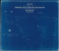
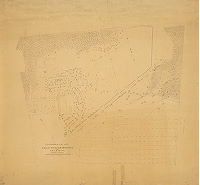
| RC-102-y1 |
|
Plan of the property of Friends Asylum for the Insane in the Thirty-fifth Ward near Frankford, Philadelphia | Webster, John H., Jr. | 1892 |
Blueprint
34 x 36 in.
1 inch = 100 feet
|
Friends Asylum (now Friends Hospital). Property bounded roughly (in 1892) by Philadelphia, Bustleton & Trenton Railroad, Adams (or Asylum) Road, Oakland Cemetery, and Tacony Creek
Building footprints of the Asylum, Tacony (mislabeled Frankford) Creek and tributary streams, pond, property lines and ownership
|
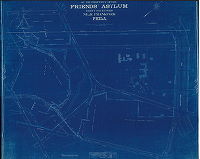
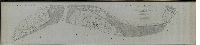
| RC-102-y2 |
|
Plan of the property of Friends Asylum, Thirty-fifth Ward near Frankford, Philadelphia | Webster, John H., Jr. | 1919 |
Blueprint
36 x 44 in.
1 inch = 100 feet
|
Friends Asylum and surrounding property, bounded (in 1919) by Whitaker Ave., Loudon St., Wyoming Ave., Ramona Ave (Fisher's La.), Adams Ave., Roosevelt Boulevard, and Oxford Road Branch of the Connecting Railway
Building footprints of the Asylum, Tacony Creek and tributary streams, pond, mill race, property lines and ownership, Tacony Creek Park, Oakland Cemetery
|
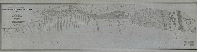
| RC-102-z |
|
Plan of grounds occupied by the West Philadelphia Railroad [Copy made in 1896] | Campbell, Henry R. | 1835 |
Tracing
43 x 148 in.
|
West Philadelphia Railroad, from Schuylkill River to junction with Columbia Railroad
Property lines and ownership, streams crossing the line, building footprints
|
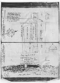
| RC-103 LetitiaPenn 1 |
|
[No title. Photostat of pages 101 and 102 in Warrant Book No. 2 shows lot at Second and Market Sts. owned by Letitia Penn, daughter of William Penn] | Not named | 1698 |
Photostat
21 x 16 in.
|
Philadelphia. Second and Market Sts.
Building footprint, garden plan
|
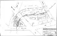
| RC-108+F423+F415:F422+F415:F415:F423 |
|
Surveys for the channelization of Frankford Creek. Department of Public Works, Bureau of Engineering, Surveys and Zoning. Property of Baxter, Kelly and Faust Inc. Wards 23rd, 33rd [Philadelphia] | Delany, Joseph F. | 1946 |
Blueprint
24 x 32 in.
1 inch = 30 feet
|
Northeast Philadelphia
Property lines, building footprints, actual and proposed creek channels, actual and proposed streets, factories. First of nine plans.
|
| RC-108-FFCK-NewChannel-2 |
|
Surveys for the channelization of Frankford Creek. Department of Public Works, Bureau of Engineering, Surveys and Zoning. Property of Philadelphia Felt Co. Wards 23rd, 33rd [Philadelphia] | Delany, Joseph F. | 1945 |
Blueprint
24 x 32 in.
1 inch = 40 feet
|
Northeast Philadelphia
Property lines, building footprints, actual and proposed creek channels, actual and proposed streets, factories. Second of nine plans.
|
| RC-108-FFCK-NewChannel-3 |
|
Surveys for the channelization of Frankford Creek. Department of Public Works, Bureau of Engineering, Surveys and Zoning. Properties of The Phila Felt Co., Fiorentino Viola, Gaetano Damore et. ux., Bella J. Martin w/f David. Albert F. Zimmerman, Lillian Brophy. Wards 23rd, 33rd [Philadelphia] | Delany, Joseph F. | 1945 |
Blueprint
24 x 32 in.
1 inch = 30 feet
|
Northeast Philadelphia
Property lines, building footprints, actual and proposed creek channels, actual and proposed streets, factories. Third of nine plans.
|
| RC-108-FFCK-NewChannel-4 |
|
Surveys for the channelization of Frankford Creek. Department of Public Works, Bureau of Engineering, Surveys and Zoning. Properties of Charles A. Shetzline, Giovanni Felice, Winifred Sellers, Phila. Spinning Mills, Carmine Decristafaro, Emma E. Quigley et al heirs of Sarah Smith. Wards 23rd, 33rd [Philadelphia] | Delany, Joseph F. | 1945 |
Blueprint
24 x 32 in.
1 inch = 30 feet
|
Northeast Philadelphia
Property lines, building footprints, actual and proposed creek channels, actual and proposed streets, factories. Fourth of nine plans.
|
| RC-108-FFCK-NewChannel-5 |
|
Surveys for the channelization of Frankford Creek. Department of Public Works, Bureau of Engineering, Surveys and Zoning. Properties of Charles A. Shetzline, Jettison Corporation, Adam J. Kaszupski et ux, Edgard Platel, Edward T. Dooley. Wards 23rd, 33rd [Philadelphia] | Delany, Joseph F. | 1945 |
Blueprint
24 x 32 in.
1 inch = 30 feet
|
Northeast Philadelphia
Property lines, building footprints, actual and proposed creek channels, actual and proposed streets, factories. Fifth of nine plans.
|
| RC-108-FFCK-NewChannel-6 |
|
Surveys for the channelization of Frankford Creek. Department of Public Works, Bureau of Engineering, Surveys and Zoning. Properties of Charles A. Shetzline, James Bromley. Wards 23rd, 33rd [Philadelphia] | Delany, Joseph F. | 1946 |
Blueprint
24 x 32 in.
1 inch = 30 feet
|
Northeast Philadelphia
Property lines, building footprints, actual and proposed creek channels, actual and proposed streets, factories. Sixth of nine plans.
|
| RC-108-FFCK-NewChannel-7 |
|
Surveys for the channelization of Frankford Creek. Department of Public Works, Bureau of Engineering, Surveys and Zoning. Properties of Charles A. Shetzline, James Bromley, Not registered. Wards 23rd, 33rd [Philadelphia] | Delany, Joseph F. | 1946 |
Blueprint
24 x 32 in.
1 inch = 40 feet
|
Northeast Philadelphia
Property lines, building footprints, actual and proposed creek channels, actual and proposed streets, factories. Seventh of nine plans.
|
| RC-108-FFCK-NewChannel-8 |
|
Surveys for the channelization of Frankford Creek. Department of Public Works, Bureau of Engineering, Surveys and Zoning. Properties of J. Alexander Kline et ux, Morris Richman, New Dreamland Corp. Wards 23rd, 45th [Philadelphia] | Delany, Joseph F. | 1945 |
Blueprint
24 x 32 in.
1 inch = 30 feet
|
Northeast Philadelphia
Property lines, building footprints, actual and proposed creek channels, actual and proposed streets, factories. Eighth of nine plans.
|
| RC-108-FFCK-NewChannel-9 |
|
Surveys for the channelization of Frankford Creek. Department of Public Works, Bureau of Engineering, Surveys and Zoning. Properties of the Connecting Railroad Co., Robert B. Tinsman, Edgewater Dyeing and Finishing Co. Wards 23rd, 45th [Philadelphia] | Delany, Joseph F. | 1945 |
Blueprint
24 x 32 in.
1 inch = 30 feet
|
Northeast Philadelphia
Property lines, building footprints, actual and proposed creek channels, actual and proposed streets, factories. Ninth of nine plans.
|
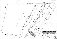
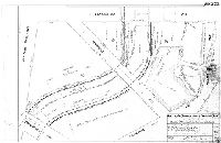
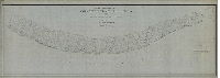
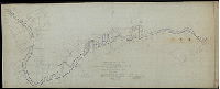
| RC-108-z |

|
Frankford Creek [Flood] Relief - General Plan. Oct. 1931. Scale 200 feet to 1 inch. | Not named | 1931 |
Blueprint
30 x 98 in.
1 inch = 200 feet
|
Frankford Creek and adjacent area from Ramona Ave. to the Delaware River
Frankford Creek, property lines and ownership, building footprints
|
| RC-109-03 |
|
[No title. Benjamin Franklin Parkway. In corner: "Bureau of Engineering , Surveys & Zoning. City Plans Division. Compiled July 12, 1930 by R. J. B. Revised to Nov. 15, 1941." Similar to RC-109-03-a and RC-109-03-B, with all jury plans listed.] | Not named | 1941 |
Blueprint, positive, folded
26 x 85 in.
1 inch = 100 feet
|
Benjamin Franklin Parkway
Jury plans listed for each Parkway section
|
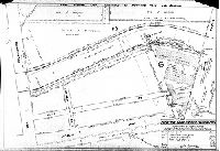
| RC-109-04 |
|
Plan of approaches to Art Museum. Commissioners of Fairmount Park, Phila. PA. | Not named | 1943 |
Blueprint
36 x 78 in.
1 inch = 50 feet
|
Benjamin Franklin Parkway
Art Museum, Aquarium in old Fairmount Water Works, cliffs above Aquarium, Lincoln Monument, Italian Fountain, public boat house
|
| RC-110-x |

|
Map of the public roads in Bucks County Pennsylvania constructed from actual surveys made under the direction of the State Highway Department. 1935. | Not named | 1935 |
Paper
22 x 34 in.
|
Bucks County, Pennsylvania
Roads, municipal divisions
|
| RC-110-y |
|
Map of the public roads in Montgomery County Pennsylvania enlarged from actual surveys by the State Highway Department. | Not named | 1930 ca. |
Paper
22 x 34 in.
|
Montgomery County, Pa.
Roads, municipal divisions
|
| RC-110-z |
|
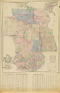
Map of the Main Line and Eastern Delaware County including portion of Chester County in Penna. Published by Franklin Survey Co. | Franklin Survey Co. | 1933 |
Mounted
49 x 77 in.
1 inch = 200 feet
|
Main Line: Parts of Montgomery, Delaware and Chester Counties, Pennsylvania
Roads, property owners and acreage, municipal divisions
|
| RC-111-x |
|
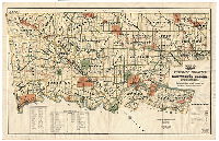
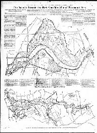
Plan showing proposed location of hospital group, administration building, power plant, railroad siding, and roads & drives connecting the same. 35th Ward, Phila. PA. November 1912. [Plan labeled on back, "Byberry Farms", showing buildings of Philadelphia State Hospital at Byberry, a psychiatric institution that closed in 1990 and was mostly demolished in 2006] | Albright & Mebus | 1912 |
Blueprint
42 x 53 in.
1 inch = 200 feet
|
Northeast Philadelphia. Philadelphia State Hospital at Byberry
Topography, building footprints and use identified, streams, property owners
|
| RC-111-y |
|
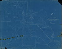
Plot Plan - Northwest of the [Roosevelt] Boulevard. Philadelphia State Hospital [Byberry], Philadelphia, Pennsylvania. Showing all buildings, roads & utilities. March 6, 1942. Revised to 1950. | Not named | 1942 |
Paper
22 x 38 in.
1 inch = 200 feet
|
Northeast Philadelphia. Philadelphia State Hospital at Byberry
Topography, building footprints Poquessing and Byberry Creeks
|
| RC-111-z |
|
Plot plan - Southeast of the [Roosevelt] Boulevard. Philadelphia State Hospital [Byberry] showing all buildings, roads & utilities. March 6, 1942. Revised to 1949. | Not named | 1942 |
Paper
27 x 50 in.
1 inch = 200 feet
|
Northeast Philadelphia. Philadelphia State Hospital at Byberry
Topography, building footprints Poquessing and Byberry Creeks. On reverse: "Mr. R. F. Johnson, Resident Engineer; Dr. Eugene L Sielke, Superintendent. Phila. State Hospital. Phone: OR3-8800"
|
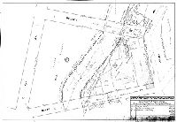
| RC-119 |
|
Topographical map of the Country Club Grounds at Bala, Penna. | Van Duzee, H., C.E. | 1890 |
Mounted
46 x 49 in.
1 inch = 50 feet
|
West Philadelphia
Golf course, trees, building footprints
|
| RC-A-1 |
|
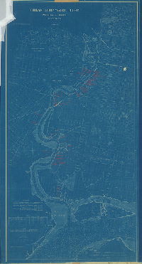
U.S. Coast and Geodetic Survey. Water Front of the City of Philadelphia from Tasker to Pollock Street. Surveyed under the direction of R. M. Bache, Assistant, by Neville B. Craig, in September and October, 1889. Scale 1:1200 | Craig, Neville B. | 1889 |
Tracing
29 x 100 in.
1 inch = 100 feet
|
Delaware River front
Wharves, streams, marshland, river banks, drainage ditches, building footprints, Port Wardens Line, chart of triangulation points
|
| RC-A-2 |
|
U.S. Coast and Geodetic Survey. Water Front of Philadelphia from Market to Tasker Street. Surveyed under the direction of R. M. Bache, Assistant, by Neville B. Craig, in September and October, 1889. Scale 1:1200 | Craig, Neville B. | 1889 |
Tracing
29 x 102 in.
1 inch = 100 feet
|
Delaware River front
Wharves, railroads, chart of triangulation points, Port Wardens Line
|
| RC-A-3 |
|
U.S. Coast and Geodetic Survey. Water Front of the City Of Philadelphia from Bridge Street to Erie Avenue. Surveyed under the direction of R. M. Bache, Assistant, by Neville B. Craig in December 1888. Scale 1:1200 | Craig, Neville B. | 1888 |
Tracing
36 x 100 in.
1 inch = 100 feet
|
Delaware River front
Wharves, streams, marshland, river banks, drainage ditches, building footprints, Port Wardens Line, chart of triangulation points
|
| RC-A-4 |
|
U.S. Coast and Geodetic Survey. T. C. Mendenhall, Superintendent. Water Front of the City of Philadelphia from Erie Avenue to Susquehanna Avenue. Surveyed under the direction of R. M. Bache, Assistant, by Neville B. Craig. Drawn under the direction of the City by A. E. Harvey, C. M. Broughton and J. H. Hutchinson in July, August and September 1890. Scale 1:1200 | Craig, Neville B. | 1890 |
Tracing
33 x 132 in.
1 inch = 100 feet
|
Delaware River front
Wharves, railroads, Port Richmond coal piers, marshland, building footprints, Port Wardens Line, chart of triangulation points
|
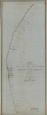
| RC-A-5 |
|
U.S. Coast and Geodetic Survey. T. C. Mendenhall, Superintendent. Philadelphia. Greenwich Point to Fort Mifflin Topographical survey by R. M. Bache, Assistant. August 5th to November 4th, 1891. Scale 1:2400 | Bache, R. M. | 1891 |
Tracing
38 x 162 in.
1 inch = 200 feet
|
Delaware River front
Topography, building footprints, Navy Yard, railroads, wharves, marshland, streams
|
| RC-A-6 |
|
Sheet No. 3. U.S. Coast and Geodetic Survey. Waterfront of the City of Philadelphia from Susquehanna Avenue to Market Street. Surveyed under the direction of R. M. Bache, Assistant, by Neville B. Craig in December 1888 and January 1889. Scale 1:1200 | Craig, Neville B. | 1889 |
Tracing
59 x 100 in.
1 inch = 100 feet
|
Delaware River front
Wharves, railroads, street railway, Port Wardens Line. "Elevations refer to the plane of mean low water at Kensington Water Works"
|
| RC-A-7 |
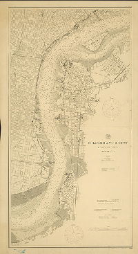
|
U.S. Coast and Geodetic Survey. Philadelphia Water Front, Delaware River, Pennsylvania. October 1900. | USCGS | 1900 |
Paper
55 x 29 in.
1 inch = 800 feet
|
Delaware River front
Wharves, river banks, marshland, building footprints, railroads, streets
|
| RC-A-7-a |
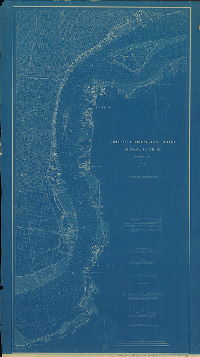
|
Philadelphia Water Front, Delaware River, Pennsylvania | USCGS | 1891 |
Blueprint
53 x 30 in.
1 inch = 800 feet
|
Delaware River front
Soundings, marshland, riverfront structures, and many other features
|
| RC-A-8 |
|
Chart of the Delaware River in front of the City of Philadelphia from Bridesburg to Fort Mifflin December 1879. Scale 1:9600 [800 feet to 1 inch] | USCGS | 1879 |
Mounted
1 inch = 800 feet
|
Delaware River front, Pennsylvania and New Jersey sides
Worn, dirty working copy with penciled annotations including proposed drawbridge at Market Street, Philadelphia to Camden, which was never built
|
| RC-AA-1 |
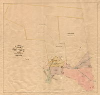
|
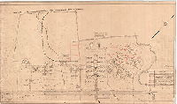
Plan of property between Wissahickon Ave. and Park Boundary, 21st Ward, to be included in Fairmount Park. Russell Thayer, Chief Engineer & Supt, Fairmount Park, March 1889. | Thayer, Russell | 1889 |
Mounted
26 x 28 in.
1 inch = 100 feet
|
Fairmount Park property around Rittenhouse Town
Building footprints, Monoshone Creek and tributary stream, mill race, dam and pond, property owners, boundaries and acreage
|
| RC-AA-2 |
|
[No title. Topography from Wayne Avenue west to Wissahickon Creek and north of Chelten Avenue.] | Not named | 1890 ca. |
Tracing
38 x 51 in.
1 inch = 100 feet
|
Wayne Avenue north of Chelten Ave. and west to Wissahickon Creek
Topography, streams, Wissahickon Creek
|
| RC-AA-z |
|
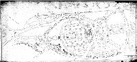
The Bulletin presents the first complete map of Fairmount Park. The Wisasahickon Hills of legend and story. [Two maps, with accompanying article and key to deatures, published by the Evening Bulletin, April 1, 1939. Negative print.] | Not named | 1939 |
Paper
23 x 17 in.
|
Fairmount Park
Roads, drives, trails, streams, park buildings, with key identifying many features
|
| RC-A-z |
|
Philadelphia Water Front. Schuylkill River, Pennsylvania. Published Feb. 1891. T. C. Mendenhall, Superintendent. Verified: B. A. Colonna, assistant in charge of Office. Price 50 cents. | USCGS | 1891 |
Blueprint
53 x 30 in.
1 inch = 800 feet
|
Schuylkill River and vicinity, Fairmount to Delaware River
Annotated in red ink with location of industries and other property owners along the riverfront. Soundings, marshland, streams, building footprints, wharves
|
| RC-B-01 |

|
Plan of the Port Warden’s line on the Delaware River from Pike Street to Poquessing Creek in the 23rd, 25th and 35th Wards of the City of Philadelphia, established by ordinance of Councils approved May 18, 1886 and May 28, 1888, showing the computed position of the line with reference to city streets. Neville B. Craig, December 30, 1891. | Craig, Neville B. | 1891 |
Tracing
21 x 274 in.
1 inch = 200 feet
|
Delaware River front
Port Warden's Line and benchmarks used to determine its location
|
| RC-B-03 |
|
Plan of the Port Warden’s line on the Delaware River from Snyder Avenue to Oregon Avenue, established by ordinance of Councils approved May 18, 1886, showing the computed positions of the line with reference to city streets. Calculations by C. A. Trik, October 13, 1890, from data of city coordinates computed by Neville B. Craig in connection with U.S. Coast and Geodetic Survey October 1889. [Title transcribed fromCity Archives Record Group 90.14 Index, page 451] | Trik, C.A. | 1890 |
Tracing
31 x 47 in.
1 inch = 100 feet
|
Delaware River front
Port Warden's Line and benchmarks used to determine its location
|
| RC-B-04 |
|
Plan of Port Warden’s line on the Delaware River from Lombard to Christian Street. Survey of Nov. 1889. [From 90.14 Index, page 451: "Line as fixed by Act of Assembly approved February 27, 1854 and ordinance of Councils approved December 4, 1856."] | Craig, Neville B. | 1889 |
Tracing
24 x 39 in.
1 inch = 100 feet
|
Delaware River front
Port Warden's Line and benchmarks used to determine its location
|
| RC-B-05 |
|
Plan of the Port Warden’s line on the Delaware River from Moore Street to Schuylkill River, showing connection with city streets, authorized by ordinance of councils, approved May 18, 1886. Computed and drawn in the Bureau of Surveys March 1899. [From City Archives Record Group 90.14 Index, p. 451: "Drawn by B. A. Haldeman and R. P. Green"] | Haldeman, B. A., and Green, R. P. | 1889 |
Tracing
28 x 113 in.
1 inch = 400 feet
|
Delaware River front
Port Warden's Line and benchmarks used to determine its location
|
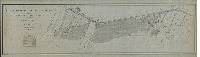
| RC-BB-2 |
|
Plan of the Borough of Frankford, Philadelphia, Pa. | Webster, George S. | 1890 |
Mounted
22 x 30 in.
1 inch = 400 feet
|
Frankford Borough and adjacent area, bounded roughly by Bridge St., Duncannon St., M St., Wheatsheaf Lane, and Almond St.
Shows the changing boundaries of Frankford, as defined by Acts of Assembly on March 7, 1800, April 4, 1831 and April 5, 1863.
|
| RC-BB-w |
|
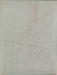
Plan showing former and present beds of Frankford Creek adjacent to Pennsylvania and New Jersey Railroad and registered owners abutting thereon. Bureau of Surveys, Registry Division, August 18, 1914. P-4-18. | Hoffman, A. Zane | 1914 |
Tracing
32 x 22 in.
1 inch = 100 feet
|
Frankford Creek, bounded roughly by Sepviva St., Roxborough St., Almond St. and Wheatsheaf Lane
Frankford Creek and tributary streams, both the former and present creek beds, property owners
|
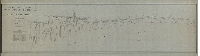
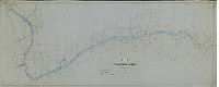
| RC-BB-x |
|
Frankford Creek surveyed under the direction of William Ludlow, Capt. of Engrs. Bvt. Lt. Col. U.S.A, by Assistant Engineers E. A. Gieseler, F. Sylvester, J. N. Odiorne and W. B. Silvey. November 1881. [Copy made in 1883] | Ludlow, William, and others | 1881 |
Tracing
42 x 108 in.
|
Frankford Creek. Army Corps of Engineers plan, from Frankford Ave. to mouth of creek at Delaware River.
Soundings, property owners, factories. This plan has an associated report that can be found online at http://www.phillyh2o.org/backpages/FrankfordCreek1882.htm
|
| RC-BB-y |
|
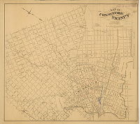
Map of Frankford and vicinity. Published by J. Albert Brous. | Brous, J. Albert | 1873 |
Mounted
30 x 34 in.
|
Frankford. Bounded roughly by Frankford Creek, Delaware River, Longshore St. and F St.
Creeks, new street names added in red ink, property owners, cemeteries, U.S. Arsenal
|
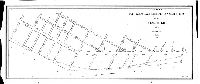
| RC-BB-z |
|
Plan of Frankford Creek from Frankford Ave. to Delaware River. Compiled tracing from official plans on file in Bureau of Surveys, Dec. 28, 1892. Scale 1" = 100' | Not named | 1892 |
Tracing
43 x 107 in.
|
Frankford Creek, from Frankford Avenue to mouth at Delaware River.
Property owners, factories
|
| RC-B-z |
|
Plan of Port Warden’s and arbitrary low water lines on the Delaware River below Bridesburg. July 30, 1894. [From City Archives Record Group 90.14 Index p. 451: "John H. Webster"] | Not named | 1894 |
Blueprint
13 x 30 in.
1 inch = 300 feet
|
Delaware River front, Pike St. to Bridge St.
Port Warden's Line and low water line
|
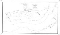
| RC-C-01 |
|
Sheet No. 1. Delaware River, mouth of Schuylkill to Gloucester. Port Warden lines of 1886. Prepared by U.S. Advisory Commission for Board of Harbor Commissioners of the City of Philadelphia, January 1886. Approved by Board of Harbor Commissioners ... March 4, 1886. Approved by ordinance of Councils ... May 18, 1886 | USCGS | 1886 |
Tracing
36 x 61 in.
1 inch = 400 feet
|
Delaware River front, Schuylkill River to Gloucester
League Island, wharves, creeks, Greenwich Point, Howell's Cove, Ladd's Cove, Red Bank, Big Timber Creek
|
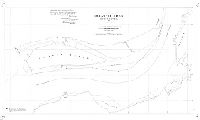
| RC-C-01-a |
|
Sheet No. 1. Delaware River, mouth of Schuylkill River to Gloucester. Port Warden lines proposed by U.S. Advisory Commission for the Port of Philadelphia, November 1884. Transmitted to the Philadelphia Harbor Commission, December 13th, 1884, in accordance with its resolution of October 21st, 1884. | USCGS | 1884 |
Tracing
36 x 60 in.
1 inch = 400 feet
|
Delaware River front, Schuylkill River to Gloucester
League Island, wharves, creeks, Greenwich Point, Howell's Cove, Ladd's Cove, Red Bank, Big Timber Creek
|
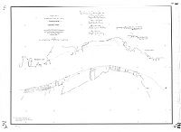
| RC-C-02 |
|
Sheet No. 2. Delaware River, Gloucester to Kaighn's Point. Port Warden lines of 1886. Prepared by U.S. Advisory Commission for Board of Harbor Commissioners of the City of Philadelphia, January 1886. Approved by Board of Harbor Commissioners ... March 4, 1886. Approved by ordinance of Councils May 18, 1886 | USCGS | 1886 |
Tracing
36 x 49 in.
1 inch = 400 feet
|
Delaware River front, Gloucester to Kaighn's Point
Wharves
|