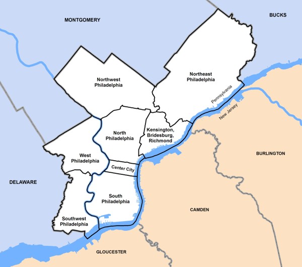
For the sake of indexing the various maps and atlases available on GeoHistory, the city of Philadelphia has been divided into regions. These regions are not "neighborhoods," but are conglomerations of city "Planning Analysis" divisions that facilitate locating appropriate materials in the collections.
Click the map for a larger view.
A non-exhaustive list of neighborhoods, organized by regional area.
Maps are tagged with the highest level area that appropriately describes the map. A map of the entire state of Pennsylvania, or a significant portion thereof, will be tagged as "Pennsylvania," not as any of the individual counties or cities shown. A map that is listed as "Philadelphia" will generally not also be listed as "North Philadelphia," even though North Philadelphia may be included on the map.
If you are doing research on a particular area of a city or state, make sure to look through resources that cover a wider range than the area you are interested in. For instance, if you are researching an area in Northeast Philadelphia, also look for citywide atlases of Philadelphia.