|
The historic maps on PhilaPlace
were made available by the Greater
Philadelphia GeoHistory Network thanks to the generosity of our friends
at the Free Library of Philadelphia,
the Athenaeum of Philadelphia, and
Matthew Ainslie, a private researcher and collector.
You can discover more about the GeoHistory Network by clicking any of the
links at the top of this page, and you can browse our full collection of
resources using the links below:
|
|
Digital mosaics of the individual sections of each of the following maps were
created and aligned to actual geography and integrated into the Google Maps viewer.
In any screenshots or references to the maps, please cite both the GeoHistory Network
and the original source listed below. The original images, as well as the digital mosiac,
may be viewed by clicking the title of any of the resources.
|
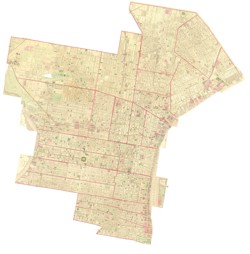
Creator:
G. M. Hopkins
Date:
1875
Description:
Vol. 6, comprising 21 Wards, being the 2nd to 20th and the 29th to 31st, both inclusive. From official Records, Private plans and Actual Surveys. Based on Plans deposited in the Department of Surveys.
Source:
Private Collection of Matt Ainslie
|
|
|
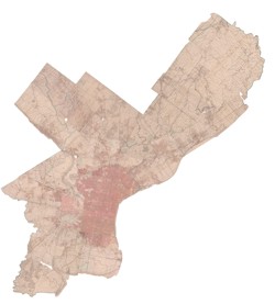
Creator:
George W. & Walter S. Bromley, Civil Engineers
Date:
1895
Description:
Complete in One Volume. From actual surveys and official plans.
Source:
|
|
|
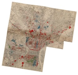
Creator:
J. M. Brewer
Date:
1934
Description:
Shows racial concentrations, location ratings, age, real estate sales prices and industrials. 2 sheets.
Source:
|
|
|
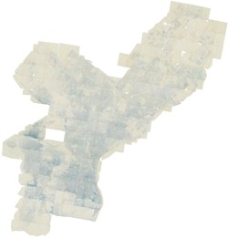
Creator:
Plans & Registry Division, Bureau of Engineering Surveys & Zoning, Department of Public Works, Federal Works Progress Administration for Pennsylvania
Date:
1962
Description:
Land-Use Zoning Project No. 18313. Survey showing actual zoning use for each parcel of land
in the city. Follows an indentical survey completed in 1942, and earlier surveys at a smaller scale.
Source:
|
|
|