PhilaGeoHistory.org
Project Information
- Project Summary
- Data Concept Diagrams
- Tech Concept & Diagrams
- New! Pilot Grant Report
- New! Next Steps
Conference Proceedings
- Presentations / PowerPoint
- Breakout Transcripts
- Suggested Links
- Details (archived)
Advisory Committee
- Advisory Committe Forums
- Institution Survey
Useful Links
- PACSCL
- Athenaeum of Philadelphia
- Phila. Arch. & Buildings
- CML @ Penn
- CityMaps @ Phila.gov
- Boston Streets Project
- Suggested Project Links
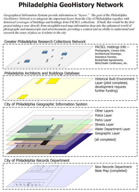
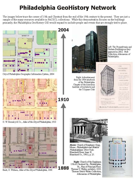
We've prepared two diagrams that explain how the Greater Philadelphia GeoHistory Network (GPGN) would relate different types of geographically organized data. The first shows the different layers of data that would interrelate, and the second shows specifically how the historical data could be used to trace the history of a location over a span of time.
You can also download both diagrams as a PDF.